Red Lodge, Montana facts for kids
Quick facts for kids
Red Lodge, Montana
|
|
|---|---|
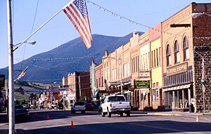
Main Street (2000)
|
|
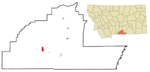
Location within Carbon County and Montana
|
|
| Country | United States |
| State | Montana |
| County | Carbon |
| Area | |
| • Total | 2.71 sq mi (7.03 km2) |
| • Land | 2.71 sq mi (7.03 km2) |
| • Water | 0.00 sq mi (0.00 km2) |
| Elevation | 5,588 ft (1,703 m) |
| Population
(2020)
|
|
| • Total | 2,257 |
| • Density | 832.23/sq mi (321.27/km2) |
| Time zone | UTC-7 (Mountain (MST)) |
| • Summer (DST) | UTC-6 (MDT) |
| ZIP code |
59068
|
| Area code | 406 |
| FIPS code | 30-61525 |
| GNIS ID | 2411529 |
Red Lodge is a city in Montana, United States. It is the main town, or county seat, of Carbon County. In 2020, about 2,257 people lived there.
Contents
Discovering Red Lodge's Past
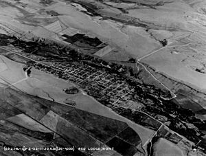
Red Lodge has a rich history, starting long before it became a city. On September 17, 1851, the U.S. government signed a special agreement, called a treaty, with the Crow Nation. This treaty confirmed that the Crow people controlled the land where Red Lodge is today.
Early Discoveries and Growth
In 1866, people found lots of coal in the area. Then, in 1870, gold was discovered nearby! Another treaty in 1880 allowed people to start settling in the area from April 11, 1882.
The first post office in Red Lodge opened on December 9, 1884. A rail line was built into town, and coal started being shipped out in June 1889. The boundaries of the Crow Reservation changed again in 1892, opening up even more land for settlement. From then until the 1930s, coal mining was the most important activity in Red Lodge.
New People and Busy Times
Many new settlers came to Red Lodge in the late 1800s. They came from countries like Italy, the British Isles, Finland, Norway, Sweden, Germany, and Austria-Hungary. Even with new settlers, many Native Americans still lived in the area in the mid-1880s. By 1892, the town's population grew to 1,180 people.
By 1896, Red Lodge was a very lively town with many businesses. By 1906, the population had reached 4,000, and by 1911, it was 5,000!
Challenges and New Beginnings
Red Lodge faced tough times during the Great Depression. This was a period in the 1930s when many people lost their jobs and businesses closed. Many coal mines had to shut down. To help the town's economy, some people started making and selling illegal alcohol, which they called "syrup." This was sold to places as far away as Chicago and San Francisco.
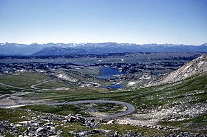
In 1931, work began on the Beartooth Highway. This important road connects Red Lodge to Yellowstone National Park. It officially opened in 1936.
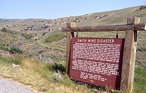
A sad event happened in 1943 at the Smith Mine #3, near Bearcreek. An explosion trapped and killed 74 miners. Only three workers in the mine that day survived. This was the worst coal mine disaster in Montana's history. The mine closed soon after, but it reopened briefly in the late 1970s. There is a memorial at the Red Lodge cemetery to remember the miners.
Since the mid-1980s, the downtown area of Red Lodge has been updated. This was done to attract visitors interested in history and culture. Many buildings had fallen apart because the town's population had dropped from its highest point of 6,000 people in 1915 to about 2,000.
In 2006, it was estimated that Red Lodge's population could grow from about 1,200 people in winter to over 1,800 during the summer. This happens because of tourists arriving via the Beartooth Highway.
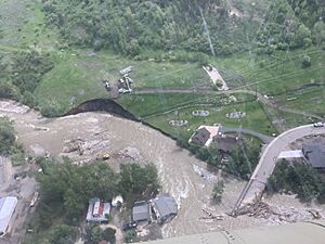
In 2022, Red Lodge was greatly affected by floods in Montana.
Exploring Red Lodge's Geography
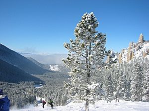
Red Lodge is located right next to the Beartooth Mountains to the south. Rock Creek flows along the eastern side of the town. About 30 miles southwest of Red Lodge, in the Custer Gallatin National Forest, is Granite Peak. This is the highest point in all of Montana. Grizzly Peak, part of the Red Lodge Mountain ski area, is one of several mountains around the town.
The United States Census Bureau reports that the city covers a total area of 2.80 square miles (7.25 km2). All of this area is land.
Red Lodge's Climate
Red Lodge has a continental climate. This means it has cold, somewhat dry winters and warm, wetter summers. Summers are cooler here than in areas of Montana further north because Red Lodge is at a high elevation. Winters, however, are milder than areas to the east. This is due to the "chinook wind" influence, which brings warmer air.
| Climate data for Red Lodge, Montana, 1991–2020 normals, extremes 1894–present | |||||||||||||
|---|---|---|---|---|---|---|---|---|---|---|---|---|---|
| Month | Jan | Feb | Mar | Apr | May | Jun | Jul | Aug | Sep | Oct | Nov | Dec | Year |
| Record high °F (°C) | 70 (21) |
70 (21) |
72 (22) |
80 (27) |
88 (31) |
96 (36) |
101 (38) |
98 (37) |
97 (36) |
86 (30) |
80 (27) |
71 (22) |
101 (38) |
| Mean maximum °F (°C) | 53.9 (12.2) |
54.3 (12.4) |
61.6 (16.4) |
70.5 (21.4) |
77.9 (25.5) |
85.2 (29.6) |
90.9 (32.7) |
90.0 (32.2) |
85.5 (29.7) |
74.7 (23.7) |
61.5 (16.4) |
54.6 (12.6) |
91.5 (33.1) |
| Mean daily maximum °F (°C) | 37.5 (3.1) |
36.7 (2.6) |
45.7 (7.6) |
53.3 (11.8) |
62.0 (16.7) |
71.6 (22.0) |
81.2 (27.3) |
80.6 (27.0) |
71.2 (21.8) |
56.4 (13.6) |
43.1 (6.2) |
35.7 (2.1) |
56.3 (13.5) |
| Daily mean °F (°C) | 25.7 (−3.5) |
25.5 (−3.6) |
33.7 (0.9) |
40.9 (4.9) |
49.3 (9.6) |
57.6 (14.2) |
65.6 (18.7) |
64.7 (18.2) |
56.4 (13.6) |
43.9 (6.6) |
32.1 (0.1) |
25.0 (−3.9) |
43.4 (6.3) |
| Mean daily minimum °F (°C) | 13.9 (−10.1) |
14.3 (−9.8) |
21.7 (−5.7) |
28.5 (−1.9) |
36.6 (2.6) |
43.7 (6.5) |
49.9 (9.9) |
48.7 (9.3) |
41.6 (5.3) |
31.4 (−0.3) |
21.2 (−6.0) |
14.2 (−9.9) |
30.5 (−0.8) |
| Mean minimum °F (°C) | −9.9 (−23.3) |
−8.7 (−22.6) |
−1.5 (−18.6) |
12.9 (−10.6) |
23.7 (−4.6) |
31.2 (−0.4) |
40.9 (4.9) |
37.5 (3.1) |
28.3 (−2.1) |
12.4 (−10.9) |
−2.3 (−19.1) |
−9.7 (−23.2) |
−20.4 (−29.1) |
| Record low °F (°C) | −38 (−39) |
−42 (−41) |
−30 (−34) |
−10 (−23) |
7 (−14) |
20 (−7) |
30 (−1) |
22 (−6) |
8 (−13) |
−13 (−25) |
−25 (−32) |
−42 (−41) |
−42 (−41) |
| Average precipitation inches (mm) | 0.84 (21) |
1.14 (29) |
1.78 (45) |
2.77 (70) |
4.72 (120) |
2.59 (66) |
1.45 (37) |
1.01 (26) |
1.63 (41) |
2.34 (59) |
1.39 (35) |
1.00 (25) |
22.66 (574) |
| Average snowfall inches (cm) | 13.5 (34) |
19.4 (49) |
20.2 (51) |
25.5 (65) |
6.2 (16) |
0.6 (1.5) |
0.0 (0.0) |
0.0 (0.0) |
2.1 (5.3) |
17.0 (43) |
18.7 (47) |
18.7 (47) |
141.9 (358.8) |
| Average precipitation days (≥ 0.01 in) | 4.6 | 4.8 | 7.1 | 9.3 | 12.1 | 11.4 | 9.9 | 8.1 | 7.1 | 6.6 | 5.7 | 5.7 | 92.4 |
| Average snowy days (≥ 0.1 in) | 5.1 | 5.2 | 6.1 | 5.5 | 2.5 | 0.4 | 0.0 | 0.0 | 0.7 | 3.1 | 5.0 | 5.8 | 39.4 |
| Source 1: NOAA | |||||||||||||
| Source 2: National Weather Service | |||||||||||||
People of Red Lodge
| Historical population | |||
|---|---|---|---|
| Census | Pop. | %± | |
| 1890 | 624 | — | |
| 1900 | 2,152 | 244.9% | |
| 1910 | 4,860 | 125.8% | |
| 1920 | 4,515 | −7.1% | |
| 1930 | 3,026 | −33.0% | |
| 1940 | 2,950 | −2.5% | |
| 1950 | 2,730 | −7.5% | |
| 1960 | 2,278 | −16.6% | |
| 1970 | 1,844 | −19.1% | |
| 1980 | 1,896 | 2.8% | |
| 1990 | 1,958 | 3.3% | |
| 2000 | 2,177 | 11.2% | |
| 2010 | 2,125 | −2.4% | |
| 2020 | 2,257 | 6.2% | |
| source: U.S. Decennial Census |
|||
Red Lodge is part of the larger Billings area.
What the 2010 Census Showed
In 2010, a count of the population called the census found that 2,125 people lived in Red Lodge. There were 1,082 households, which are groups of people living together. About 513 of these were families.
Most people in Red Lodge (96.3%) were White. Smaller groups included African American, Native American, Asian, and Pacific Islander people. About 1.9% of the population was Hispanic or Latino.
The average age in the city was 47.3 years old. About 16.8% of the people were under 18. About 19.8% were 65 years or older. The population was almost evenly split between males (49.4%) and females (50.6%).
Learning in Red Lodge
Red Lodge has three public schools for students:
- Mountain View Elementary School
- Roosevelt Middle School
- Red Lodge High School
For the 2021-2022 school year, there were 319 students in kindergarten through 8th grade. The high school, for grades 9 through 12, had 180 students. The sports teams for Red Lodge schools are called the Rams.
The Red Lodge Carnegie Library serves the community. It's a place where everyone can find books and learn.
The Yellowstone Bighorn Research Association has a Geology Field Station south of Red Lodge. This is a place where scientists and students study rocks and the Earth.
Fun Outdoor Activities
Red Lodge is famous for many outdoor activities. You can go skiing, mountain biking, fly fishing, and backpacking nearby. The town also hosts the national skijoring finals, which is a sport where a person on skis is pulled by a horse.
How Red Lodge Connects
Roads and Travel
U.S. Route 212 goes through Red Lodge from north to south. South of town, it becomes the Beartooth Highway, which is a very scenic road. Montana Highway 78 comes into town from the west, connecting to Columbus to the north. Another road, Secondary Highway 308, links Red Lodge east to Belfry.
The Red Lodge Airport is a small airport right next to the west side of town. For bigger flights, the closest commercial airport is Billings Logan International Airport.
Healthcare
The Beartooth Billings Clinic provides medical care for people in the area. They offer emergency services, same-day care, mental health support, and regular doctor visits.
Red Lodge in the News
Radio Stations
- KMXE FM 99.3
Newspapers
- Carbon County News (published weekly)
- The Local Rag (published from 1991 to 2019)
- Red Lodge Pickett (published from 1892 to 1922)
Famous People from Red Lodge
- Doug Brown, a long-distance runner.
- Brady Canfield, who won a Bronze medal in the 2003 FIBT World Championships for skeleton racing.
- Kim Gillan, a former Montana State Senator.
- John Johnston, who was the first marshal (a type of police officer) in Red Lodge in 1888.
- Laurie Niemi, an offensive tackle for the Washington Redskins football team.
- Alice Greenough Orr, a famous rodeo performer.
- Gary D. Robson, an author and inventor in closed captioning.
- Emily E. Sloan, a lawyer and author.
- K. Ross Toole, a historian who studied Montana's history.
See also
 In Spanish: Red Lodge (Montana) para niños
 | Emma Amos |
 | Edward Mitchell Bannister |
 | Larry D. Alexander |
 | Ernie Barnes |


