List of National Monuments in County Galway facts for kids
The Irish state has officially approved the following List of National Monuments in County Galway. In the Republic of Ireland, a structure or site may be deemed to be a "National Monument", and therefore worthy of state protection, if it is of national importance. If the land adjoining the monument is essential to protect it, this land may also be protected.
National Monuments
| NM# | Monument name | Description | Image | Townland | Location |
|---|---|---|---|---|---|
| 278 | Knockmoy | Church | Abbert Demesne | 53°26′27″N 8°44′35″W / 53.440896°N 8.74295°W | |
| 166 | Knockmoy Abbey | Abbey (Cistercian) |  |
Abbeyknockmoy | 53°26′25″N 8°44′34″W / 53.440334°N 8.742886°W |
| 47 | Kilconnell Abbey | Friary (Franciscan) |  |
Kilconnell | 53°19′57″N 8°24′03″W / 53.332629°N 8.400786°W |
| 273 | Dunmore Abbey | Friary (Augustinian) |  |
Abbeyland North | 53°37′05″N 8°44′29″W / 53.618089°N 8.741255°W |
| 512 | Clontuskert Abbey | Priory (Augustinian) |  |
Abbeypark | 53°16′57″N 8°12′56″W / 53.282561°N 8.215499°W |
| 49 | Annaghdown | Early Medieval Ecclesiastical Site |  |
Annaghdown | 53°23′13″N 9°04′21″W / 53.386886°N 9.072626°W |
| 252 | Ardamullivan Castle | Castle |  |
Ardamullivan | 53°00′16″N 8°49′45″W / 53.004326°N 8.829296°W |
| 164 | Athenry Abbey | Priory (Dominican) | 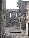 |
Athenry | 53°17′43″N 8°44′52″W / 53.295362°N 8.747692°W |
| 406 | Athenry Castle | Castle | 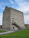 |
Athenry | 53°18′00″N 8°44′41″W / 53.299990°N 8.744619°W |
| 371 | Aughrim Ringforts | Two Ringforts | Attidermot | 53°17′37″N 8°19′01″W / 53.293618°N 8.316994°W | |
| 470 | Aughnanure Castle | Castle |  |
Oughterard | 53°25′06″N 9°16′31″W / 53.418254°N 9.275336°W |
| 369 | Caheravoley Fort | House & Bawn | Caheravoley, Kilcahill | 53°25′08″N 8°54′29″W / 53.418843°N 8.908063°W | |
| 42 | Doonbeg Ringfort | Ringfort | Carrownlisheen (Inishmaan) | 53°05′00″N 9°35′41″W / 53.083463°N 9.594777°W | |
| 42 | Carrownlisheen Wedge Tomb (Diarmuid and Gráinne's Bed) | Wedge Tomb |  |
Carrownlisheen (Inishmaan) | 53°05′14″N 9°34′52″W / 53.087355°N 9.581059°W |
| 42 | Templesaghtmacree | Church |  |
Carrownlisheen (Inishmaan) | 53°05′02″N 9°35′25″W / 53.083943°N 9.590272°W |
| 42 | Carrownlisheen Cross | Cross | Carrownlisheen (Inishmaan) | 53°04′50″N 9°34′32″W / 53.080631°N 9.575505°W | |
| 42 | Labbanakinneriga | Church | Carrownlisheen (Inishmaan) | 53°05′02″N 9°35′25″W / 53.083889°N 9.59027°W | |
| 42 | Doonfarvagh | Cashel | Carrownlisheen (Inishmaan) | 53°04′51″N 9°34′48″W / 53.080778°N 9.579967°W | |
| 42 | Kilcoonagh Church | Church | Carrownlisheen (Inishmaan) | 53°04′50″N 9°34′33″W / 53.080631°N 9.575734°W | |
| 42 | Dún Conor (Dún Conchuir) | Cashel |  |
Carrowntemple (Inishmaan) | 53°05′00″N 9°35′41″W / 53.083461°N 9.594788°W |
| 248 | Dunmore Castle | Castle | 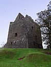 |
Castlefarm | 53°37′26″N 8°45′20″W / 53.623893°N 8.755526°W |
| 467 | St. Cuan's Well | Well & Cross slabs | Castlegar East | 53°24′55″N 8°18′57″W / 53.415398°N 8.315935°W | |
| 428 | Feartagar or Jennings Castle | Castle |  |
Castlegrove East | 53°34′11″N 8°56′34″W / 53.569650°N 8.942710°W |
| 272 | Isert Kelly Castle | Castle | Castlepark | 53°09′29″N 8°43′08″W / 53.158015°N 8.718935°W | |
| 259 | Kiltartan Castle | Castle |  |
Castletown (Kiltartan) | 53°05′25″N 8°48′27″W / 53.090312°N 8.807569°W |
| 165 | Claregalway Abbey | Friary (Franciscan) |  |
Claregalway | 53°20′48″N 8°56′40″W / 53.346667°N 8.944444°W |
| 563 | Cloonigny Castle | Ringfort & Castle | Cloonigny | 53°21′17″N 8°21′17″W / 53.354788°N 8.354778°W | |
| 283 | Derryhiveny Castle | Castle | Derryhiveny South | 53°07′37″N 8°11′32″W / 53.127061°N 8.192313°W | |
| 527 | Doorus Demesne wedge tomb | Wedge Tomb | Doorus Demesne | 53°09′08″N 8°58′20″W / 53.152298°N 8.972353°W | |
| 254 | Drumacoo | Early Medieval Ecclesiastical Site | 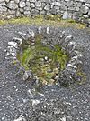 |
Drumacoo | 53°11′55″N 8°54′16″W / 53.198749°N 8.904506°W |
| 365 | Drumharsna Castle | Castle | 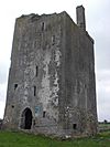 |
Drumharsna South | 53°08′36″N 8°50′35″W / 53.143282°N 8.84304°W |
| 206 | Fiddaun Castle | Castle |  |
Tubber | 53°00′38″N 8°52′46″W / 53.010514°N 8.879438°W |
| 554 | Kilnalekin Abbey | Abbey (Cistercian) | Friary | 53°06′11″N 8°23′31″W / 53.103056°N 8.391901°W | |
| 439 | Glinsk Castle | Castle |  |
Glinsk | 53°39′07″N 8°25′55″W / 53.652037°N 8.4319°W |
| 52 | High Island | Early Medieval Ecclesiastical Site |  |
High Island and Kill | 53°46′31″N 7°30′01″W / 53.775218°N 7.500249°W |
| 412 | Inchagoill | Early Medieval Ecclesiastical Site |  |
Inchagoill | 53°29′09″N 9°18′59″W / 53.485769°N 9.316415°W |
| 41.01 | Creggankeel Fort | Cashel | Inisheer | 53°03′26″N 9°31′07″W / 53.057332°N 9.518607°W | |
| 41.05 | St. Gobnet's Church (Kilgobnet) | Church |  |
Inisheer | 53°03′58″N 9°31′45″W / 53.066032°N 9.529267°W |
| 41.06 | Knockgrannary (Cnoc Raithní) | Burial Ground |  |
Inisheer | 53°03′54″N 9°31′24″W / 53.065060°N 9.523324°W |
| 41.08 | St. Cavan's Church | Church |  |
Inisheer | 53°03′50″N 9°30′50″W / 53.063894°N 9.513924°W |
| 41.07 | O'Brien's Castle (Great Fort, Furmina Castle) | Cashel | 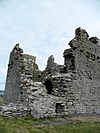 |
Inisheer | 53°03′43″N 9°31′09″W / 53.062083°N 9.519172°W |
| 41.02 | Grave of the Seven Daughters (Cill na Seacht Niníon) | Early Medieval Ecclesiastical Site |  |
Inisheer | 53°03′26″N 9°31′06″W / 53.057275°N 9.518338°W |
| 642 | Kilcornan | Deserted Medieval Village | Kilcornan (Monivea) | 53°18′48″N 8°42′49″W / 53.313342°N 8.713583°W | |
| 43.01 | Arkin's Castle | Castle |  |
Killeany (Inishmore) | 53°06′17″N 9°39′47″W / 53.10482°N 9.66295°W |
| 43.04 | Temple Benen | Church |  |
Killeany (Inishmore) | 53°06′11″N 9°39′59″W / 53.103017°N 9.666322°W |
| 43.11 | Turmartin | Watch Tower | Killeany (Inishmore) | 53°05′29″N 9°38′20″W / 53.091527°N 9.638835°W | |
| 43 | Oghil Leacht Cuimhne | Leacht Cuimhne (cenotaph for those lost at sea) | Killeany (Inishmore) | 53°07′45″N 9°41′25″W / 53.129185°N 9.690258°W | |
| 43 | Tighlagh Eany | Church | Killeany (Inishmore) | 53°06′05″N 9°39′10″W / 53.101298°N 9.652707°W | |
| 43 | Killeany Clacháns | Clocháns | Killeany (Inishmore) | 53°06′35″N 9°41′19″W / 53.109809°N 9.688515°W | |
| 43.03 | St. Eany's | Early Medieval Ecclesiastical Site | Killeany (Inishmore) | 53°06′12″N 9°39′50″W / 53.103352°N 9.664019°W | |
| 43 | Doocaher (Black Fort) | Promontory Fort | Killeany (Inishmore) | 53°06′16″N 9°41′15″W / 53.104456°N 9.687600°W | |
| 51 | Kilmacduagh monastery | Churches & Round Tower |  |
Kilmacduagh | 53°02′59″N 8°53′23″W / 53.049734°N 8.889767°W |
| 43 | Temple MacDuagh | Church |  |
Kilmurvy (Inishmore) | 53°07′51″N 9°45′33″W / 53.130967°N 9.759053°W |
| 43.15 | Templenaneeve | Church | Kilmurvy (Inishmore) | 53°07′51″N 9°45′33″W / 53.130967°N 9.759053°W | |
| 43 | Dun Aengus | Promontory Fort |  |
Inishmore | 53°07′33″N 9°45′55″W / 53.125969°N 9.765213°W |
| 43 | Clochán na Carraige | Clochán |  |
Kilmurvy (Inishmore) | 53°08′32″N 9°45′37″W / 53.142282°N 9.760188°W |
| 446 | Kiltiernan Church | Church & Cashel | Kiltiernan East | 53°11′17″N 8°50′34″W / 53.187997°N 8.842892°W | |
| 627 | Lackan Ringfort | Ringfort & Souterrain | Lackan (Ardrahan) | 53°09′49″N 8°46′56″W / 53.163637°N 8.782195°W | |
| 621 | Lissard Ringforts | Two Ringforts & Souterrain | Lissard | 53°20′53″N 8°23′22″W / 53.348145°N 8.389551°W | |
| 245 | Castlekirk (Hen's Castle) | Castle | Drumsnauv | 53°29′33″N 9°30′48″W / 53.492565°N 9.513196°W | |
| 499 | Rathsoony | Ringfort | Masonbrook | 53°10′30″N 8°30′56″W / 53.175002°N 8.515569°W | |
| 499 | Rahannagragh (Rahannagroagh) | Ringfort | Masonbrook | 53°10′37″N 8°30′51″W / 53.176949°N 8.514203°W | |
| 609 | Merlinpark Castle (Merlin Castle) | Castle | Merlinpark | 53°16′47″N 8°59′53″W / 53.279765°N 8.998110°W | |
| 498 | The Seven Monuments | Embanked Stone Circle | Moanmore East | 53°11′19″N 8°31′52″W / 53.188576°N 8.531205°W | |
| 43 | St. Kieran's | Early Medieval Ecclesiastical Site | Oghil (Inishmore) | 53°07′55″N 9°41′07″W / 53.132051°N 9.685329°W | |
| 43 | St. Soorney's | Church & Enclosure | Oghil (Inishmore) | 53°08′01″N 9°41′43″W / 53.133509°N 9.695255°W | |
| 43 | Temple an Cheathrair Aluinn | Church & grave | Oghil (Inishmore) | 53°07′47″N 9°42′58″W / 53.12976°N 9.716108°W | |
| 43 | Oghill | Cashel |  |
Oghil (Inishmore) | 53°07′38″N 9°41′59″W / 53.127183°N 9.699676°W |
| 43 | Killeany | Clocháns | Oghil (Inishmore) | 53°07′39″N 9°43′08″W / 53.127392°N 9.718971°W | |
| 43 | Killeany Tomb | Wedge Tomb | Oghil (Inishmore) | 53°07′39″N 9°43′08″W / 53.127392°N 9.718971°W | |
| 43 | Onaght | Castle & house site | Onaght (Inishmore) | 53°08′24″N 9°46′36″W / 53.140023°N 9.776759°W | |
| 43 | Onaght | Clocháns | Onaght (Inishmore) | 53°08′32″N 9°45′37″W / 53.142282°N 9.760188°W | |
| 43 | Kilcholan Church | Church | Onaght (Inishmore) | 53°08′25″N 9°46′33″W / 53.140358°N 9.775955°W | |
| 43 | Onaght Cashel | Cashel | Onaght (Inishmore) | 53°08′24″N 9°46′36″W / 53.140023°N 9.776759°W | |
| 43 | Templebrecan | Early Medieval Ecclesiastical Site | Onaght (Inishmore) | 53°08′46″N 9°46′39″W / 53.146094°N 9.777593°W | |
| 231 | Killursa | Church |  |
Ower | 53°28′04″N 9°08′42″W / 53.467703°N 9.144971°W |
| 462 | Pallas Castle | Castle |  |
Pallas (Tynagh) | 53°07′36″N 8°21′44″W / 53.126574°N 8.362318°W |
| 48 | Kilbennen | Church & Round Tower |  |
Pollacorragune | 53°32′20″N 8°53′31″W / 53.538837°N 8.892038°W |
| 461 | Portumna Abbey | Friary (Dominican) | 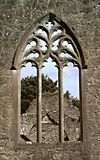 |
Portumna Demesne | 53°05′10″N 8°13′03″W / 53.086053°N 8.217479°W |
| 515 | Portumna Castle | Castle |  |
Portumna Demesne | 53°05′12″N 8°13′14″W / 53.086613°N 8.220645°W |
| 46 | Roscam | Early Medieval Ecclesiastical Site |  |
Roscam | 53°15′51″N 8°59′06″W / 53.264227°N 8.984986°W |
| 50 | Ross Errilly Abbey | Friary (Franciscan) |  |
Headford | 53°28′47″N 9°07′54″W / 53.479628°N 9.13166°W |
| 242 | St. MacDara's Island | Early Medieval Ecclesiastical Site |  |
St. MacDara's Island | 53°18′16″N 9°55′02″W / 53.304426°N 9.917302°W |
| 643 | Tonaroasty | Deserted Medieval Village | Tonaroasty | 53°11′36″N 8°32′47″W / 53.193407°N 8.546418°W | |
| 505 | Tuam High Cross | High Cross | 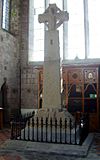 |
Tuam | 53°30′50″N 8°51′18″W / 53.513802°N 8.855109°W |
| 431 | Pearse's Cottage | House with historic associations |  |
Turlough | 53°23′10″N 9°37′12″W / 53.386046°N 9.619890°W |
| 327 | Turoe stone | Sculptured Stone | 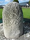 |
Bullaun | 53°15′10″N 8°33′42″W / 53.252706°N 8.5617°W |

All content from Kiddle encyclopedia articles (including the article images and facts) can be freely used under Attribution-ShareAlike license, unless stated otherwise. Cite this article:
List of National Monuments in County Galway Facts for Kids. Kiddle Encyclopedia.
