List of islands of Wyoming facts for kids

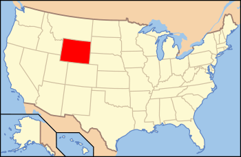
Location of Wyoming within the United States
|
|
| Geography | |
|---|---|
| Location | Wyoming |
| Total islands | 35 named |
| Administration | |
| State | |

Did you know that Wyoming, even though it's far from any ocean, has islands? It's true! Wyoming is a huge state, the 10th largest in the United States. It covers about 97,814 square miles (253,348 km2). Even without a coastline, Wyoming has a lot of water. About 0.72% of the state's total area is water. That's about 713 square miles (1,847 km2) of lakes and rivers!
Wyoming is home to 35 islands that have official names. Most of these islands are found in two big lakes. These are Jackson Lake and Yellowstone Lake. Both lakes are located in the northwest part of the state. You can find them inside famous national parks. The Green River and other rivers also have many islands. These are often called river islands.
Contents
What are Wyoming's Islands?
Islands are pieces of land completely surrounded by water. In Wyoming, these islands are not in the ocean. Instead, they are found in large lakes and rivers. Some are tiny, while others are quite large. They often provide homes for wildlife.
Where to Find Wyoming's Islands
Most of Wyoming's islands are in the northwestern part of the state. This area is known for its beautiful lakes and rivers. These water bodies are often fed by melting snow from the mountains.
Islands in Yellowstone Lake
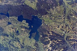
Yellowstone Lake is a very large lake in Yellowstone National Park. It's one of the highest elevation lakes in North America. Many islands dot its surface.
- Frank Island is the largest island in Yellowstone Lake. It's a popular spot for birds.
- Carrington Island is another island in this famous lake.
- Dot Island is known for its wildlife.
- The Molly Islands are a group of small islands. They are important nesting sites for American White Pelicans.
- Peale Island and Pelican Roost are also found here.
- Stevenson Island is another notable island in Yellowstone Lake.
Islands in Jackson Lake
Jackson Lake is located in Grand Teton National Park. It's a beautiful lake with clear water. Several islands are found here.
- Arizona Island is one of the islands in Jackson Lake.
- Badger Island is another island in this scenic lake.
- Cow Island and Dollar Island are also part of Jackson Lake.
- Elk Island is named after the animals often seen in the area.
- Grassy Island and Indian Island add to the beauty of the lake.
- Marie Island, Moose Island, and Sheffield Island are also found here.
Islands in Wyoming's Rivers
Wyoming's rivers, like the Green River and North Platte River, also have islands. These are often formed when a river splits around a piece of land.
- Big Island is found in the Green River.
- Bush Island is located in the Wind River.
- Ferry Island and Freezeout Island are also in the Green River.
- Johnson Island and Mullison Island are in the North Platte River.
- Long Island, Tarters Island, Telephone Island, and Willow Island are other islands in the Green River.
- Mack Island is in the New Fork River.
- Treasure Island is found in the Bechler River.
Islands in Smaller Lakes
Some islands are found in smaller lakes too.
- Boulder Island and Mystic Isle are both located in Leigh Lake.
- Ball Island is in Cottonwood Creek.
- Oxbow Bend is a unique island-like feature in the Snake River.
List of Named Islands in Wyoming
Here is a list of the 35 named islands in Wyoming, showing where they are located.
| Island | Body of water | County | Elevation | Coordinates |
|---|---|---|---|---|
| Arizona Island | Jackson Lake | Teton | 6,811 feet (2,076 m) | 43°57′58″N 110°39′10″W / 43.96611°N 110.65278°W |
| Badger Island | Jackson Lake | Teton | 6,775 feet (2,065 m) | 43°52′18″N 110°39′06″W / 43.87167°N 110.65167°W |
| Ball Island | Cottonwood Creek | Teton | 7,064 feet (2,153 m) | 42°43′07″N 110°02′52″W / 42.71855°N 110.04766°W |
| Big Island | Green River | Sweetwater | 6,211 feet (1,893 m) | 41°45′13″N 109°43′33″W / 41.75357°N 109.72597°W |
| Boulder Island | Leigh Lake | Teton | 6,919 feet (2,109 m) | 43°48′00″N 110°43′37″W / 43.80000°N 110.72694°W |
| Bush Island | Wind River | Fremont | 7,519 feet (2,292 m) | 43°29′20″N 109°34′18″W / 43.48889°N 109.57167°W |
| Carrington Island | Yellowstone Lake | Teton | 7,736 feet (2,358 m) | 44°27′23″N 110°33′17″W / 44.45639°N 110.55472°W |
| Cow Island | Jackson Lake | Teton | 6,798 feet (2,072 m) | 43°55′55″N 110°38′42″W / 43.93194°N 110.64500°W |
| Dollar Island | Jackson Lake | Teton | 6,814 feet (2,077 m) | 43°52′11″N 110°39′50″W / 43.86972°N 110.66389°W |
| Donoho Point | Jackson Lake | Teton | 6,886 feet (2,099 m) | 43°50′47″N 110°37′45″W / 43.84639°N 110.62917°W |
| Dot Island | Yellowstone Lake | Teton | 7,746 feet (2,361 m) | 44°27′07″N 110°24′35″W / 44.45194°N 110.40972°W |
| Elk Island | Jackson Lake | Teton | 6,873 feet (2,095 m) | 43°51′41″N 110°40′39″W / 43.86139°N 110.67750°W |
| Ferry Island | Green River | Sublette | 6,745 feet (2,056 m) | 42°31′25″N 110°03′21″W / 42.52361°N 110.05583°W |
| Frank Island | Yellowstone Lake | Teton | 7,795 feet (2,376 m) | 44°25′31″N 110°22′04″W / 44.42528°N 110.36778°W |
| Freezeout Island | Green River | Sweetwater | 6,253 feet (1,906 m) | 41°50′36″N 109°47′19″W / 41.84333°N 109.78861°W |
| Grassy Island | Jackson Lake | Teton | 6,791 feet (2,070 m) | 43°51′33″N 110°43′54″W / 43.85917°N 110.73167°W |
| Indian Island | Jackson Lake | Teton | 6,778 feet (2,066 m) | 43°57′40″N 110°39′33″W / 43.96111°N 110.65917°W |
| Johnson Island | North Platte River | Carbon | 6,640 feet (2,020 m) | 41°34′24″N 106°58′04″W / 41.57333°N 106.96778°W |
| Long Island | Green River | Sublette | 6,650 feet (2,030 m) | 42°23′10″N 110°06′57″W / 42.38611°N 110.11583°W |
| Mack Island | New Fork River | Sublette | 6,870 feet (2,090 m) | 42°38′50″N 109°50′23″W / 42.64717°N 109.83959°W |
| Marie Island | Jackson Lake | Teton | 6,772 feet (2,064 m) | 43°50′48″N 110°39′19″W / 43.84667°N 110.65528°W |
| Molly Islands | Yellowstone Lake | Teton | 7,739 feet (2,359 m) | 44°18′49″N 110°15′54″W / 44.31361°N 110.26500°W |
| Moose Island | Jackson Lake | Teton | 6,778 feet (2,066 m) | 43°55′30″N 110°39′01″W / 43.92500°N 110.65028°W |
| Mullison Island | North Platte River | Carbon | 6,778 feet (2,066 m) | 41°27′57″N 106°48′29″W / 41.46583°N 106.80806°W |
| Mystic Isle | Leigh Lake | Teton | 6,919 feet (2,109 m) | 43°49′11″N 110°43′28″W / 43.81972°N 110.72440°W |
| Oxbow Bend | Snake River | Teton | 6,735 feet (2,053 m) | 43°51′46″N 110°32′53″W / 43.86278°N 110.54806°W |
| Peale Island | Yellowstone Lake | Teton | 7,743 feet (2,360 m) | 44°17′17″N 110°18′59″W / 44.28806°N 110.31639°W |
| Pelican Roost | Yellowstone Lake | Teton | 7,736 feet (2,358 m) | 44°31′20″N 110°18′20″W / 44.52222°N 110.30556°W |
| Sheffield Island | Jackson Lake | Teton | 6,804 feet (2,074 m) | 43°52′37″N 110°39′18″W / 43.87694°N 110.65500°W |
| Stevenson Island | Yellowstone Lake | Teton | 7,762 feet (2,366 m) | 44°30′55″N 110°23′04″W / 44.51528°N 110.38444°W |
| Tarters Island | Green River | Sublette | 6,709 feet (2,045 m) | 42°29′02″N 110°04′36″W / 42.48389°N 110.07667°W |
| Telephone Island | Green River | Sweetwater | 6,227 feet (1,898 m) | 41°47′12″N 109°46′01″W / 41.78667°N 109.76694°W |
| Treasure Island | Bechler River | Teton | 6,713 feet (2,046 m) | 44°14′35″N 110°56′24″W / 44.24306°N 110.94000°W |
| Willow Island | Green River | Sublette | 7,254 feet (2,211 m) | 42°53′11″N 109°51′17″W / 42.88639°N 109.85472°W |

