List of parks in Indianapolis facts for kids
This list is all about the amazing parks you can find in Indianapolis, Indiana, USA!
Most of these parks are looked after by the city's Department of Parks and Recreation, also known as Indy Parks. In 2020, Indianapolis had 212 city parks, four parks owned by the state, and many other parks, plazas, gardens, and nature spots managed by private groups.
Contents
City Parks: Fun for Everyone!
Indianapolis has 212 city parks, covering a huge area of about 11,258 acres. Imagine all the fun you can have there! These parks offer 129 playgrounds, 155 sports fields, and 153 miles of trails for walking or biking. You can also find 23 recreation and nature centers, 21 splash pads, 19 swimming centers, 13 golf courses, and four dog parks for your furry friends.
Here are some of the cool city parks:
| Name | Image | Est. | Size ac (ha) |
Location | Description |
|---|---|---|---|---|---|
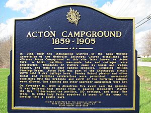
| Acton Park | 2004 | 23 acres (9.3 ha) | 39°39′43″N 85°58′20″W / 39.6620°N 85.9723°W | ||
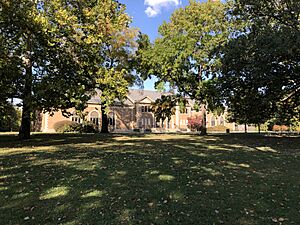
| Beckwith Memorial Park | 1970 | 5.2 acres (2.1 ha) | 39°48′44″N 86°07′23″W / 39.8121°N 86.1230°W | Beckwith Memorial Park has basketball courts, benches, a football field, a playground, and a shelter. It was renamed to honor Frank R. Beckwith, who was the first African American in Indiana to run for president in a major party election. | |
| Broad Ripple Park | 1946 | 56.2 acres (22.7 ha) | 39°52′16″N 86°07′51″W / 39.8712°N 86.1309°W | Broad Ripple Park has sports fields, a baseball diamond, a boat ramp, and a dog park. You can also find a family center, an outdoor swimming pool, picnic tables, a playground, and tennis courts. It's located along the White River. This park used to be the home of White City Amusement Park and the Broad Ripple Park Carousel, which is now at The Children's Museum of Indianapolis. It's also a great spot for birdwatching! | |
| Brookside Park | 1898 | 99.6 acres (40.3 ha) | 39°47′26″N 86°06′35″W / 39.7905°N 86.1096°W | Brookside Park offers baseball fields, basketball courts, a disc golf course, a family center, a football field, and an outdoor swimming pool. There are also paved trails, picnic tables, playgrounds, and tennis courts. This park is part of the Indianapolis Park and Boulevard System and is another good place for birdwatching. | |
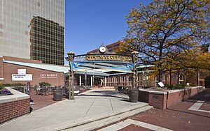
| Charles L. Whistler Memorial Plaza | 1977 | 0.5 acres (0.20 ha) | 39°46′07″N 86°09′14″W / 39.7687°N 86.1539°W | Charles L. Whistler Memorial Plaza has a stage, benches, and movable tables and chairs. You can also see an original archway from Tomlinson Hall here. It's next to the Indianapolis City Market and was named after Charles L. Whistler, a community leader, in 1987. | |
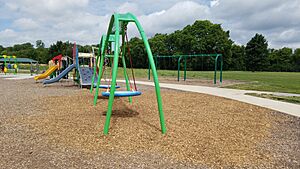
| Colts Canal Playspace | 2018 | 1 acre (0.40 ha) | 39°46′38″N 86°09′52″W / 39.7773°N 86.1644°W | The Colts Canal Playspace is right next to the Canal Walk and Indianapolis Cultural Trail. It has a playground that's easy for everyone to use, benches, and shady spots. This was the first public playground built in downtown Indianapolis. | |
| Dan Wakefield Park | 1928 | 2.7 acres (1.1 ha) | 39°51′54″N 86°08′51″W / 39.8649°N 86.1476°W | Dan Wakefield Park features a beach volleyball court, a playground, a shelter, a splash pad, and tennis courts. It was originally called Broadway & 61st Park, but was renamed in 2016 to honor author and journalist Dan Wakefield. | |
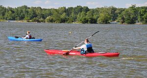
| Eagle Creek Park | 1972 | 5,300 acres (2,100 ha) | 39°52′07″N 86°18′20″W / 39.868642°N 86.305676°W | Eagle Creek Park is the biggest park in Indianapolis and one of the largest city parks in the U.S.! It has a huge 1,400-acre lake, an outdoor theater, a beach, a dog park, a golf course, and a nature center. You can rent canoes, kayaks, paddle boats, and even mountain bikes here. Popular activities include birdwatching, fishing, hiking, and swimming. It's the only city park that asks for an entrance fee. It's also part of the Indy Birding Trail. | |
| Edna Balz Lacy Family Park | 1917 | 2 acres (0.81 ha) | 39°45′24″N 86°08′54″W / 39.7568°N 86.1484°W | Edna Balz Lacy Family Park has a beach volleyball court, a bocce ball court, picnic tables, a playground, a shelter, and a shuffleboard court. It was first called Greer Park, but was renamed in 1995 to honor a kind person named Edna Balz Lacy. | |
| Ellenberger Park | 1911 | 37.4 acres (15.1 ha) | 39°46′36″N 86°04′35″W / 39.7766°N 86.0765°W | Ellenberger Park has sports fields, baseball diamonds, an outdoor swimming pool, playgrounds, a sledding hill, tennis courts, and trails. It's also the start of the Pleasant Run Greenway. This park is another great spot for birdwatching! | |
| Fall Creek Trail at Geist Dam | 64 acres (26 ha) | 39°54′37″N 85°59′23″W / 39.9103°N 85.9896°W | This park has a trail and woods located south of Geist Reservoir. It's part of the Indy Birding Trail. | ||
| Franklin Township Community Park | 1970 | 99 acres (40 ha) | 39°40′46″N 86°00′33″W / 39.6795°N 86.0091°W | Franklin Township Community Park has baseball fields, basketball courts, benches, picnic tables, a playground, a shelter, soccer fields, trails, and woods. It's part of the Indy Birding Trail. | |
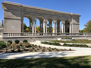
| Garfield Park | 1873 | 123 acres (50 ha) | 39°44′01″N 86°08′45″W / 39.733528°N 86.14573°W | Garfield Park is the oldest city park in Indianapolis. It has a family center, an aquatic center, baseball fields, a basketball court, a community arts center, and a beautiful conservatory with sunken gardens. You can also find football/soccer fields, a public library, playgrounds, and tennis courts. It was first called Southern Park, but was renamed in 1881 to honor President James A. Garfield. It's part of the Indy Birding Trail. | |
| Glenns Valley Nature Park | 1991 | 27 acres (11 ha) | 39°38′45″N 86°11′37″W / 39.6459°N 86.1937°W | This park has a nature center, picnic tables, trails, and woods. There's also a playground shared with the nearby elementary school. It's part of the Indy Birding Trail. | |
| Grassy Creek Regional Park | 1971 | 242 acres (98 ha) | 39°48′49″N 85°58′45″W / 39.8136°N 85.9792°W | This park started as German Church & 30th Park and was much smaller. Over time, it grew to its current size. It has a basketball court, a playground, a shelter, soccer fields, softball fields, a splash pad, tennis courts, and trails. Much of the park is open space with woods and wetlands. It's part of the Indy Birding Trail. | |
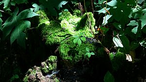
| Gray Park | 1999 | 7.8 acres (3.2 ha) | 39°39′53″N 86°06′05″W / 39.6646°N 86.1014°W | Gray Park has unpaved trails in a wooded area along Buck Creek. It's part of the Indy Birding Trail. | |
| Gustafson Park | 1961 | 32.3 acres (13.1 ha) | 39°48′37″N 86°15′30″W / 39.8104°N 86.2584°W | Gustafson Park has basketball courts, benches, football fields, an outdoor swimming pool, picnic tables, playgrounds, a shelter, tennis courts, and the Randy Shambaugh Baseball Park. It was first called Northwest Park, but was renamed in 1967 to honor a community leader named Howard Gustafson. | |
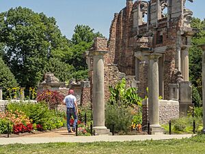
| Holliday Park | 1916 | 95 acres (38 ha) | 39°52′17″N 86°09′42″W / 39.8713°N 86.1616°W | Located along the White River, Holliday Park has an arboretum (a tree garden), a nature center, picnic tables, a playground, a rock garden, and 3.5 miles of trails. It's famous for "The Ruins," which are three large statues from an old building in New York City. These statues were put here in 1973. It's part of the Indy Birding Trail. | |
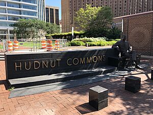
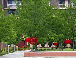
| Hudnut Commons | 1988 | 2.22 acres (0.90 ha) | 39°45′58″N 86°09′45″W / 39.7662°N 86.1624°W | Hudnut Commons is built on top of an underground parking garage. It has benches, brick walkways, fountains, gardens, and a lawn. It was renamed in 2014 to honor William "Bill" Hudnut, who was the mayor of Indianapolis from 1976 to 1992. | |
| Irving Circle Park | 1904 | 0.55 acres (0.22 ha) | 39°45′59″N 86°04′13″W / 39.7664°N 86.0703°W | ||
| Kin Hubbard Memorial Park | 1982 | 0.33 acres (0.13 ha) | 39°46′20″N 86°04′58″W / 39.7722°N 86.0828°W | Kin Hubbard Memorial Park has a bench, open space, and trees along the Pleasant Run Greenway. It's named after cartoonist Kin Hubbard. | |
| Marott Woods Nature Preserve | 1945 | 99.2 acres (40.1 ha) | 39°53′17″N 86°08′35″W / 39.8881°N 86.1431°W | Marott Woods Nature Preserve has picnic tables, a shelter, trails, and woods. It's next to the White River and the Monon Trail. It's part of the Indy Birding Trail. | |
| Pathways to Peace Garden | 1995 | 0.08 acres (0.032 ha) | 39°46′20″N 86°09′47″W / 39.7723°N 86.1631°W | Pathways to Peace Garden has benches, planters, and nice landscaping. It's one of the smallest city parks, covering only about 3,600 square feet. | |
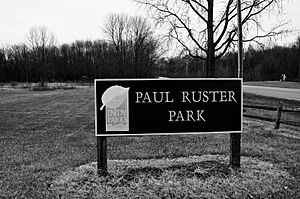
| Paul Ruster Park | 1970 | 102 acres (41 ha) | 39°45′33″N 85°57′46″W / 39.7593°N 85.9629°W | Paul Ruster Park has a dog park, a playground, a pond, shelters, a sledding hill, trails, and woods. It was first called Prospect & Muessing Park, but was renamed in 1979 to honor a local teacher and coach named Paul Ruster. It's part of the Indy Birding Trail. | |
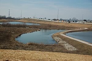
| Pogue's Run Art & Nature Park | 2004 | 43 acres (17 ha) | 39°48′02″N 86°05′21″W / 39.80046°N 86.089135°W | Pogue's Run Art & Nature Park was created as part of a project to control flooding along the Pogue's Run waterway. It has benches, public art, trails, wetlands, and open spaces. It's part of the Indy Birding Trail. | |
| Raymond Park | 1971 | 35.8 acres (14.5 ha) | 39°44′19″N 86°00′57″W / 39.7386°N 86.0157°W | Raymond Park has prairie, trails, wetlands, and woods. It also shares baseball fields, basketball courts, a disc golf course, tennis courts, and the Indy Island Aquatic Center with the nearby Raymond Park Middle School. It's part of the Indy Birding Trail. | |
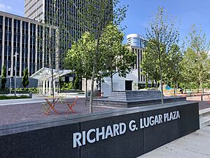
| Richard G. Lugar Plaza | 2018 | 2 acres (0.81 ha) | 39°46′03″N 86°09′13″W / 39.7674°N 86.1535°W | Richard G. Lugar Plaza has a cool interactive fountain, a lawn for events, bike racks, and movable tables and chairs. It also connects to the Indianapolis Cultural Trail. It's named after Richard Lugar, who was mayor from 1968 to 1976 and then a U.S. Senator. | |
| Riverside Park | 1898 | 862 acres (349 ha) | 39°48′18″N 86°11′37″W / 39.804976°N 86.193495°W | ||
| Skiles Test Nature Park | 1974 | 80.91 acres (32.74 ha) | 39°52′19″N 86°03′00″W / 39.8719°N 86.0499°W | Skiles Test Nature Park has restored prairie, woods, and both paved and unpaved trails, including access to the Fall Creek Greenway. It's part of the Indy Birding Trail. | |
| Southeastway Park | 1961 | 188 acres (76 ha) | 39°41′12″N 85°57′29″W / 39.686664°N 85.958022°W | Southeastway Park has an activity center, picnic tables, playgrounds, a pond, shelters, a sledding hill, and trails. It also has different types of prairies, wetlands, and woods. It's part of the Indy Birding Trail. | |
| South Street Square Park | 2019 | 4.26 acres (1.72 ha) | 39°45′38″N 86°09′07″W / 39.7606°N 86.1520°W | South Street Square Park has benches, a lawn for events, and walking paths. A company called Eli Lilly and Company helped develop this park and then gave it to Indy Parks. They also help take care of it. | |
| Southwestway Park | 1961 | 587 acres (238 ha) | 39°39′12″N 86°14′27″W / 39.6533°N 86.2408°W | Located along the White River, Southwestway Park has a golf course, baseball fields, a playground, soccer fields, trails, and woods. You can enjoy birdwatching, fishing, hiking, horseback riding, and mountain biking here. It's part of the Indy Birding Trail. | |
| Spades Park | 1896 | 31 acres (13 ha) | 39°47′09″N 86°07′40″W / 39.7859°N 86.1279°W | Spades Park has open space, a playground, and a shelter. It's part of the Indianapolis Park and Boulevard System and is also a good place for birdwatching. | |
| Stacy Park | 0.25 acres (0.10 ha) | 39°45′24″N 86°08′01″W / 39.7568°N 86.1336°W | Stacy Park has benches, a picnic table, a playground, and a shelter. | ||
| Stamm Park | 1926 | 2.03 acres (0.82 ha) | 39°53′01″N 86°07′49″W / 39.8835°N 86.1302°W | Stamm Park features woods and open space. | |
| Stout Field Park | 1974 | 13.7 acres (5.5 ha) | 39°43′58″N 86°13′42″W / 39.7327°N 86.2284°W | Stout Field Park has a basketball court, picnic tables, a playground, restrooms, a shelter, a splash pad, and walking paths. It's named after the old Stout Field airport. | |
| Tarkington Park | 1945 | 10.32 acres (4.18 ha) | 39°49′38″N 86°09′29″W / 39.8272°N 86.1580°W | Tarkington Park has benches, basketball courts, a café, picnic tables, a playground, a splash pad, and tennis courts. It got a big makeover in 2017. It's named after author Booth Tarkington. | |
| Tolin-Akeman Park | 1989 | 5.5 acres (2.2 ha) | 39°41′29″N 86°05′34″W / 39.6914°N 86.0927°W | Tolin-Akeman Park has open space, a playground, and a shelter. | |
| Town Run Trail Park | 2000 | 127 acres (51 ha) | 39°55′37″N 86°04′42″W / 39.9269°N 86.0782°W | Town Run Trail Park has a special mountain bike course, hiking trails, picnic tables, and a shelter. It's very wooded and is right next to the White River. | |
| Virginia Lee O'Brien Park | 1956 | 3.6 acres (1.5 ha) | 39°48′02″N 86°04′04″W / 39.8005°N 86.0678°W | Virginia Lee O'Brien Park has a basketball court, open space, and a playground. | |
| Washington Park | 1923 | 128.1 acres (51.8 ha) | 39°48′53″N 86°06′52″W / 39.8147°N 86.1145°W | Washington Park has basketball courts, a disc golf course, a family center, playgrounds, and walking paths. It's also home to the Indianapolis Metropolitan Police Department North District offices. The first Indianapolis Zoo was located here from 1964 to 1987. It's part of the Indy Birding Trail. | |
| Watson Road Bird Preserve | 1925 | 4 acres (1.6 ha) | 39°49′25″N 86°08′29″W / 39.8235°N 86.1413°W | Watson Road Bird Preserve has undeveloped woods. It's part of the Indy Birding Trail. | |
| WISH Park | 1995 | 16.1 acres (6.5 ha) | 39°53′11″N 86°12′21″W / 39.8864°N 86.2059°W | WISH Park has benches, a playground, a shelter, and woods. It's named after the local television station WISH-TV, which gave the land to the city. |
Other Fun Spots from Indy Parks
Indy Parks also runs other cool places like Kuntz Memorial Soccer Stadium and the Major Taylor Velodrome, which is a special track for bicycle racing.
Private Parks: Run by Dedicated Groups
These parks are not managed by the city. Instead, they are run by their own groups of volunteers and rely on donations and help from the community.
| Name | Image | Est. | Size ac (ha) |
Location | Description |
|---|---|---|---|---|---|
| ARTSPARK | 2005 | 9.5 acres (3.8 ha) | 39°52′41″N 86°08′39″W / 39.8781°N 86.1443°W | This sculpture park is located along the south side of the White River and next to the Monon Trail. It has 27 pieces of artwork and is managed by the Indianapolis Art Center. It's free to visit! | |
| Ball Nurses' Sunken Garden and Convalescent Park | 1934 | 5.5 acres (2.2 ha) | 39°46′36″N 86°10′56″W / 39.7767°N 86.1821°W | This garden was designed to help people feel better. It's a historic site with benches, a pergola (a shaded walkway), and a fountain with a sculpture called Eve. It's owned by Indiana University. | |
| Daubenspeck Community Nature Park | 2006 | 22 acres (8.9 ha) | 39°55′01″N 86°11′03″W / 39.9169°N 86.1841°W | Daubenspeck Community Nature Park has benches, boardwalks, tall grassy areas, trails, wetlands, and woods. It's managed by a volunteer group and is part of the Indy Birding Trail. | |
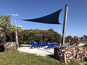
| The Idle | 2018 | 1 acre (0.40 ha) | 39°45′20″N 86°08′38″W / 39.7556°N 86.1440°W | The Idle has a gravel path that leads to a view overlooking the I-65/I-70 highway interchange. It has benches, a shade canopy, and seats from the old Bush Stadium. You can get to it from the Indianapolis Cultural Trail. | |
| James Irving Holcomb Botanical Gardens | 1950 | 20 acres (8.1 ha) | 39°50′39″N 86°10′15″W / 39.8442°N 86.1709°W | These gardens have benches, a carillon (a musical instrument with bells), a fountain, a pond, walking paths, a waterfall, and woods. They are owned by Butler University and named after James Irving Holcomb, who helped the university for many years. It's part of the Indy Birding Trail. | |
| Nina Mason Pulliam EcoLab | 2002 | 55 acres (22 ha) | 39°49′06″N 86°12′14″W / 39.8184°N 86.2040°W | This park was designed to show off nature's beauty. It has old stonework, outdoor classrooms, a pond, trails, wetlands, and woods. It's owned by Marian University and named after a kind person named Nina Mason Pulliam. It's part of the Indy Birding Trail. | |
| Virginia B. Fairbanks Art & Nature Park: 100 Acres | 2010 | 100 acres (40 ha) | 39°49′34″N 86°11′20″W / 39.8261°N 86.1888°W | This park has unique art installations created by artists from all over the world. It also has bike racks, meadows, a quarry pond, walking paths, wetlands, and woods. It's owned by the Indianapolis Museum of Art and is free to visit. It's named after Virginia B. Fairbanks and is part of the Indy Birding Trail. |
State Parks: Big and Beautiful
These parks are managed by the state of Indiana.
| Name | Image | Est. | Size ac (ha) |
Location | Description |
|---|---|---|---|---|---|
| Fort Harrison State Park | 1996 | 1,744 acres (706 ha) | 39°52′17″N 86°01′11″W / 39.871441°N 86.019816°W | This park used to be a U.S. Army base called Fort Benjamin Harrison. Now, it has a golf course, an inn, a museum, a playground, a sledding hill, a dog park, and trails for horseback riding and hiking. You can also go birding, cross-country skiing, cycling, fishing, and picnicking. It's managed by the Indiana Department of Natural Resources and is part of the Indy Birding Trail. | |
| Military Park | 1852 | 14 acres (5.7 ha) | 39°46′14″N 86°10′07″W / 39.770433°N 86.168567°W | Military Park is the oldest park in Indianapolis and a historic site. It has a shelter house, walking paths, and open green space. The Indianapolis Cultural Trail runs along one side, and the Canal Walk is on another. | |
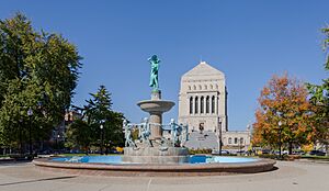
| University Park | 1876 | 4 acres (1.6 ha) | 39°46′19″N 86°09′25″W / 39.771999°N 86.157017°W | University Park is part of a larger historic area called the Indiana World War Memorial Plaza. It has a beautiful fountain called Depew Memorial Fountain, walking paths, flower gardens, benches, and statues. | |
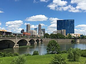
| White River State Park | 1979 | 250 acres (100 ha) | 39°46′00″N 86°10′11″W / 39.766667°N 86.169722°W | This park is split by the White River and is home to many big attractions! You can find the Indianapolis Zoo, the Eiteljorg Museum of American Indians and Western Art, the Indiana State Museum, and the NCAA Hall of Champions here. It also has an amphitheater and a baseball park called Victory Field. Parts of the Canal Walk and Indianapolis Cultural Trail go through the park. It's part of the Indy Birding Trail. |
Former Parks: What Used to Be There
Sometimes parks change or are removed. Here's one that used to be in Indianapolis.
| Name | Image | Est. | Size | Location | Description |
|---|---|---|---|---|---|
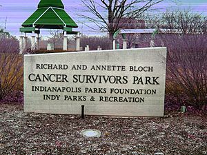
| Richard and Annette Bloch Cancer Survivors Park | 1995 | 0.98 acres (0.40 ha) | 39°46′50″N 86°10′28″W / 39.7806°N 86.1745°W | This park was taken down in 2017. |
See also
 | Bayard Rustin |
 | Jeannette Carter |
 | Jeremiah A. Brown |


