Long Beach Island facts for kids
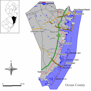
Long Beach Island (often called LBI or just The Island) is a long, narrow island along the Atlantic Ocean coast in Ocean County, New Jersey. It's a popular spot for summer vacations. The island runs from north to south. The northern part usually has bigger, more expensive homes. The southern part has more homes packed together and lots of shops.
Long Beach Island is only about 1 to 2 miles away from the mainland of New Jersey. The main ways people make a living here are through tourism, fishing, and real estate (buying and selling homes). You can only get to the island by car using one main road, a causeway.
About 10,000 people live on the island all year. These people live in six different towns. The biggest town is Long Beach Township. But in the summer, the island gets very busy! The population can grow to about 100,000 people. This includes part-time residents and tourists, who are sometimes called "shoobies." Many people who own vacation homes here are quite wealthy. They come from New Jersey, New York, Pennsylvania, and Connecticut.
Scientists believe that sea level rise could greatly affect the island. By 2013, the ocean level had already gone up by six inches. It is expected to rise even more by 2030. This means the island might need big changes to protect itself in the future.
Contents
Island Geography: Where is LBI?

Long Beach Island is located about 24 miles north of Atlantic City. It's also about 61 miles east-southeast of Philadelphia and 101 miles south of New York City. LBI is about 18 miles long. This includes three miles of marshland that are part of the Edwin B. Forsythe National Wildlife Refuge at the very southern tip.
The island is about half a mile wide at its widest point in Ship Bottom. It's only about a fifth of a mile wide at its narrowest point in Harvey Cedars.
State Route 72 cuts through Long Beach Island. This road connects the mainland to the island at Ship Bottom. It's the only way for cars to get to the island over Manahawkin Bay. This road divides the island into a northern part and a southern part.
- North of the bridge: You'll find towns like Surf City, North Beach, Harvey Cedars, Loveladies, High Bar Harbor, and Barnegat Light.
- South of the bridge: You'll find Ship Bottom, Brant Beach, Long Beach Township (including North Beach Haven), Beach Haven, and Holgate at the very end.
Island History: A Look Back in Time
People have lived on Long Beach Island since 1690. At first, it was a popular place for hunters. Barnegat Inlet, north of the island, was very important for shipping goods and for whaling from the 1600s to the 1900s.
Because the inlet was so important and its waters were rough, a lighthouse was built in 1835. But this first lighthouse wasn't very good. It was often mistaken for another ship. Erosion destroyed it in 1857. The lighthouse we see today, the Barnegat Lighthouse, was finished in 1859. It was built by the U.S. Army Corps of Engineers, led by George Gordon Meade. He later became famous for leading Union forces in the Civil War.
As tourism grew, the Tuckerton Railroad built a bridge across Barnegat Bay in 1886. This allowed trains to bring visitors to Beach Haven. In 1916, a scary event happened in Beach Haven. A shark attack killed a college student, Charles Vansant. This event partly inspired the famous book Jaws.
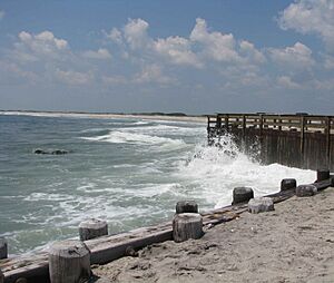
Big storms have hit the island many times. A severe winter storm in 1920 destroyed many beaches and hotels. It even created a new inlet in Holgate. Another storm in 1923 hurt tourism, and train service stopped. In 1935, the railroad bridge to the mainland washed away completely.
One of the most famous storms was the Ash Wednesday Storm of 1962. This storm broke Long Beach Island into many pieces. It almost destroyed the entire island. The current Route 72 Causeway was built in the late 1950s. It replaced an older car bridge, which had replaced the destroyed railroad bridge.
Hurricane Sandy's Impact on LBI


In October 2012, Hurricane Sandy caused a lot of damage to Long Beach Island. People had to leave their homes. Parts of the island were badly flooded, with the ocean meeting the bay in some spots. Streets were covered with up to four feet of sand. The huge storm surge and waves damaged many homes along the ocean and bay.
The main bridge to the island, the Manahawkin Bay Bridge, was closed for 13 days after the storm. Locals could only visit briefly to get their belongings. Bulldozers worked hard to clear hundreds of tons of sand, power lines, and even boats to make the roads safe again. Long Beach Island finally reopened to residents on November 10. However, some areas, like Holgate, were still too dangerous due to damage. Many areas still didn't have sewer, water, or electricity.
The damage was different across the island. Areas with protective sand dunes had less damage. But areas without dunes, or where dunes were broken, were hit much harder. In places like Holgate, the destruction was very bad. Building these protective dunes has been a big project by the U.S. Army Corps of Engineers. But it has caused arguments between local leaders who want the dunes and property owners who worry about their property value. Because of this, the dune system is not yet complete. Other areas hit hard included Loveladies and North Beach. Towns with good dunes, like Harvey Cedars, Ship Bottom, Surf City, and Barnegat Light, did much better.
Electricity was back for most of the island by November 4, 2012. Natural gas service was restored to almost the entire island by November 20, 2012. By mid-November, many businesses were open again. Life on most of the island was back to normal by mid-December.
Island Communities: Towns on LBI
There are six main towns on Long Beach Island. Long Beach Township is the largest. It includes many smaller neighborhoods:
Island Culture: Fun Things to Do
Long Beach Island is known for attracting families during the summer. It's different from busier beach towns like Belmar or Seaside Heights. LBI hasn't had a boardwalk since a hurricane washed the one in Beach Haven away in 1944. There are only a few bars for nightlife.
Visitors usually enjoy activities like miniature golf, parasailing, jet-skiing, walking, shopping, and relaxing on the beaches. The island is also a great place for fishing. Many fishing and charter boats leave from the island's two inlets.
The Lighthouse International Film Festival started on the island in 2009. It's a three-day event that shows movies in different places around the island. Other art spots include the Surflight Theatre in Beach Haven and many art galleries. The Surflight Theatre closed for a while but has reopened and plans to have more shows each year.
Beach Protection: Keeping Our Beaches Safe
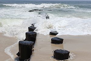
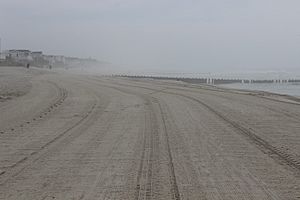
Some of the island's 18 miles of beaches have lost a lot of sand over the years. This threatens the expensive homes along the water. In 2005, the Army Corps of Engineers started a big project. They are building a 22-foot-high, 30-foot-wide dune along the entire island. They use sand pumped from offshore. In front of the dunes, there's a 200-foot-wide stretch of sand between the dune and the ocean.
This project, called beach replenishment, started in Ship Bottom and Surf City. It's still continuing towards the northern part of the island. Beach replenishment has been a very debated topic. Some surfers and swimmers say that pumping sand harms the sandbars that create good waves and swimming spots. Some homeowners worry that the dunes will make their property worth less. But island officials say the dunes are needed to stop beach erosion and protect the island from storms.
Island Travel: Getting Around LBI
The only way for cars to get to Long Beach Island is via State Route 72. This road includes the Dorland J. Henderson Memorial Bridge. People often just call it "The Causeway." The bridge is famous for its "String of Pearls," which are lights along its railings. The bridge was designed by an African American engineer named Dorland J. Henderson, who also designed the unique lights. The bridge connects Manahawkin on the mainland to Ship Bottom on the island. You can also reach the island by water transport.
A big project started in 2005 to add a second bridge span and replace the old bridge. The new southern span opened in 2016. The original bridge was rebuilt over the next three years, and the whole project finished in 2019.
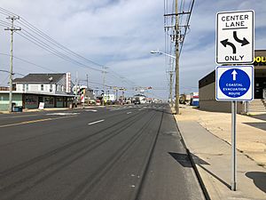
On the island itself, one road is key for getting around: County Route 607. This road has different names in different towns, like Bay Avenue in Beach Haven or Long Beach Boulevard in most other places. It runs the entire length of LBI and connects all the towns and neighborhoods.
For public transportation, NJ Transit Bus route 559 goes to Manahawkin. There's also a local bus service called Ocean Ride on the OC9 Long Beach Island route.
During the summer, TransportAzumah offers daily bus service between Midtown Manhattan in New York City and Long Beach Island. It also stops at Newark Liberty International Airport.
The LBI Shuttle runs the entire 18-mile length of the island along Long Beach Boulevard. It costs $2 during the day (10 am to 10 pm) and $5 at night (10 pm to close). It serves all the towns on Long Beach Island.
Island Landmarks: Places to Visit
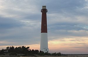
The historic Barnegat Lighthouse is located in Barnegat Lighthouse State Park at the northern tip of the island. The lighthouse tower is 165 feet tall. The park also has trails through local plants and along a jetty. You can visit the lighthouse from Memorial Day to Labor Day. There's a small fee to climb the 217 steps. If you don't want to climb, you can see live views from the top on a screen in the nearby Interpretive Center.
In Loveladies, you'll find the Long Beach Island Foundation of the Arts and Sciences. This organization offers art, science, and fun programs for locals and visitors.
In Beach Haven, the Fantasy Island Amusement Park is the only place on the island with full-time amusement rides, including a classic carousel. Fantasy Island has rides, games, food, live shows, and an arcade. Entry and parking are free. The annual Festival Of The Sea carnival also happens at the St. Francis Community Church in Ship Bottom every August.
Lucille's Oh Fudge! Candies in Brant Beach has a large display of salt water taffy. This candy was first made in nearby Atlantic City.
Thundering Surf Water Park is the island's only water park. It has six water slides, a kids' area, a lazy river, miniature golf, and a Flow House. It's a popular spot for families.
Two important shopping areas are Schooner's Wharf/Bay Village in Beach Haven and Viking Village in Barnegat Light. Viking Village has many family-owned shops, often linked to the local fishing industry. You can also find handmade crafts there. Schooner's Wharf/Bay Village is more for tourists, with many restaurants and shops. The annual Chowderfest clam chowder competition is held at Schooner's Wharf/Bay Village every October. This event brings many tourists to the island during the off-season.
Climate and Nature
Long Beach Island has a climate with hot, somewhat humid summers and cool winters. It rains throughout the year. In summer, a cool ocean breeze often blows in the afternoon. But sometimes it can get very hot and humid. In winter, it can get very cold and windy. The average snowfall each year is between 12 and 18 inches.
| Climate data for ninth St Beach, Ship Bottom, NJ (1981-2010 Averages) | |||||||||||||
|---|---|---|---|---|---|---|---|---|---|---|---|---|---|
| Month | Jan | Feb | Mar | Apr | May | Jun | Jul | Aug | Sep | Oct | Nov | Dec | Year |
| Mean daily maximum °F (°C) | 40.2 (4.6) |
42.4 (5.8) |
49.1 (9.5) |
57.8 (14.3) |
68.1 (20.1) |
77.2 (25.1) |
82.6 (28.1) |
81.5 (27.5) |
75.6 (24.2) |
65.1 (18.4) |
55.0 (12.8) |
45.1 (7.3) |
61.7 (16.5) |
| Daily mean °F (°C) | 33.1 (0.6) |
35.2 (1.8) |
41.5 (5.3) |
50.3 (10.2) |
60.2 (15.7) |
69.6 (20.9) |
75.3 (24.1) |
74.3 (23.5) |
67.9 (19.9) |
56.9 (13.8) |
47.4 (8.6) |
37.9 (3.3) |
54.2 (12.3) |
| Mean daily minimum °F (°C) | 26.0 (−3.3) |
27.9 (−2.3) |
33.9 (1.1) |
42.9 (6.1) |
52.4 (11.3) |
62.1 (16.7) |
68.0 (20.0) |
67.1 (19.5) |
60.3 (15.7) |
48.7 (9.3) |
39.9 (4.4) |
30.7 (−0.7) |
46.7 (8.2) |
| Average precipitation inches (mm) | 3.34 (85) |
3.01 (76) |
4.10 (104) |
3.60 (91) |
3.09 (78) |
2.99 (76) |
3.94 (100) |
4.23 (107) |
3.08 (78) |
3.53 (90) |
3.14 (80) |
3.55 (90) |
41.60 (1,057) |
| Average relative humidity (%) | 66.9 | 64.7 | 63.2 | 64.3 | 67.5 | 71.6 | 70.9 | 72.5 | 71.4 | 70.0 | 68.9 | 67.8 | 68.3 |
| Average dew point °F (°C) | 23.3 (−4.8) |
24.5 (−4.2) |
29.9 (−1.2) |
38.7 (3.7) |
49.4 (9.7) |
60.0 (15.6) |
65.2 (18.4) |
64.9 (18.3) |
58.3 (14.6) |
47.2 (8.4) |
37.7 (3.2) |
28.2 (−2.1) |
44.0 (6.7) |
| Source: PRISM | |||||||||||||
| Climate data for Atlantic City, NJ Ocean Water Temperature (24 SW Long Beach Island) | |||||||||||||
|---|---|---|---|---|---|---|---|---|---|---|---|---|---|
| Month | Jan | Feb | Mar | Apr | May | Jun | Jul | Aug | Sep | Oct | Nov | Dec | Year |
| Daily mean °F (°C) | 37 (3) |
35 (2) |
42 (6) |
48 (9) |
56 (13) |
63 (17) |
70 (21) |
73 (23) |
70 (21) |
61 (16) |
53 (12) |
44 (7) |
54 (12) |
| Source: NOAA | |||||||||||||
Local Media
The SandPaper is a weekly newsmagazine that covers news on the island and mainland. It also shares cultural, historical, and entertainment stories.
The Press of Atlantic City provides daily news about the towns. Local governments also write columns for The Southern Ocean Times, one of seven weekly papers from Micromedia Publications. There's also a website called LBI Eats, written by locals, which shares island news, restaurant reviews, and details about the best features of the area.


