Longlands Fell facts for kids
Quick facts for kids Longlands Fell |
|
|---|---|

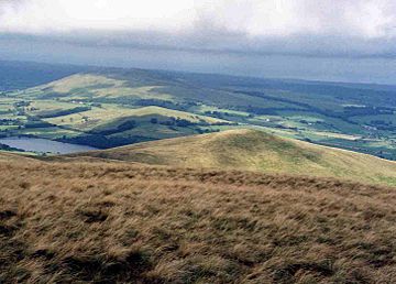
Longlands Fell seen from Lowthwaite Fell.
|
|
| Highest point | |
| Elevation | 483 m (1,585 ft) |
| Prominence | c. 33 m |
| Parent peak | Lowthwaite Fell |
| Listing | Wainwright |
| Geography | |
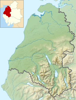
| Location | Cumbria, England |
| Parent range | Lake District, Northern Fells |
| OS grid | NY275353 |
| Topo map | OS Landranger 89, 90 OS Explorer 4 |
Longlands Fell is a small fell (a type of mountain or hill) located in the northern part of the Lake District in England. It's part of a group of hills called the Uldale Fells. This fell is about 5.5 kilometers (3.4 miles) southwest of the village of Caldbeck.
Longlands Fell stands 483 meters (1,585 feet) tall. It is one of the most northerly fells in the entire Lake District, along with Binsey.
Contents
Exploring Longlands Fell's Landscape
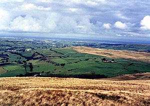
Longlands Fell has gentle, grassy slopes. These slopes gradually go down towards the flat lands north of the Lake District. This makes it quite easy to walk up the fell from that direction.
The Quiet Uldale Fells
Longlands Fell is one of the Uldale Fells. The other fells in this group are Great Sca Fell, Great Cockup, and Meal Fell. These fells are mostly used for sheep grazing. Not many hikers or visitors come here. This makes the Uldale Fells one of the quietest parts of the Lake District National Park. The park's boundary is only two kilometers (1.2 miles) to the north.
A Look at Longlands Fell's History
Unlike the nearby Caldbeck Fells, which had many mines, the Uldale Fells only had one mine. This was the Longlands Fell copper mine.
Mining for Copper
The copper mine on Longlands Fell started in the second half of the 1800s. However, it soon became clear that the mine was not making enough money. Because of this, it was closed down. Today, one of the old mine tunnels is used to collect water for the village of Uldale.
Ancient Settlements Nearby
Just north of Longlands Fell is a smaller hill called Aughtertree Fell. On Aughtertree Fell, you can find signs of an Iron Age farming settlement. People first lived here about 3,000 years ago. It was likely abandoned during the Dark Ages.
Walking Up Longlands Fell
Longlands Fell is known as one of the easier walks in the Lake District. It's a great choice for those who want a less challenging hike.
Starting Your Ascent
Most people start their walk from the small group of houses called Longlands hamlet. From there, you follow a track that goes northeast around the base of the fell. This track is also part of the Cumbria Way, a long-distance walking route.
When you reach the bottom of the northern ridge, you can follow the easy slopes up to the top.
Connecting to Other Fells
Many hikers combine climbing Longlands Fell with other fells. A 2.5-kilometer (1.5-mile) ridge connects Longlands Fell to Great Sca Fell to the southeast. From Great Sca Fell, you can easily reach the other fells in the area along its ridges.
Views from the Summit
The top of Longlands Fell offers some amazing views.
What You Can See
- To the north, you can see the Solway Firth and the Galloway hills in Scotland.
- Looking south, you get good views of Skiddaw, one of the highest mountains in the Lake District.
- The fells around the Whinlatter forest are also clearly visible from the summit.
 | Chris Smalls |
 | Fred Hampton |
 | Ralph Abernathy |


