Ma Ma Creek, Queensland facts for kids
Quick facts for kids Ma Ma CreekQueensland |
|||||||||||||||
|---|---|---|---|---|---|---|---|---|---|---|---|---|---|---|---|

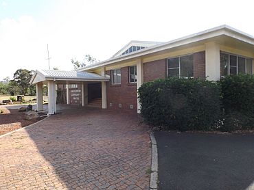
Ma Ma Creek Community Centre, 2014
|
|||||||||||||||
| Population | 155 (2021 census) | ||||||||||||||
| • Density | 6.60/km2 (17.1/sq mi) | ||||||||||||||
| Postcode(s) | 4347 | ||||||||||||||
| Area | 23.5 km2 (9.1 sq mi) | ||||||||||||||
| Time zone | AEST (UTC+10:00) | ||||||||||||||
| Location | |||||||||||||||
| LGA(s) | Lockyer Valley Region | ||||||||||||||
| State electorate(s) | Lockyer | ||||||||||||||
| Federal Division(s) | Wright | ||||||||||||||
|
|||||||||||||||
Ma Ma Creek is a small country town located in the Lockyer Valley Region of Queensland, Australia. It's a quiet place where people live in a rural setting. In 2021, about 155 people called Ma Ma Creek home.
Contents
Exploring Ma Ma Creek's Location
Ma Ma Creek is a rural area. While there are some homes in the main town, most people live on larger blocks of land along the Gatton Clifton Road. Farmers in the area use irrigation to grow crops along this road. Other parts of the area are used for grazing animals like cattle on natural plants. The actual Ma Ma Creek (which is a waterway) flows through the area from south to north.
Main Roads in Ma Ma Creek
The main road in the area is the Gatton–Clifton Road, also known as State Route 80. This road runs through Ma Ma Creek from the north-east to the south.
A Look at Ma Ma Creek's Past
The town of Ma Ma Creek gets its name from the creek that flows nearby. This creek is a small stream that eventually joins the Lockyer Creek, which then flows into the Brisbane River and finally reaches Moreton Bay.
How Ma Ma Creek Got Its Name
The name Ma Ma is thought to come from the Aboriginal word mia mia. This word means bark huts. However, mia mia is actually a term from Western Australia. This suggests that European settlers probably gave the creek its name.
Early Services and Schools
Ma Ma Creek got its first post office on May 1, 1884. Before that, a smaller "receiving office" had been open since 1881. The Ma Ma Creek Provisional School first opened its doors on October 27, 1880. It later became the Ma Ma State School on January 21, 1889.
Remembering the Fallen: The War Memorial
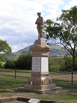
The Ma Ma Creek War Memorial is a special monument that remembers three brothers: James, George, and Bertie Andrews. All three of them sadly died fighting in World War I. Their mother, Fleurine Elsie Andrews, had the memorial built in 1920. Even though it was a private monument, the community uses it for ANZAC Day ceremonies to honor all soldiers.
Ma Ma Creek's Population Over Time
The number of people living in Ma Ma Creek has changed over the years.
- In 2011, the area had a population of 403 people.
- By 2016, the population was 149 people.
- In the most recent count in 2021, about 155 people lived in Ma Ma Creek.
Special Places: Heritage Listings
Ma Ma Creek has some sites that are listed as important heritage places. This means they are protected because of their historical value.
- One such place is the Ma Ma Creek War Memorial located on Gatton-Clifton Road.
Learning in Ma Ma Creek
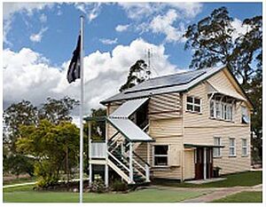
Ma Ma Creek State School is a government primary school for students from Prep to Year 6. It's located at 803 Gatton-Clifton Road. In 2017, the school had 16 students and a few teachers and staff.
There isn't a high school in Ma Ma Creek itself. Older students usually go to Lockyer District State High School in nearby Gatton.
Community Life and Facilities
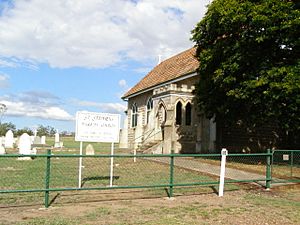
The town has a community centre where people can gather. There's also a general store for everyday needs. Ma Ma Creek has two churches: St Stephen's Anglican Church and a Church of Christ. St Stephen's Anglican Church also has a cemetery next to it.
 | Mary Eliza Mahoney |
 | Susie King Taylor |
 | Ida Gray |
 | Eliza Ann Grier |


