Mallacoota, Victoria facts for kids
Quick facts for kids MallacootaVictoria |
|||||||||
|---|---|---|---|---|---|---|---|---|---|

Mallacoota
|
|||||||||
| Population | 1,183 (2021 census) | ||||||||
| Postcode(s) | 3892 | ||||||||
| Elevation | 22 m (72 ft) | ||||||||
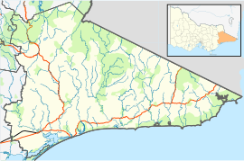
| Location | |||||||||
| LGA(s) | Shire of East Gippsland | ||||||||
| State electorate(s) | Gippsland East | ||||||||
| Federal Division(s) | Gippsland | ||||||||
|
|||||||||
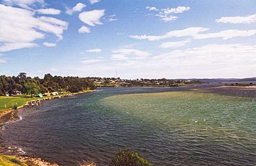
Mallacoota is a lovely small town in the East Gippsland area of Victoria, Australia. It's located right on the coast. In 2021, about 1,183 people lived there. But during holidays like Easter and Christmas, the town gets super busy! Its population can grow by about 8,000 people.
Mallacoota is the last town you'll find on Victoria's east coast before you reach the border with New South Wales. It even has a small airport (Mallacoota Airport) for light planes and commercial flights from Melbourne.
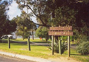
This town is a really popular spot for holidays. People love to go boating, fishing, and swimming here. It's also great for walking along the wild coast, birdwatching, and surfing. The Mallacoota Arts Council often holds fun events throughout the year. The Mallacoota Inlet is a key stop on the coastal walk from New South Wales to Victoria. You'll also find a place called Gipsy Point at the top of the inlet.
Contents
A Look Back: Mallacoota's History
For a very long time, the land around Mallacoota belonged to the Bidawal people. They lived here before European settlers arrived.
New settlers started coming to the area in the 1830s. A small wooden lighthouse was built on nearby Gabo Island in 1854. A stronger granite lighthouse was finished in 1862. By the 1880s, people were catching lots of fish to sell. Some of these fish were even sent all the way to Melbourne. Around the same time, the first tourists started visiting Mallacoota.
Gold was found in 1894, and a mine called Spotted Dog Mine operated for three years. The Mallacoota Post Office opened in 1894. Later, during World War II, a small airfield was built to help protect the coast. Over the years, industries like logging and farming became less important. Instead, tourism and the abalone industry grew. Abalone are a type of sea snail that people eat. The town's biggest employer, the abalone co-operative, started in 1967.
In December 2019, big bushfires in the East Gippsland region had a huge effect on Mallacoota and the nearby town of Genoa.
Mallacoota's Location and Nature
Mallacoota is one of the most isolated towns in Victoria. It's about 25 kilometres (15.5 miles) off the main Princes Highway. It's also quite a drive from big cities: about 523 kilometres (325 miles) from Melbourne and 526 kilometres (327 miles) from Sydney, New South Wales.
The town is famous for its beautiful wild flowers. It's also known for its abalone industry. The Mallacoota Inlet is a special area where fresh water from rivers mixes with salty ocean water. This estuary has two main parts: Top Lake and Bottom Lake. The town is surrounded by the amazing Croajingolong National Park.
Gipsy Point is at the top of the Mallacoota Inlet. It's a fantastic place to see many different kinds of birds.
Sports and Fun in Mallacoota
If you like golf, you can play at the Mallacoota Golf and Country Club.
Mallacoota also has a soccer club called the Mallacoota Blues. They have teams for kids and adults. They play in the Far South Coast Football Association. The town also hosts the yearly Mallacoota Cup soccer tournament.
During certain times of the year, you can go whale watching! You might see amazing creatures like Burrunan dolphins, southern right whales, and humpback whales swimming along the coast.
Fishing competitions are very popular in Mallacoota. Many are held on weekends throughout the year. These events bring lots of visitors, which helps local businesses.
The 2019-2020 Bushfires: A Big Event
Mallacoota faced a huge challenge during the 2019-2020 bushfire season.
How the Fire Started
On the evening of December 28, a lightning strike near Wingan River started a bushfire. Even though the weather wasn't too bad at first, the fire began to spread towards the coast. Experts knew that strong winds and dangerous fire conditions were coming soon. This meant the town was at risk if the fire wasn't stopped.
Warnings and Safety Measures
People in the East Gippsland area were warned to evacuate on December 28. This led to over 30,000 holidaymakers leaving the region. Mallacoota was not included in these first warnings.
Right after the fire started, about 95 volunteer firefighters from the Country Fire Authority (CFA) arrived in Mallacoota. They came with 18 fire trucks to help the local fire brigade. At that time, about 10,000 people were in the town, including residents and visitors.
On December 29, people in Mallacoota were told it was too late to leave. The main road to Melbourne was closed. However, roads to New South Wales were still safe. Later that day, the roads to Melbourne reopened, but people were still advised to stay in Mallacoota for safety.
On December 30, local authorities held a meeting to tell everyone about the fire and where to shelter. People who wanted to leave were told they could go north towards Eden and Canberra. Soon after, all roads were officially closed. About 1,000 residents and 3,000 visitors stayed in town.
The Fire's Impact
On December 31, strong winds pushed the fire through the Croajingolong National Park towards Mallacoota. Firefighters couldn't stop it because of the rough land and thick smoke. At 4:40 pm on December 30, an emergency warning told everyone to go to a safe place. People went to the local hall or the wharf. Many boat owners took their boats onto the lake for safety. More than 50 boats with up to 300 people were on the lake.
The town was evacuated towards the main wharf and into the hall. They stayed there for over 24 hours. The smoke was so thick that it turned day into night. Around 8:00 am on December 31, a firestorm reached the town's industrial area. The fire front was about 10 kilometres (6 miles) wide. Many homes were destroyed or damaged, especially in Genoa Road and Terra Nova Drive. Over 135 homes were lost. However, the main parts of the town where people were sheltering, and most of the important buildings, were saved. Luckily, no one died in the fires.
After the Fires
Even after the main danger passed, fires continued to burn around the town. On December 31, people started to leave their shelters and go back to their homes. Some areas were still cut off by active fires. On January 1, thick smoke covered the town. Many people needed medical help, and supplies of asthma inhalers ran out.
Evacuation by Sea and Air
On January 2, the Royal Australian Navy arrived in Mallacoota. They brought medical supplies and fuel. On January 3, they started a large evacuation by sea. This was because hundreds of kilometres of roads were damaged, making it hard to leave by car. Nearly 1,000 people and their pets were evacuated on HMAS Choules. It was a 20-hour trip to Hastings. The Royal Australian Air Force also helped, evacuating another 450 people by air once the smoke cleared enough to fly safely.
Getting Back to Normal
On January 18, roads were opened for residents to cross the border into New South Wales to buy supplies. During the Australia Day weekend, campers and visitors were allowed to return briefly to collect their belongings. By February 6, all roads into Mallacoota were fully open again.
Mallacoota's Climate
Mallacoota has an oceanic climate. This means it has mild temperatures all year round. Sometimes, in winter, it can get unusually warm. This is due to a special weather effect called the foehn effect.
| Climate data for Mallacoota (1991–2020 averages, 1974–2022 extremes) | |||||||||||||
|---|---|---|---|---|---|---|---|---|---|---|---|---|---|
| Month | Jan | Feb | Mar | Apr | May | Jun | Jul | Aug | Sep | Oct | Nov | Dec | Year |
| Record high °C (°F) | 42.0 (107.6) |
41.6 (106.9) |
36.9 (98.4) |
37.2 (99.0) |
26.7 (80.1) |
22.2 (72.0) |
23.5 (74.3) |
26.6 (79.9) |
35.2 (95.4) |
36.2 (97.2) |
40.7 (105.3) |
41.6 (106.9) |
42.0 (107.6) |
| Mean daily maximum °C (°F) | 24.3 (75.7) |
24.0 (75.2) |
22.5 (72.5) |
20.2 (68.4) |
17.6 (63.7) |
15.4 (59.7) |
15.0 (59.0) |
15.7 (60.3) |
17.5 (63.5) |
19.2 (66.6) |
20.9 (69.6) |
22.3 (72.1) |
19.6 (67.3) |
| Mean daily minimum °C (°F) | 15.8 (60.4) |
15.7 (60.3) |
14.3 (57.7) |
11.8 (53.2) |
9.3 (48.7) |
7.3 (45.1) |
6.3 (43.3) |
6.4 (43.5) |
8.3 (46.9) |
10.0 (50.0) |
12.2 (54.0) |
13.8 (56.8) |
10.9 (51.6) |
| Record low °C (°F) | 6.8 (44.2) |
6.6 (43.9) |
6.5 (43.7) |
4.0 (39.2) |
2.4 (36.3) |
0.7 (33.3) |
0.4 (32.7) |
0.5 (32.9) |
0.7 (33.3) |
2.9 (37.2) |
3.2 (37.8) |
5.6 (42.1) |
0.4 (32.7) |
| Average precipitation mm (inches) | 62.8 (2.47) |
70.0 (2.76) |
70.6 (2.78) |
84.5 (3.33) |
75.8 (2.98) |
96.5 (3.80) |
80.4 (3.17) |
65.9 (2.59) |
68.5 (2.70) |
73.3 (2.89) |
80.3 (3.16) |
68.6 (2.70) |
897.0 (35.31) |
| Average precipitation days | 8.9 | 9.0 | 9.7 | 10.9 | 13.2 | 15.2 | 13.8 | 12.8 | 12.7 | 12.4 | 11.1 | 9.7 | 139.4 |
| Average relative humidity (%) | 66 | 69 | 66 | 67 | 68 | 69 | 65 | 63 | 64 | 65 | 65 | 66 | 66 |
| Source 1: Bureau of Meteorology, Mallacoota (1991–2020) | |||||||||||||
| Source 2: Bureau of Meteorology, Mallacoota (all years) | |||||||||||||
Famous People from Mallacoota
- E. J. Brady (1869–1952) – A well-known author and poet.
- Sean Dempster (born 1984) – An Australian rules footballer who played for the Sydney Swans and St Kilda Football Club.
- Sue Hines (born 1959) – A children's author.
- Bruce Pascoe (born 1947) – An Indigenous Australian author.
 | Emma Amos |
 | Edward Mitchell Bannister |
 | Larry D. Alexander |
 | Ernie Barnes |


