Martin Hill (Pennsylvania) facts for kids
Quick facts for kids Martin Hill |
|
|---|---|

Martin Hill
|
|
| Highest point | |
| Elevation | 2,775 ft (846 m) NGVD 29 |
| Geography | |
| Parent range | Appalachian Mountains |
| Topo map | USGS Beans Cove (PA) Quadrangle |
| Climbing | |
| Easiest route | Road |
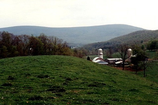
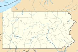
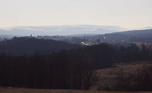
Martin Hill is a mountain ridge in Bedford County, Pennsylvania, Pennsylvania. It connects Tussey Mountain to its east and Evitts Mountain to its west. This mountain is part of the Martin Hill Wild Area, which belongs to the Buchanan State Forest.
What makes Martin Hill special is that its highest point doesn't have any communication towers or transmitters. These are usually found on a smaller peak nearby. Martin Hill is the second highest mountain in Pennsylvania's Ridge-and-Valley Appalachians. The tallest is Wills Mountain, which is a bit higher at 2,780 feet (847 meters).
Contents
Animals and Plants of Martin Hill
Martin Hill is a wild and rugged mountain. It has many trails that follow the top ridge and go down its sides. You can find lots of cool animals living here.
Wildlife You Might See
Keep an eye out for amazing wildlife on Martin Hill! Some of the animals that call this mountain home include:
- Bobcats
- Black bears
- Ruffed grouse (a type of bird)
- Wild turkeys
- White-tailed deer
Trees and Other Plants
The forests on Martin Hill are mostly made up of oak and hickory trees. But there are many other interesting plants too:
- Mountain laurel (Kalmia latifolia)
- White pine (Pinus strobus)
- Hemlock (Tsuga canadensis)
On the higher parts of the mountain, you can also find:
- Sassafras (Sassafras albidum)
- Fire cherry (Prunus pensylvanica)
- Striped maple (Acer pensylvanicum)
Exploring Martin Hill
Martin Hill is a great place for outdoor adventures. It's part of a larger wild area that offers a quiet escape into nature.
The Sweet Root Natural Area
Next to Martin Hill is the Sweet Root Natural Area. This area covers about 13,000 acres (53 square kilometers) of wild land. Many people think it's one of the most peaceful and remote places in Pennsylvania.
Views from the Mountain
There used to be a forest fire lookout tower on Martin Hill. It was taken down in 2003. From that tower, you could see amazing views!
- To the north, you could see the ridges of Evitts and Tussey Mountain stretching far away.
- Blue Knob was visible about 30 miles (48 km) away.
- To the east, you could see Sideling Hill, including its deep road cut on I-68 in Maryland.
- To the south, Dans Mountain in Maryland was visible.
- To the west, you could see the highest point of Wills Mountain and the Allegheny Front.
Even though the old tower is gone, you can still find other great spots on the mountain. There are rocky areas and overlooks that offer beautiful views of the surrounding landscape.
The Mid State Trail
The former fire tower site on Martin Hill is also the highest point on Pennsylvania's longest walking path, the Mid State Trail. This makes Martin Hill an important spot for hikers and nature lovers.
 | Selma Burke |
 | Pauline Powell Burns |
 | Frederick J. Brown |
 | Robert Blackburn |


