Wills Mountain facts for kids
Quick facts for kids Wills Mountain |
|
|---|---|

Wills Mountain in Pennsylvania
|
|
| Highest point | |
| Elevation | 2,790 feet (850 m) |
| Prominence | 1,440 feet (440 m) |
| Geography | |
| Location | Bedford County, Pennsylvania / Allegany County, Maryland, U.S. |
| Parent range | Allegheny Mountains, part of the Ridge-and-Valley Appalachians |
| Topo map | USGS Hyndman (PA) Quadrangle |
| Climbing | |
| Easiest route | Jeep trail |
Wills Mountain is a long, narrow mountain ridge in the Appalachian Mountains of the United States. It stretches through parts of Pennsylvania and Maryland. This mountain is special because its top is covered with a very hard rock called quartzite. It's also part of a larger group of mountains known as the Ridge-and-Valley Appalachians.
Wills Mountain starts near Bedford, Pennsylvania, and goes all the way to Cumberland, Maryland. It's the most northern of several ridges that form a big geological fold called the Wills Mountain Anticline.
Contents
Exploring Wills Mountain: Where Is It?
Wills Mountain is located in two different states: Pennsylvania and Maryland. Each part has its own interesting features.
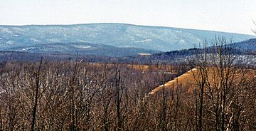
Wills Mountain in Pennsylvania
The Pennsylvania part of Wills Mountain is found in Bedford County. Here, the mountain reaches a height of about 2,782 feet (848 meters). While some mountains in Pennsylvania are taller, Wills Mountain is the highest in its specific region, the Ridge and Valley area. It might even have the highest prominence in Pennsylvania. Prominence means how much a mountain stands out from the land around it.
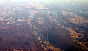
The mountain ridge starts suddenly near the Juniata River. This is just north of a spot called Kinton Knob, which is west of Bedford. The valley south of Kinton Knob is known as Milligans Cove. This area is a great example of a "breached anticline," which is a geological fold that has been worn away by erosion.
Parts of Wills Mountain, including its very top, are within Pennsylvania State Game Lands No. 48. This means access to the mountain is limited. You can mostly find jeep trails and a gravel road on the ridge. The summit, or top, of Wills Mountain does not have any towers or transmitters. Getting to the top can be tough, as it requires a hike of more than 1,800 feet (549 meters) uphill.
Wills Mountain in Maryland

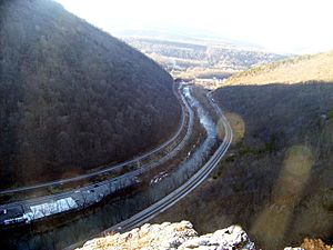
The Maryland part of Wills Mountain is in Allegany County. Here, the mountain rises steeply from a place called the Cumberland Narrows. This is a "water gap" located west of Cumberland. A water gap is a valley that a river or stream has cut through a mountain ridge. The highest point of Wills Mountain in Maryland is about 1,877 feet (572 meters).
On the south side of the Narrows is Haystack Mountain. Geologically, Haystack Mountain and Wills Mountain are very similar. They are both central ridges of the Wills Mountain Anticline. The Cumberland Narrows was carved into these hard, quartzite-capped mountains by Wills Creek. This process took millions of years.
The Cumberland Narrows is an important passage. It serves as a western gateway from Cumberland to the Appalachian Plateau. The Old National Road, which is now Alternate U.S. 40, goes through the Narrows. Also, several train lines and a bike trail called the Great Allegheny Passage use this easy route through the mountains.
A famous rocky spot at the south end of Wills Mountain in the Cumberland Narrows is called Lover's Leap.
Understanding Wills Mountain's Geology
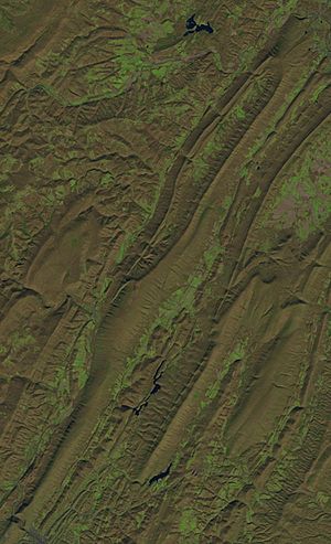
Wills Mountain gets its strong shape from a very hard rock called Silurian Tuscarora quartzite. This rock resists erosion, which is why it forms the top of the mountain ridge. The mountain sits in the middle of the Wills Mountain Anticline. This is a large geological structure that stretches from southern Pennsylvania through Maryland and West Virginia into Virginia.
In an anticline, layers of rock are bent upwards, like a giant arch. The tough Tuscarora quartzite forms the very top of the mountain. Other, softer rocks like limestones and shales are found on the mountain's slopes. These softer rocks erode more easily.
 | Isaac Myers |
 | D. Hamilton Jackson |
 | A. Philip Randolph |


