McLeod River facts for kids
Quick facts for kids McLeod River |
|
|---|---|

|
|
| Country | Canada |
| Province | Alberta |
| Physical characteristics | |
| Main source | Cardinal Divide 1,621 m (5,318 ft) 52°59′00″N 117°20′15″W / 52.98333°N 117.33750°W |
| River mouth | Athabasca River 690 m (2,260 ft) 52°51′55″N 115°42′01″W / 52.86528°N 115.70028°W |
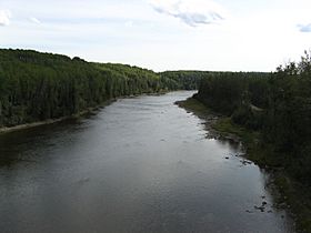
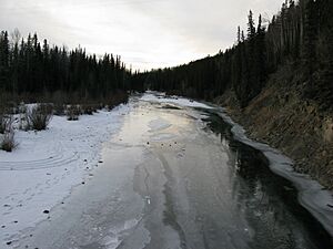
The McLeod River is a cool river in west-central Alberta, Canada. It starts in the rolling hills at the base of the Canadian Rockies. This river is a big branch, or tributary, of the larger Athabasca River.

Where the McLeod River Flows
The McLeod River begins right outside the eastern edge of Jasper National Park. It forms where two smaller streams, Thornton Creek and Cheviot Creek, meet. These streams get their water from melting snow on Tripoli and Cheviot Mountains.
The river then follows a road called Grave Flats Road. Along the way, it collects water from Prospect, Whitehorse, and Cadomin Creeks. Finally, it flows into a lake called Lac des Roches, which is south of the town of Cadomin.
After the lake, the river winds through the hills. Soon, four more important rivers join it. These are the Gregg, Erith, Embarrass, and Edson rivers. The McLeod River then meets the mighty Athabasca River near the town of Whitecourt, Alberta.
Plans for a Big Dam
In the 1950s and 1960s, the Alberta Government thought about moving water from one river system to another. They wanted to take water from the Athabasca-Mackenzie rivers and send it to the North and South Saskatchewan rivers.
In 1970, a first report came out about building a dam on the McLeod River. This dam was going to be about 20 kilometres (12 miles) northeast of Edson, Alberta. It would have been close to the small community of Peers, Alberta.
The plan was to send the water through a special channel, called a canal, to Chip Lake. The report described the dam as a very large structure.
The main part of the dam would have been 5,810 foot (1,770 metres) long. It would have been 140 foot (43 metres) tall at its highest point. There would also be long walls, called dykes, to hold back the water.
Two tunnels were planned to let the river flow during construction. One tunnel would later be used to let water out at a low level. A special overflow area, called a spillway, was designed to handle very large floods. This would stop the water from going over the top of the dam.
The dam would have created a huge lake, or reservoir, about 12 miles (19 kilometres) long. This reservoir would have held a lot of water.
However, the idea for the McLeod Valley Dam was put aside in the 1970s. This happened because building costs became too high. Also, people started to worry about how the dam would affect the environment.
What Feeds the McLeod River?
Many smaller rivers and creeks flow into the McLeod River. Here is a list of them, starting from where the McLeod River begins and going downstream towards the Athabasca River:
- Thornton Creek
- Cheviot Creek
- Prospect Creek
- Whitehorse Creek
- Drummond Creek
- Harlequin Creek
- Cadomin Creek
- Luscar Creek
- Lac des Roches
- Watson Creek
- Mackenzie Creek
- Beaverdam Creek
- Taylor Creek
- Chief Creek
- Thompson Creek
- Rainbow Creek
- Mercoal Creek
- Deerlick Creek
- Eunice Creek
- Wampus Creek
- Mary Gregg Creek
- Mary Gregg Lake
- Trapper Creek
- Antler Creek
- McCardell Creek
- Gregg River
- Berry's Creek
- Sphinx Creek
- Drinnan Creek
- Folding Mountain Creek
- Mystery Lake
- Warden Creek
- Teepee Creek
- Wigwam Creek
- Anderson Creek
- Quigley Creek
- McPherson Creek
- White Creek
- Corral Creek
- Embarras River
- Mitchell Creek
- Baril Creek
- Lambert Creek
- Neill Creek
- Prest Creek
- Bryan Creek
- Dummy (Hay) Creek
- Erith River
- Rodney Creek
- Raven Creek
- Hanlan Creek
- Lendrum Creek
- Lund Creek
- Halpenny Creek
- Wickham Creek
- Little Sundance Creek
- Swartz Creek
- Wolf Creek
- Edson River
- Bench Creek
- Trout Creek
- January Creek
- South Carrot Creek
- Lost Creek
- Groat Creek
- Beaver Creek
 | Tommie Smith |
 | Simone Manuel |
 | Shani Davis |
 | Simone Biles |
 | Alice Coachman |

