
Mende, Lozère facts for kids
Quick facts for kids
Mende
|
||
|---|---|---|
|
Prefecture and commune
|
||

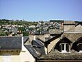
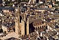
Aerial view of Mende, with the cathedral.
|
||
|
||

Mende
Location in France

Mende
Location in Occitanie
|
||
| Country | France | |
| Region | Occitanie | |
| Department | Lozère | |
| Arrondissement | Mende | |
| Canton | Mende-1 Mende-2 |
|
| Intercommunality | Communauté de communes Cœur de Lozère | |
| Area
1
|
36.56 km2 (14.12 sq mi) | |
| Population
(2014)
|
11,542 | |
| • Density | 315.70/km2 (817.66/sq mi) | |
| Demonym(s) | Mendois | |
| Time zone | UTC+01:00 (CET) | |
| • Summer (DST) | UTC+02:00 (CEST) | |
| INSEE/Postal code |
48095 /48000
|
|
| Elevation | 691–1,236 m (2,267–4,055 ft) (avg. 964 m or 3,163 ft) |
|
| Website | www.mende.fr | |
| 1 French Land Register data, which excludes lakes, ponds, glaciers > 1 km2 (0.386 sq mi or 247 acres) and river estuaries. | ||

Mende is an important town in France. It is a commune, which is like a local district, and also the main city, or prefecture, of the Lozère area. Mende is part of the Occitanie region in southern France. It is also the main town of the Mende arrondissement, which is a smaller administrative area.
People who live in Mende are called Mendois (for boys and men) or Mendoises (for girls and women) in French.
Contents
Exploring Mende's Location
Mende is found in the southern part of the Massif Central, which is a large mountain range. It's just north of the Cévennes mountains. The town is also close to Mont Lozère, which is the highest point in the Lozère area.
The Lot River flows right through Mende. Most of the town is built on the left side of this river.
Size and Height of Mende
The town of Mende covers an area of about 36.56 square kilometers (about 14.12 square miles). Its average height above sea level is 964 meters (about 3,163 feet). At the town hall, the height is around 740 meters (about 2,428 feet).
Neighboring Towns
Mende is surrounded by several other communes. These include Chastel-Nouvel to the north, Badaroux to the east, and Lanuéjols to the southeast. To the south, you'll find Brenoux and Saint-Bauzile. To the southwest is Balsièges, and to the west are Barjac and Servières.
 |
Chastel-Nouvel | |
||
| Barjac Servières |
Badaroux | |||
| Balsièges | Brenoux Saint-Bauzile |
Lanuéjols |
Mende's Climate
Mende has an Oceanic climate with mild summers. This type of climate is known as Cfb in the Köppen climate classification system.
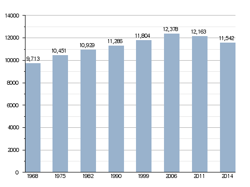
Mende's Population Over Time
In 2014, the city of Mende had 11,542 people living there. This means there were about 315 people for every square kilometer.
How Mende's Population Has Changed
How Mende is Governed
Mende has been the main city (prefecture) of the Lozère department since 1790. It is also the capital of the Mende arrondissement. The town is divided into two smaller areas called cantons:
- Mende-1: This part of Mende had 5,513 people in 2014.
- Mende-2: This part of Mende had 6,029 people in 2014.
Mende is also part of a group of communes called Cœur de Lozère (which means "Heart of Lozère"). This group works together on different projects.
Mende's Sister Cities
Mende has special friendships with other cities around the world. These are called "twinned" or "partner" towns:
 Wunsiedel, Germany, since 1980.
 Volterra, Italy, since 1993.
 Vila Real, Portugal, since 2003.
Gallery of Mende
-
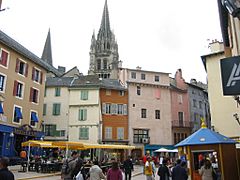
The Place de la République
-
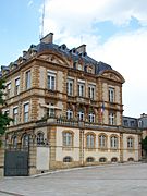
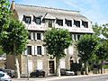
The prefecture building at Mende
-
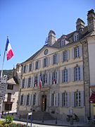
The town hall
-
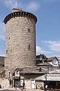
The Tower of the Penitents


Related Pages
Images for kids
-
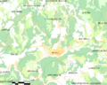
Map of the commune of Mende
-
Due east, with the N88, towards Badaroux and Langogne
-
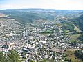
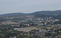
Mende at the foot of Mont Mimat, view of the Causse d'Auge
-
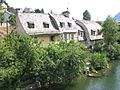
A house alongside the Lot river
-
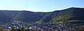
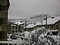
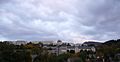
Mende in December 2008
-
A view the Causse d'Auge in December 2008
-
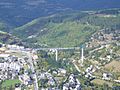
The Rieucros Viaduct in September 2007
-
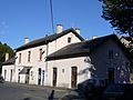
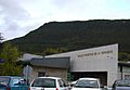
The Gare de Mende
-
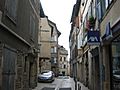
The Rue Basse
-
The Valcroze district and the village of Chabannes
-
The Fontanille district and the Notre Dame High School
-
The Chaldecoste district from the Place de la République
-
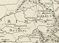
On this map is found Anderitum (Javols), Mimate (Mende) and Gredone (Grèzes).
-
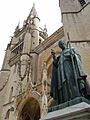
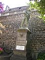
Statue of Pope Urban V
-
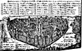
Mende in the 16th century from an old engraving
-
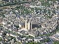
An aerial view of the cathedral
-
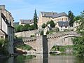
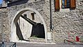
The Notre-Dame Bridge
-
The Place aux Blés
-
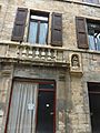
A house of the 17th century called "Maison de Mandrin" with false balusters beneath the windows.
-
War memorial of 1870
-
The Émile-Joly Square, the Saint-Ilpide home, and the Rieucros Viaduct and the hospital in the background
-

Seminary, which once housed the Plaisance school
-

The Jacques Maillot Institute (IUP) branch of the University of Perpignan
-
The chariot of the Beast of Gévaudan opens the flower parade of the great feasts of Mende, each year
-
Vernède sports hall (partly for bowling)
-
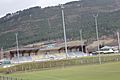
The Jean-Jacques Delmas Stadium
-

The Round of 32 of the Coupe de France from 2012 to 2013 between AF Lozère and AC Arles-Avignon.
-

Round of 16 finals of the Coupe de France Volleyball 2010-2011 between VB Mende and VB Tours
-

Christophe Laurent at the 2007 Tour de Suisse
-
The Castan Trophy, final of the Trèfle Lozérien in 2008
-

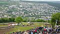
Julien Bérard won the 2nd stage of the Tour du Gévaudan 2008, which arrived in Mende
-
The cathedral
-
The entrance of the old synagogue
-
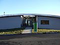
Entrance to POLeN
-
A house with a toit en carène
-
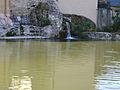
The water flows through underground pipes to the Lot, here to the Notre Dame Bridge
-
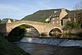
The Notre-Dame Bridge
-
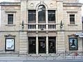
The old theatre became municipal cinema (miniplex)
-
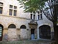
The courtyard of the Hôtel de Ressouches
-
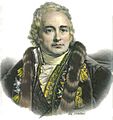
Jean-Antoine Chaptal


.jpg)


See also
 In Spanish: Mende (Lozère) para niños
