
Lot (river) facts for kids
Quick facts for kids Lot |
|
| Occitan: Olt | |
| River | |
 The Lot at Cahors
|
|
| Country | France |
|---|---|
| Regions | Occitanie, Auvergne-Rhône-Alpes, Nouvelle-Aquitaine |
| Departments | Lozère, Aveyron, Cantal, Lot, Lot-et-Garonne |
| Communes | Mende, Cahors, Fumel, Villeneuve-sur-Lot |
| Tributaries | |
| - left | Bramont, Dourdou de Conques, Riou Mort, Diège, Boudouyssou |
| - right | Colagne, Truyère, Célé, Thèze, Lémance, Lède |
| Cities | Cahors, Villeneuve-sur-Lot |
| Source | Cévennes |
| - location | Le Bleymard, Massif Central, France |
| - elevation | 1,272 m (4,173 ft) |
| - coordinates | 44°30′50″N 3°46′47″E / 44.51389°N 3.77972°E |
| Mouth | Garonne |
| - location | Aiguillon, Nouvelle-Aquitaine, France |
| - elevation | 23 m (75 ft) |
| - coordinates | 44°18′52″N 0°20′04″E / 44.31444°N 0.33444°E |
| Length | 485 km (301 mi) |
| Basin | 11,400 km² (4,402 sq mi) |
| Discharge | for Villeneuve-sur-Lot |
| - average | 155 m³/s (5,474 cu ft/s) |
The Lot River (also called Olt in Occitan) is a beautiful river in southern France. It's a major branch of the Garonne river. In fact, the French department called Lot gets its name from this very river!
Contents
About the Lot River
The Lot River is quite long, stretching for about 485 kilometers (301 miles). Imagine a river almost as long as the distance from London to Paris! Its drainage basin, which is the area of land where all the water flows into the river, covers about 11,400 square kilometers (4,400 square miles).
How Much Water Flows?
The amount of water flowing in the Lot River changes. On average, about 155 cubic meters (5,474 cubic feet) of water pass by every second at Villeneuve-sur-Lot. That's like filling 155 large bathtubs with water every single second!
Where the River Starts
The Lot River begins its journey high up on Mont Lozère. This mountain is part of the Cévennes mountain range, which is in the southeastern Massif Central area of France. The exact spot where the river starts is near a village called Le Bleymard, in the Lozère department. It's quite high up, at about 1,272 meters (4,173 feet) above sea level.
The River's Journey
As the Lot River flows, it makes many twists and turns, called meanders. It generally flows towards the west. Along its path, it passes through several different regions and departments in France.
Here are some of the main places the Lot River flows through:
- In the Occitanie region:
- In the Auvergne-Rhône-Alpes region:
- Cantal department: It forms part of the border with Aveyron for some distance.
- Back in the Occitanie region:
- In the Nouvelle-Aquitaine region:
- Lot-et-Garonne department: It flows through towns like Fumel, Villeneuve-sur-Lot, and Aiguillon.
The Lot River actually flows through 131 different towns and villages! Its long journey ends when it joins the Garonne River near Aiguillon. At this point, the river is much lower, only about 23 meters (75 feet) above sea level.
Rivers Joining the Lot
Many smaller rivers and streams flow into the Lot River along its course. These are called tributaries. They add more water to the Lot, making it bigger and stronger.
Tributaries from the Left
- Bramont
- Dourdou de Conques
- Riou Mort
- Diège
- Boudouyssou
Tributaries from the Right
- Colagne
- Boralde de Saint-Chély-d'Aubrac
- Boralde Flaujaguèse
- Truyère - This is a very important tributary, joining the Lot from the right.
- Célé
- Thèze
- Lémance
- Lède

Gallery
-
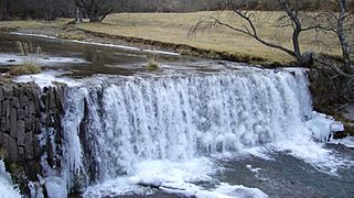
The Lot at Tournel, Lozère
-
The Lot at Luzech
-
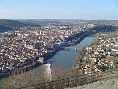
The Lot at Cahors
-
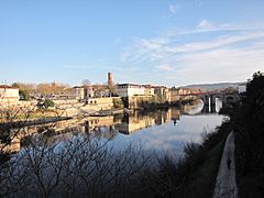
The Lot at Villeneuve-sur-Lot


Related Pages
Images for kids
-
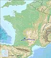
Course of the river Lot (from French page), showing how it rises deep in the Massif Central
-
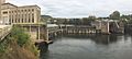
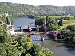
Different possibilities for bypassing the dam in Fumel, to provide continuity of navigation on the Lower Lot, are still under study


See also
 In Spanish: Río Lot para niños
