Minturn, Colorado facts for kids
Quick facts for kids
Minturn, Colorado
|
|
|---|---|
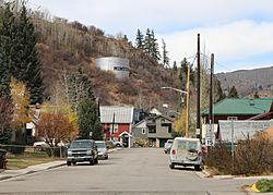
Looking northwest along Pine Street
|
|
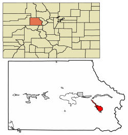
Location of Minturn in Eagle County, Colorado.
|
|
| Country | |
| State | |
| County | Eagle |
| Incorporated (town) | November 23, 1904 |
| Government | |
| • Type | Home rule municipality |
| Area | |
| • Total | 8.20 sq mi (21.23 km2) |
| • Land | 8.02 sq mi (20.77 km2) |
| • Water | 0.18 sq mi (0.47 km2) |
| Elevation | 7,861 ft (2,396 m) |
| Population
(2020)
|
|
| • Total | 1,033 |
| • Density | 125.98/sq mi (48.66/km2) |
| Time zone | UTC-7 (Mountain (MST)) |
| • Summer (DST) | UTC-6 (MDT) |
| ZIP code |
81645 (PO Box)
|
| Area code(s) | 970 |
| FIPS code | 08-50920 |
| GNIS feature ID | 2413005 |
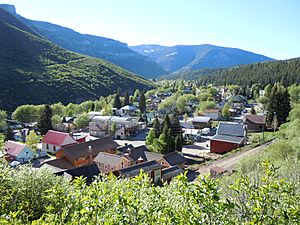
Minturn is a small town in Eagle County, Colorado, United States. It is a "home rule municipality," which means it has its own local government rules. In 2020, about 1,033 people lived there.
Contents
Exploring Minturn's Location
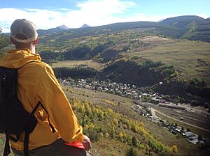
Minturn is located in the southeastern part of Eagle County. It sits right on the Eagle River. The town is nestled between two popular resort areas: Vail and Beaver Creek.
How to Get Around Minturn
The town limits stretch about 2 miles northwest along U.S. Route 24. This road connects to Interstate 70 at Exit 171. From there, it's about 5 miles east to Vail. It's also 5 miles west to Avon, which is at the base of Beaver Creek Resort.
Eagle, the main town in the county, is about 25 miles to the west. If you travel east, Denver is about 101 miles away. U.S. Route 24 also goes south for about 30 miles. It crosses the Continental Divide at Tennessee Pass and leads to Leadville.
Minturn's Size and Water Features
The town of Minturn covers a total area of about 8.2 square miles (21.23 square kilometers). Most of this area, about 8.02 square miles (20.77 square kilometers), is land. The rest, about 0.18 square miles (0.47 square kilometers), is water.
Nature and Outdoor Fun Around Minturn
Minturn is surrounded on three sides by the White River National Forest. The Holy Cross Wilderness area is right next to the southwest side of town. This national forest is a great place for outdoor activities. You can go hiking, biking, snowshoeing, and cross-country skiing there.
There are five special huts in the area run by the Tenth Mountain Hut Association. These huts have trails connected to them, perfect for adventurers. Camp Hale, a historic site where soldiers trained for winter during World War II, is also nearby.
The Holy Cross District is part of the Sawatch Range mountains. It also includes the western side of the Gore Range. This district covers the forest areas around Vail, Minturn, Red Cliff, and Avon.
The upper Eagle River offers many beautiful outdoor activities. This part of the river stretches over 20 miles from Tennessee Pass to Dowd Junction. If you love rivers, you can enjoy fishing, rafting, kayaking, and canoeing. The best time for floating on the river is usually from late May through July. You can easily get to the river from several public spots along Highway 24.
People Living in Minturn
The 2020 census counted 1,033 people living in Minturn. These people lived in 365 homes.
Who Lives in Minturn?
Most people in Minturn are White, making up about 82% of the population. About 21.58% of the people are Hispanic or Latino. Other groups include Native American, African American, and Asian people.
Homes and Jobs in Minturn
Most of the homes in Minturn were occupied, about 80.21%. About 61% of people owned their homes. The average travel time for people to get to work was about 17 minutes. Around 79.2% of the people in town had jobs.
Education in Minturn
Many adults in Minturn have a good education. About 38.9% have a bachelor's degree, and 21.3% have a graduate degree. This means many people have gone to college or beyond.
Minturn's Past: A Look at History
The town of Minturn is named after Robert Bowne Minturn, Jr.. He was an important person in the Denver and Rio Grande Western Railroad, which helped start the town. He was also part of a company called Grinnell, Minturn & Co.
Early Days and Growth
The first families in Minturn settled where Gore Creek and the Eagle River meet in the late 1800s. Some of them built farms and grew crops. Others mined for silver in the mountains above the town.
When the Denver & Rio Grande Railroad arrived in 1887, Minturn quickly grew. It became a busy place for transportation and industry. More and more miners and railroad workers moved there with their families. This created a need for more businesses and services. Because of this growth, Minturn officially became an incorporated town on November 15, 1904.
Changes Over Time
Minturn has changed a lot over the years. It has adapted to big shifts in the local economy. For example, the Vail and Beaver Creek ski resorts were built nearby. The Gilman mine, which was important, closed down. Also, some train lines through Minturn were no longer used.
Even with these changes, Minturn has kept its unique feel. It still has its special buildings and a good quality of life. It has gone from an "Old West" town to a modern one, but its character remains.
Getting Around Minturn and Beyond
Minturn has several ways to connect to other places.
Air Travel
The closest airport is Eagle County Regional Airport. It's near Gypsum, about 30 miles west of Minturn.
Bus Services
Eagle County offers bus service from the Dowd Junction Transit Stop. These buses can take you to Minturn, Vail, Leadville, Eagle-Vail, Avon, Beaver Creek, Edwards, Eagle, Gypsum, and Dotsero.
Roads and Highways
Interstate 70 runs east and west, about two miles north of Minturn. U.S. Route 24 also goes east and west right through Minturn. To the east, it leads to the towns of Red Cliff and then Leadville.
See also
 In Spanish: Minturn (Colorado) para niños
 | Stephanie Wilson |
 | Charles Bolden |
 | Ronald McNair |
 | Frederick D. Gregory |


