Tennessee Pass (Colorado) facts for kids
Quick facts for kids Tennessee Pass |
|
|---|---|
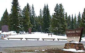
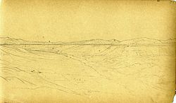
Summit of Tennessee Pass along U.S. Highway 24, showing the memorial to the 10th Mountain Division
|
|
| Elevation | 10,424 ft (3,177 m) |
| Traversed by | Denver and Rio Grande Western Railroad |
| Location | Eagle / Lake counties, Colorado, U.S. |
| Range | Sawatch Range |
| Coordinates | 39°21′45″N 106°18′40″W / 39.36250°N 106.31111°W |
| Topo map | USGS Leadville North |
Tennessee Pass is a high mountain pass in the Rocky Mountains of central Colorado, United States. It sits at an elevation of 10,424 ft (3,177 m). The pass got its name from Tennessee, which was the home state of some of the first explorers who came to this area looking for gold and other minerals.
Contents
Exploring Tennessee Pass
Tennessee Pass crosses the Continental Divide. This is like the backbone of North America, where rivers on one side flow to the Atlantic Ocean and rivers on the other side flow to the Pacific. The pass is located north of Leadville. It sits between the northern parts of the Sawatch Range to the west and the Mosquito Range to the east.
The pass connects the start of the Arkansas River in the south with the upper valley of the Eagle River in the north. The Eagle River's water eventually flows into the Colorado River.
Driving the Pass
U.S. Highway 24 goes over Tennessee Pass. This road helps people travel between Leadville and Interstate 70 in the Eagle Valley. The road up to the pass is not very steep on either side. It also does not have many sharp turns. The very top of the pass is almost flat.
The road over Tennessee Pass is usually open all year. Most vehicles can easily drive it. It only closes when there are very bad winter storms.
Ski Cooper and History
At the top of Tennessee Pass, you will find Ski Cooper. This is a ski area located in the San Isabel National Forest. It is managed with permission from the United States Forest Service. Much of the ski area is above the tree line. This means there are no trees, offering amazing views of the Sawatch Range peaks.
Ski Cooper was once a training ground during World War II. United States Army troops from the 10th Mountain Division trained here. Their camp, Camp Hale, was nearby. There is a special memorial at the summit of the pass. It honors the brave soldiers of this division.
Railroad History
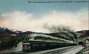
The Denver and Rio Grande Western Railroad built a narrow gauge railroad over Tennessee Pass in 1881. They wanted to reach the rich mining areas around Aspen. This was to get there before another railroad company, the Colorado Midland.
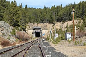
Later, in 1890, a new standard gauge line was built. It went from Pueblo to Grand Junction. A tunnel was built about 200 ft (61 m) below the summit. This tunnel was a joint project with the Colorado Midland Railway. In 1945, a newer tunnel replaced the old one.
For a long time, the Rio Grande's Tennessee Pass line was the highest main railroad line in the United States. Today, the Union Pacific Railroad owns the line. However, the tracks are not currently in use for trains.
Changes in Use
After the Moffat Tunnel and Dotsero Cutoff were built, the Tennessee Pass line became a less important route. The Moffat Tunnel route had a gentler slope, with a maximum grade of 2%. The west side of the Tennessee Pass route has steeper grades, up to 3%. However, the east side of Tennessee Pass has a very gentle slope of only 1.4%.
In 1988, the Denver & Rio Grande railroad joined with the Southern Pacific Railroad. This made Tennessee Pass important again for trains crossing the country. Southern Pacific had a route from California through to Kansas. It used Donner Pass, Tennessee Pass, and then tracks owned by the former Missouri Pacific Railroad. The Moffat Tunnel route was still used too.
In 1996, the Union Pacific Railroad bought Southern Pacific. Union Pacific preferred to send its trains through the Moffat Tunnel. The last train carrying goods went over Tennessee Pass on August 23, 1997. Soon after, Union Pacific asked for permission to stop using the line.
Today, the line is not used much. Part of the old Missouri Pacific line to Pueblo has also been abandoned. This means trains would have to travel a longer way to get west.
Royal Gorge Route Railroad
About 12 mi (19 km) of the Tennessee Pass line goes through the amazing Royal Gorge. This part of the line is now used by the Royal Gorge Route Railroad. They run fun excursion trains for tourists out of Cañon City.
In 2012, part of the old railroad tunnel collapsed. This caused a sinkhole that damaged U.S. Highway 24. The highway had to be closed for a while between Redcliff and Leadville, Colorado. Luckily, the newer tunnel was not damaged.
Future of the Line
The Colorado Department of Transportation (CDOT) believes the Tennessee Pass line is important. It could be used for both passenger and freight trains. It is also the only other route across the mountains in Colorado if the Moffat Tunnel line ever gets damaged or closed. If that happened, trains would have to go through Wyoming, which would be a big problem for Colorado.
In recent years, there have been talks about selling the line. As of 2020, Union Pacific was discussing a deal with Rio Grande Pacific. Rio Grande Pacific, through its company Colorado, Midland & Pacific Railway Company, announced they would explore reopening the line. They are looking into using it for both local passenger trains and freight services.
Water Diversion
Tennessee Pass is also where the first project to move water from one river basin to another happened. This is called a transbasin diversion. Water from the Colorado River Basin was moved over the continental divide to the Arkansas River.
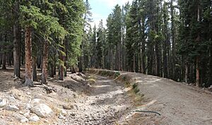
The Ewing Placer Ditch, about 1.5-mile (2.4 km) long, was built in 1880. It is still used today. It moves water from Piney Creek, which flows into the Eagle River, over the pass. This water then flows into Tennessee Creek, which is part of the Arkansas River system. The ditch was first used to help with placer mining. Later, it was used for watering farms. In 1955, the Pueblo Board of Water Works bought the ditch.
Another ditch, the Wurts Ditch, was built at Tennessee Pass in 1929. It was 6-mile (9.7 km) long and built to help water farms. The city of Pueblo bought this ditch in 1938. In 1953, they made it even longer, adding another 6.5 miles (10.5 km) to the west.
 | Misty Copeland |
 | Raven Wilkinson |
 | Debra Austin |
 | Aesha Ash |


