Mosquito Range facts for kids
Quick facts for kids Mosquito Range |
|
|---|---|

Mount Lincoln
|
|
| Highest point | |
| Peak | Mount Lincoln |
| Elevation | 14,286 ft (4,354 m) |
| Dimensions | |
| Length | 40 mi (64 km) NS |
| Geography | |
| Country | United States |
| State | Colorado |
| Parent range | Rocky Mountains |
| Borders on | Sawatch Range |
| Geology | |
| Orogeny | Laramide orogeny |
| Age of rock | Cretaceous – Paleogene |
| Type of rock | granite |
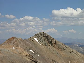
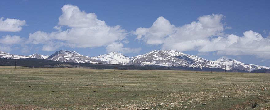
The Mosquito Range is a tall mountain range in the Rocky Mountains of central Colorado, United States. Its peaks reach about 14,000 feet high.
It stretches about 40 miles (64 km) from north to south. This range forms a natural border between Lake and Park Counties. It acts like a big wall, separating the start of the Arkansas River near Leadville from an area called South Park, where the South Platte River begins.
The highest point in the range is Mount Lincoln, standing at 14,286 feet. Other very tall peaks, known as fourteeners (mountains over 14,000 feet), include Quandary Peak (14,272 ft), Mount Bross (14,172 ft), Mount Democrat (14,148 ft), and Mount Sherman (14,036 ft).
How the Mountains Formed
These mountains were created by faults and folds in the Earth's crust. This happened during an event called the Laramide orogeny about 65 million years ago. Imagine the Earth's crust being pushed and squeezed, causing parts to lift up.
Originally, the Mosquito Range was connected to the even higher Sawatch Range to the west. But about 35 million years ago, a deep valley formed where the Arkansas River now starts, separating the two ranges. The Mosquito Range is mostly made of granite, a very hard rock.
On the eastern side, near South Park, you can find layers of older Paleozoic and Mesozoic sedimentary rocks. These rocks formed from sand, mud, and shells settling over millions of years. The northern part of the range was shaped by glaciers during the Pleistocene Ice Age. These huge ice sheets carved out U-shaped valleys in the canyons.
The high ridge of the Mosquito Range makes it quite difficult to cross between South Park and the Arkansas River area. You can see some of the tall peaks from Fremont Pass along State Highway 91. There are no major highways that cross the range. Only two backroads, Mosquito Pass and Weston Pass, go over its high points. A large part of the range is located within the Pike National Forest.
Tallest Peaks
Here are the eight highest peaks in the Mosquito Range:
| Rank | Peak | Elevation |
|---|---|---|
| 1 | Mount Lincoln | 14,293 ft = 4356.5 m |
| 2 | Quandary Peak | 14,265 ft = 4348.0 m |
| 3 | Mount Democrat | 14,148 ft = 4312.3 m |
| 4 | Mount Sherman | 14,036 ft = 4278.2 m |
| 5 | Fletcher Mountain | 13,951 ft = 4252.3 m |
| 5 | Gemini Peak | 13,951 ft = 4252.3 m |
| 7 | Pacific Peak | 13,950 ft = 4252.0 m |
| 8 | Horseshoe Mountain | 13,898 ft = 4236.1 m |
See also
 In Spanish: Cordillera del Mosquito para niños
 | Isaac Myers |
 | D. Hamilton Jackson |
 | A. Philip Randolph |


