Molonglo River facts for kids
Quick facts for kids Molonglo |
|
|---|---|

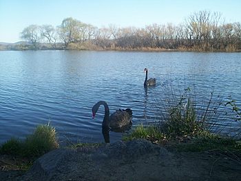
Black swans on Molonglo River
|
|
| Native name | Yeal-am-bid-gie |
| Country | Australia |
| State/Territory | |
| Regions |
|
| Districts |
|
| City | Queanbeyan |
| Physical characteristics | |
| Main source | Tinderry Range, Great Dividing Range near Captains Flat 1,130 m (3,710 ft) 35°40′5″S 149°29′50″E / 35.66806°S 149.49722°E |
| River mouth | confluence with the Murrumbidgee River near Uriarra Crossing 440 m (1,440 ft) 35°14′30″S 148°58′4″E / 35.24167°S 148.96778°E |
| Length | 115 km (71 mi) |
| Basin features | |
| River system | Murrumbidgee River, Murray-Darling basin |
| Basin size | 198,900 km2 (76,800 sq mi) |
| Tributaries |
|
| Nature reserves | Molonglo Gorge Recreation Reserve, Jerrabomberra Wetlands, Lower Molonglo Nature Reserve |
The Molonglo River is a river in Australia. It flows through parts of New South Wales and the Australian Capital Territory. This river is a key part of the larger Murrumbidgee River system. The Murrumbidgee River then flows into the huge Murray–Darling basin.
Contents
Where is the Molonglo River?
The Molonglo River starts high up on the western side of the Great Dividing Range. This is a large mountain range in Australia. The river begins at about 1,130 meters (3,700 feet) above sea level.
The River's Journey
The Molonglo River first flows from south to north. It passes through areas like Carwoola and the edge of Queanbeyan. In Queanbeyan, it meets its main smaller river, called the Queanbeyan River.
The Molonglo River then continues its journey through Canberra. Here, a large wall called the Scrivener Dam was built across it. This dam created the famous Lake Burley Griffin. After the lake, the river flows until it joins the Murrumbidgee River near Uriarra Crossing.
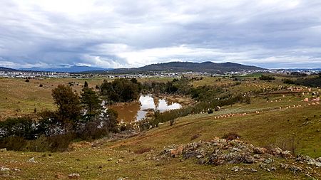
The Molonglo River is about 115 kilometers (71 miles) long. Along its path, the river changes. It goes from wide, flat areas called floodplains to narrow, rocky canyons. One of these flat areas is known as the Molonglo Plain.
Bridges and Crossings
Many roads and bridges cross the Molonglo River. These include the Captains Flat Road and the Kings Highway. In Canberra, major roads like Commonwealth Avenue and Kings Avenue cross over Lake Burley Griffin, which is part of the river.
What Does "Molonglo" Mean?
The name "Molonglo" comes from an Aboriginal word. It means "like the sound of thunder." An explorer named Charles Throsby first wrote down an Aboriginal name for the river, "Yeal-am-bid-gie," in 1820. The local Moolinggolah people, who lived near Captains Flat, likely gave the river its name. The word "bidgee" was often used in Aboriginal languages for rivers in the Canberra area. It probably meant "water" or "river."
History of the Molonglo River
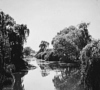
In the early days of European settlement, the Molonglo River was sometimes called the "Fish River." This was because it had many native fish. People used to catch Murray cod, Macquarie perch, and silver perch here.
Pollution and Recovery
Sadly, the river's health changed when mining started at Captains Flat. Waste from the mines, called tailings, polluted the river. This pollution caused many native fish and other water creatures to disappear downstream from the mine. Even after efforts to clean up the river in 1976, some pollution still enters the water from the old mine site.
When Lake Burley Griffin was created in 1964, there were no native fish in its waters. But in the 1970s and 1980s, people started putting native fish like Murray Cod and Golden Perch back into the lake. These fish have now returned to the lake and a small part of the river upstream. However, a large part of the Molonglo River still only has fish that were brought from other places. People are still working to bring back all the native fish species.
Current State of the River

In recent years, a lot of work has been done to restore the natural environment of the Molonglo River. This work is happening downstream from Scrivener Dam. It is part of a larger project to develop new housing areas in the Molonglo Valley. These efforts aim to make the river healthy again for everyone to enjoy.
See also
 In Spanish: Río Molonglo para niños
 | James B. Knighten |
 | Azellia White |
 | Willa Brown |


