Lake Burley Griffin facts for kids
Quick facts for kids Lake Burley Griffin |
|
|---|---|

Lake Burley Griffin
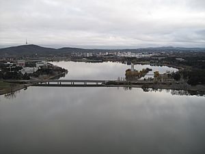
viewed from Black Mountain Tower |
|
| Location | Canberra, Australian Capital Territory () |
| Coordinates | 35°17′36″S 149°06′50″E / 35.29333°S 149.11389°E |
| Lake type | Artificial lake |
| Primary inflows | Molonglo River, Sullivans Creek, Jerrabomberra Creek |
| Primary outflows | Molonglo River |
| Catchment area | 183.5 km2 (70.8 sq mi) |
| Basin countries | Australia |
| Max. length | 11 km (6.8 mi) |
| Max. width | 1.2 km (0.75 mi) |
| Surface area | 6.64 km2 (2.56 sq mi; 1,640 acres) |
| Average depth | 4 m (13 ft) |
| Max. depth | 18 m (59 ft) |
| Water volume | 33,000,000 m3 (1.2×10⁹ cu ft; 33 GL) |
| Surface elevation | 556 m (1,824 ft) |
| Dam | Scrivener Dam |
| Islands | 6 (Queen Elizabeth II, Springbank, Spinnaker, others unnamed) |
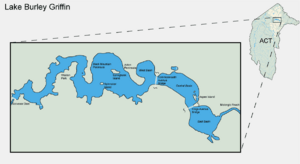
| Sections/sub-basins | East Basin, Central Basin, West Basin, West Lake and Tarcoola Reach, Yarramundi Reach |
| Settlements | Canberra |
Lake Burley Griffin is a large, human-made lake right in the middle of Canberra, which is the capital city of Australia. It was created in 1963 by building a dam across the Molonglo River. Before the lake, the river flowed through what is now the city center. The lake is named after Walter Burley Griffin, an architect who won a competition to design Canberra.
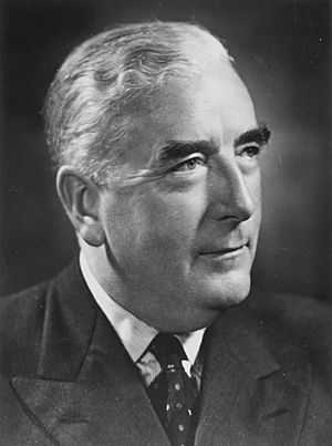
Griffin planned the lake with many cool geometric shapes. He wanted its lines to match natural landmarks around the area. However, government officials changed his first plans. Not much work was done on the lake before he left the project in 1920. Building the lake was also delayed by the Great Depression and World War II. Planning finally started again in the 1950s. After some disagreements, digging began in 1960 with strong support from Australia's Prime Minister, Robert Menzies.
Once the bridges and dams were finished, the dam gates were closed in September 1963. Because of a dry spell, the lake didn't reach its full water level until April 1964. The lake was officially opened on 17 October 1964.
The lake is in the center of Canberra and is a main feature of the city, just as Griffin had imagined. Many important places are built along its shores. These include the National Gallery of Australia, National Museum of Australia, National Library of Australia, and the Australian National University. Parliament House is also very close by. The areas around the lake are mostly parklands. They are popular for fun activities, especially when the weather is warm. People enjoy rowing, fishing, and sailing on the lake.
The lake is beautiful and measures about 11 kilometres (6.8 mi) long. At its widest point, it is about 1.2 kilometres (0.75 mi) across. The water is usually about 4 metres (13 ft) deep. The deepest part is around 18 metres (59 ft) near the Scrivener Dam. The dam is 33-metre-tall (108 ft) and helps control the water flow. If there's a drought, water can be released from Googong Dam upstream to keep the lake full.
Contents
How Lake Burley Griffin Was Designed
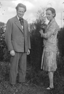
In 1909, Charles Scrivener suggested the spot for Canberra, Australia's planned capital city. One reason for this location was that it could easily hold water for a beautiful lake. Scrivener's studies showed that the land was perfect for creating a lake by flooding.
In 1911, a competition was held to design Canberra. Architects received Scrivener's detailed maps of the area. The maps showed an artificial lake, much like the one built later. They also showed four possible places for a dam. Most of the architects included artificial lakes in their designs.
Walter Burley Griffin's Original Plan
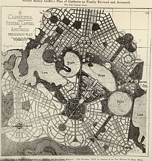
An American architect named Walter Burley Griffin won the design competition. He was invited to Australia to help build the new capital. Griffin's plan was full of geometric shapes. It included streets that formed hexagons and octagons.
His lake design was the heart of the city. It had a Central Basin, a West Basin, and an East Basin, all shaped like circles. There were also larger, less regular West and East Lakes on either side. Griffin's plan was seen as grand yet simple and clear.
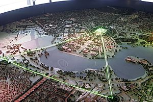
The lakes were carefully planned to line up with Canberra's natural landmarks. They stretched from east to west, dividing the city. A "land axis" ran from Capital Hill (where Parliament House is now) north across the central basin to the Australian War Memorial. This way, the War Memorial would appear at the foot of Mount Ainslie when viewed from Capital Hill.
The straight edge of the central basin was called the "water axis." It pointed towards Black Mountain. Another important line, the "municipal axis," ran along the northern side of the city. This became Constitution Avenue, connecting City Hill and the Market Centre. Commonwealth Avenue and Kings Avenue connected Capital Hill to City Hill and the Market Centre. These three avenues formed the Parliamentary Triangle, which was the main part of Griffin's design.
Later, Charles Scrivener and a government committee changed Griffin's design. They suggested making the lake more natural-looking instead of purely geometric. Griffin argued to keep his geometric shapes, but he was overruled. The new plan still had Griffin's three main basins (east, central, and west) but in a softer shape.
Griffin came to Canberra in 1913 to discuss the plans. He was appointed the Federal Capital Director of Design and Construction. The plans changed a few more times, but the lake's design largely stayed based on the committee's ideas. However, Griffin had a difficult time working with the Australian government. Not much money was available, so little work was done on the city before he left in 1920.
Changes and Political Debates
After the Great Depression and World War II, Canberra grew slowly. Many people criticized it for looking like a village, not a capital city. The Molonglo River flowed through the area, but it was mostly farmland. The lake and Parliamentary Triangle, which were central to Griffin's plan, were just empty fields.
In 1950, the largest part, the East Lake, was removed from the plans. Officials thought it would flood too much farmland and that the Molonglo River wouldn't have enough water to fill it. Today, this area is the suburb of Fyshwick.
In 1953, the West Lake was also removed and replaced with a narrow stream. Some officials thought Griffin's plan was too grand. They believed a smaller stream would save money and land. However, engineering reports showed that the smaller plan would actually cost more and be less effective at preventing floods.
Many people were unhappy about these changes. They felt the decisions were made secretly. Some organizations and politicians were not even told about the changes. Critics suggested that powerful members of the Royal Canberra Golf Club, whose course was on the proposed West Lake site, might have influenced the decision.
The Parliamentary Public Works Committee investigated and recommended restoring the West Lake. They found that the West Lake was a good idea and that it had been removed without enough study.
Prime Minister Robert Menzies was embarrassed by Canberra's slow development. He became a strong supporter of building the city. In 1958, the new National Capital Development Commission (NCDC) restored the West Lake to the plans. It was officially approved in October 1959. The NCDC also stopped a plan to build a bridge across the lake that would have gone against Griffin's original design.
A famous British architect, Sir William Holford, helped refine Griffin's plans. He changed the central basin's shape slightly, making it more like an earlier modified design.
Lake Burley Griffin Today
Lake Burley Griffin holds about 33,000,000 cubic metres (27,000 acre⋅ft) of water. Its surface area is 6.64 square kilometres (2.56 sq mi). It is 11 kilometres (6.8 mi) long and 1.2 kilometres (0.75 mi) wide at its widest point. The shoreline stretches for 40.5 kilometres (25.2 mi). The water level is about 555.93 metres (1,823.9 ft) above sea level.
The lake is not very deep. The deepest spot is 17.6 metres (58 ft) near the Scrivener Dam. The average depth is 4.0 metres (13 ft). The shallowest part is the East Basin, with an average depth of 1.9 metres (6.2 ft).
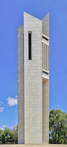
Lake Burley Griffin has six islands. Three are small and unnamed. The three larger, named islands are Queen Elizabeth II Island in the Central Basin, and Springbank and Spinnaker Island in the West Lake. Queen Elizabeth II Island is connected by a footbridge and is home to the Australian National Carillon. A seventh island was created more recently as part of the Kingston Foreshore development.
Building the Lake
In 1958, engineers studied the land and water to plan the dam. They also looked at water quality, how much silt might build up, and how the climate would affect the lake. These studies helped them predict that the water level could be kept stable even during floods.
Construction officially began in February 1959. However, there was a short delay when some officials tried to hold back funding. Once work started, it moved quickly. At its busiest, 400 to 500 people were working on the lake. John Overall, the head of the NCDC, promised Prime Minister Menzies that the lake would be finished in four years, and it was!
After all the debates about the design, most criticism of the project faded. Menzies strongly spoke out against those who still complained. Some critics thought the lake was a waste of money that should have been spent on other services. Others worried about mosquitoes, pollution, and fog, but the fog concern turned out to be wrong.
Creating the Lake and Islands
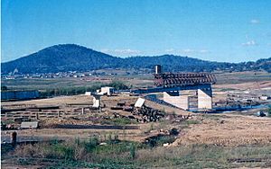
Digging for Lake Burley Griffin started in 1960. Workers cleared plants from the Molonglo River floodplain. Trees, sports fields, and houses were removed.
A lot of topsoil, about 382,000 cubic metres (500,000 cu yd), was dug up. This soil was used for public parks and gardens, including Commonwealth Park. It also helped create the six artificial islands. Springbank Island was named after the Springbank Farm that used to be there. Land dug up for a sailing course at Yarralumla was used to make Spinnaker Island.
Workers made sure the entire lake floor was at least 2 metres (6.6 ft) deep. This depth helps boats move easily and also discourages mosquitoes and weeds. A program was started to protect the soil in the surrounding area. Special traps were installed to catch loose earth, and these traps later provided sand and gravel for building.
Different types of lake edges were built. Some areas have concrete walls, while others have rock walls, especially near Commonwealth Park. Sandy and gravel beaches were made for people to enjoy. These are mostly on the western side of the lake. Rocky areas with water plants like bullrushes were also created, especially in the West Lake near Yarralumla. Over 55,000 trees, mostly Eucalypts, were planted around the lake to keep the city's natural look.
Building the Bridges
Lake Burley Griffin has three crossings: Commonwealth Avenue Bridge (310 metres or 1,020 feet), Kings Avenue Bridge (270 metres or 890 feet), and a road over Scrivener Dam. These two main bridges were built before the lake was filled. They replaced older wooden bridges.
Testing for both bridges happened in late 1959 and early 1960. Construction of Kings Avenue Bridge began in 1960, and Commonwealth Avenue Bridge started a year later. Luckily, Canberra was in a drought, so the ground stayed dry for the builders. Both bridges use strong concrete reinforced with rustproof steel cables.
The bridges are made of concrete and steel and have multiple lanes for cars. Commonwealth Avenue Bridge has three lanes in each direction, and Kings Avenue Bridge has two. Instead of regular streetlights, Kings Avenue Bridge used fluorescent tubes built into the handrails. This "integral lighting" design was so successful that it was also used for Commonwealth Avenue Bridge. Both bridges won awards for their lighting.
Kings Avenue Bridge opened on 10 March 1962. Prime Minister Menzies cut a ribbon, and a parade of cars crossed the lake. Commonwealth Avenue Bridge opened in 1963 without a big ceremony. Menzies called it "the finest building in the national capital."
The Scrivener Dam
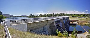
The dam that holds back the lake's water is called Scrivener Dam, named after Charles Scrivener. It was designed and built by a German company. The dam uses advanced techniques to handle any movement in the riverbed. About 55,000 cubic metres (72,000 cu yd) of concrete was used to build it. The dam is 33 metres (108 ft) high and 319 metres (1,047 ft) long. It is built to withstand a huge flood that might happen only once every 5,000 years. Construction started in September 1960, and the dam gates were closed in September 1963.
The dam has five large spillway gates. These "fish-belly flap gates" are 30.5-metre (100 ft) wide and are controlled by hydraulics. They allow very precise control of the water level. All five gates have only been opened at the same time once, during a big flood in 1976. The gates hold back two-thirds of the lake's water. They were designed to let debris flow out of the lake easily.
A road called Lady Denman Drive runs across the top of the dam. It has a road for cars and a bicycle path. This provides a third way for people in western Canberra to cross the lake.
Filling the Lake
A long drought actually helped with the lake's construction. The dam's valves were closed on 20 September 1963. For several months, with no rain, only small, mosquito-filled puddles were visible. When the drought finally ended, the lake reached its planned level on 29 April 1964.
On 17 October 1964, Prime Minister Menzies officially opened the lake. There was a ceremony with sailing boats and fireworks. Griffin's dream for the lake finally came true after five decades. It cost about A$5,039,050 in 1964, which is a lot of money! Menzies insisted the lake be named after Griffin.
If there's a very bad drought, the lake's water level can drop too low. When this happens, water can be released from Googong Dam upstream. Googong Dam was finished in 1979. It helps supply water to Canberra and Queanbeyan.
What Happened After the Lake Was Built
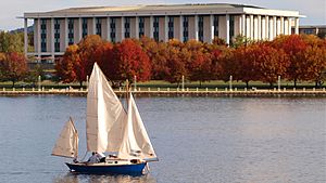
Griffin's design made the lake a central part of the city. In the years after it was built, many important national buildings were added around it. The government sees the lake as a main feature of Canberra. It also provides a waterfront view for many important places that didn't have one before.
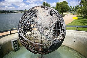
In 1970, two new attractions were added to the Central Basin. The Captain James Cook Memorial was built to celebrate 200 years since Captain Cook first saw Australia's east coast. It has a tall water jet fountain in the lake and a globe sculpture showing Cook's journeys. Queen Elizabeth II officially opened it on 25 April 1970. On the same day, she also opened the Australian National Carillon on Queen Elizabeth II Island. This is a set of 53 bronze bells given by the British Government.
The National Library of Australia opened in April 1968. The High Court of Australia and National Gallery of Australia were built in the late 1970s. They opened in 1980 and 1982. In 1988, the new Parliament House was built on Capital Hill. This completed the most important buildings in the Parliamentary Triangle.
The National Museum of Australia was built in 2001. It stands on the site of the former Royal Canberra Hospital.
More recently, the lake's layout changed a bit with the Kingston Foreshores Redevelopment. This project on the southern shore of the East Basin added luxury apartments. The old Kingston Powerhouse was turned into the Canberra Glassworks in 2007.
Fun Things to Do at the Lake
The areas around Lake Burley Griffin are very popular for recreation. There are public parks along most of the shoreline. These parks have free barbecue facilities, swimming areas, picnic tables, and toilets. They cover a large area, about 3.139 km2 (776 acres). Some popular parks include Commonwealth, Weston, Kings, and Grevillea Parks, and Lennox Gardens.
Commonwealth Park is where Floriade is held every spring. This annual flower festival lasts about a month and attracts over 300,000 visitors. It's the biggest flower festival in Australia and a major tourist attraction.
A bike path goes all around the lake. Riding, walking, or jogging around the lake are popular activities on weekends. Fireworks are often held over the lake on New Year's Eve. A big show called Skyfire has been held there since 1989.
Water Sports on the Lake
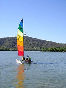
Lake Burley Griffin is used for many fun water activities. Canoeing, sailing, paddleboating, windsurfing, and dragon boating are all popular. There's a rowing course at the western end of the lake. Swimming is not as common, partly because the water can be cold. Sometimes, the lake is closed for swimming due to water quality concerns. In summer, the lake is used for the swimming part of triathlon events.
Generally, powerboats are not allowed on the lake. However, permits are given for rescue, training, commercial use, or special boats like historic steam-powered ones. There's a small area called Molonglo Reach where water skiing is allowed for up to ten powerboats.
Staying Safe on the Lake
The Australian Federal Police water police patrol the lake. They help people using the lake, like righting overturned boats or towing broken-down ones.
Most swimming spots have fenced-in areas for safety. In popular areas, there are also safety lockers with life belts and emergency phones. Between 1962 and 1991, seven people unfortunately drowned in the lake.
For safety and water quality, the lake has different zones for different activities. The far eastern part is for "primary contact" activities like swimming and water skiing. The East and Central Basins, closer to busy areas, are for "secondary contact" sports like sailing or rowing. West Lake and Tarcoola Reach are the main recreational areas, allowing both primary and secondary contact sports. Yarramundi Reach has a rowing course and allows both types of activities.
Lake Environment
Water Quality
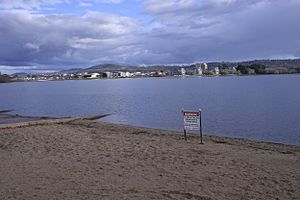
Sometimes, harmful blue-green algae blooms happen in the lake. Warnings are issued when these algae are found, as they can be bad for humans and animals. Efforts are being made to reduce the amount of phosphates entering the lake, which helps these algae grow. Blue-green algae produce toxins that can be dangerous. Several dogs have gotten sick after playing in and drinking the lake water.
The water can also look cloudy because of high "turbidity" (muddiness). This isn't usually a health risk. However, it can prevent sunlight from reaching plants in the water. Silt (fine dirt) building up is not a big problem, except in the East Basin. The Googong Dam has helped reduce heavy metal pollution from old mines upstream. Traps are set up at the lake's entry points to catch rubbish, oil, and sediment.
Fish and Fishing
Fishing is quite popular in Lake Burley Griffin. The most common fish caught is the carp, which was introduced to the lake. Another common introduced fish is the redfin European perch.
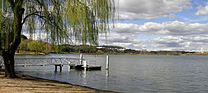
The lake also has native fish like Murray cod, western carp gudgeon, and golden perch. Other introduced fish include goldfish, Gambusia, rainbow trout, and brown trout.
Since 1981, over half a million fish have been released into the lake each year. This helps boost fish numbers, especially native species like golden perch and Murray cod. These native fish were once common in the Molonglo River but disappeared due to mining pollution. Stocking them helps balance the lake's ecosystem by having them eat other fish.
Golden perch and Murray cod have made up about 80% of the fish released in the last 30 years. The government plans to continue stocking only these two species for the next few years.
Engineering Award
Lake Burley Griffin is recognized as a National Engineering Landmark by Engineers Australia. This award highlights its importance as an engineering achievement.
See also
 In Spanish: Lago Burley Griffin para niños
 | John T. Biggers |
 | Thomas Blackshear |
 | Mark Bradford |
 | Beverly Buchanan |


