Morristown, Vermont facts for kids
Quick facts for kids
Morristown, Vermont
|
|
|---|---|

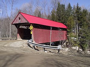
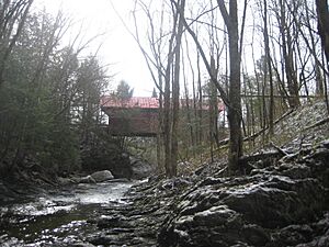
The Red Bridge in Sterling Valley
|
|

Morristown, Vermont
|
|
| Country | United States |
| State | Vermont |
| County | Lamoille |
| Communities | Cadys Falls Morristown Morrisville |
| Area | |
| • Total | 51.68 sq mi (133.85 km2) |
| • Land | 51.15 sq mi (132.48 km2) |
| • Water | 0.53 sq mi (1.37 km2) |
| Elevation | 948 ft (289 m) |
| Population
(2020)
|
|
| • Total | 5,434 |
| • Density | 105.148/sq mi (40.598/km2) |
| Time zone | UTC-5 (Eastern (EST)) |
| • Summer (DST) | UTC-4 (EDT) |
| ZIP code |
05661
|
| Area code(s) | 802 |
| FIPS code | 50-46675 |
| GNIS feature ID | 1462154 |
Morristown is a town in Lamoille County, Vermont, United States. In 2020, about 5,434 people lived there. Morristown is the biggest town in Lamoille County by population. Its main village, Morrisville, is the county's business center.
Contents
Exploring Morristown's Location
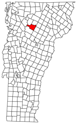
Morristown is in the southern part of Lamoille County. It sits to the east of the tall Green Mountains. The Lamoille River flows through the northern part of the town. Smaller streams, like Ryder Brook, join the river from a wide valley to the south.
The village of Morrisville is in the northern part of Morristown. It is located along the Lamoille River, near Lake Lamoille. This lake is a small reservoir. Several Vermont state roads meet in Morrisville.
- Vermont Route 100 goes northwest about 3 miles to Hyde Park. Hyde Park is the county seat. This route also goes south about 8 miles to Stowe.
- Vermont Route 12 goes southeast about 26 miles to Montpelier. Montpelier is the capital city of Vermont.
- Vermont Route 15 passes through Morristown north of Morrisville village. It goes northwest about 15 miles to Jeffersonville. It also goes southeast about 14 miles to Hardwick.
- Vermont Route 15A goes east out of Morrisville for about 2 miles to Route 15.
The town covers a total area of about 133.8 square kilometers (51.7 square miles). Most of this area, about 132.5 square kilometers (51.2 square miles), is land. The rest, about 1.4 square kilometers (0.5 square miles), is water.
Morristown's Climate
Morristown has a type of weather called a humid continental climate. This means the area has big changes in temperature during the year. Summers are warm to hot and often humid. Winters are cold, and sometimes very cold.
People Living in Morristown
| Historical population | |||
|---|---|---|---|
| Census | Pop. | %± | |
| 1790 | 10 | — | |
| 1800 | 144 | 1,340.0% | |
| 1810 | 550 | 281.9% | |
| 1820 | 726 | 32.0% | |
| 1830 | 1,315 | 81.1% | |
| 1840 | 1,502 | 14.2% | |
| 1850 | 1,441 | −4.1% | |
| 1860 | 1,751 | 21.5% | |
| 1870 | 1,897 | 8.3% | |
| 1880 | 2,099 | 10.6% | |
| 1890 | 2,411 | 14.9% | |
| 1900 | 2,533 | 5.1% | |
| 1910 | 2,652 | 4.7% | |
| 1920 | 2,813 | 6.1% | |
| 1930 | 2,939 | 4.5% | |
| 1940 | 3,130 | 6.5% | |
| 1950 | 3,225 | 3.0% | |
| 1960 | 3,347 | 3.8% | |
| 1970 | 4,052 | 21.1% | |
| 1980 | 4,448 | 9.8% | |
| 1990 | 4,733 | 6.4% | |
| 2000 | 5,139 | 8.6% | |
| 2010 | 5,227 | 1.7% | |
| 2020 | 5,434 | 4.0% | |
| U.S. Decennial Census | |||
In 2000, there were 5,139 people living in Morristown. There were 2,101 households, which are groups of people living together. The population density was about 100 people per square mile. Most of the people living in Morristown were White (about 97.5%).
The population has grown a lot over the years. In 1790, only 10 people lived there. By 2020, the population had grown to 5,434 people.
Famous People from Morristown
Morristown has been home to several notable people:
- H. Henry Powers was a lawyer. He also served as a US congressman from 1891 to 1901.
- Leslie M. Shaw was a businessman and lawyer. He became the Treasury Secretary from 1902 to 1907. He was also the 17th governor of Iowa.
- Shap Smith is a lawyer. He was the Speaker of the Vermont House of Representatives from 2009 to 2017.
See also
 In Spanish: Morristown (Vermont) para niños
 | Sharif Bey |
 | Hale Woodruff |
 | Richmond Barthé |
 | Purvis Young |


