Mount Barrow facts for kids
Quick facts for kids Mount Barrow(pialermeliggener) |
|
|---|---|

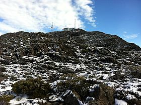
View of summit ridge at Mount Barrow
|
|
| Highest point | |
| Elevation | 1,406 m (4,613 ft) |
| Prominence | 796 m (2,612 ft) |
| Isolation | 21.43 km (13.32 mi) |
| Geography | |
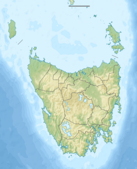
| Location | Northern Tasmania, Australia |
| Geology | |
| Age of rock | Jurassic, Ice age |
| Mountain type | Dolerite, granite |
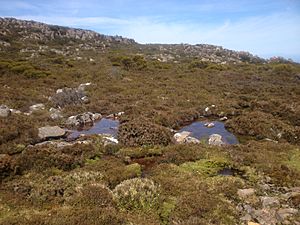
Mount Barrow (also known by its Aboriginal name, pialermeliggener) is a mountain in northern Tasmania, Australia. It stands 1,406 metres (4,613 ft) above sea level, making it a tall landmark. The mountain is located about 22 kilometres (14 mi) east-north-east of Launceston. The area around Mount Barrow has different types of natural environments. You can find cool, old rainforests, as well as subalpine and alpine landscapes, which are like very cold, high-up grasslands.
Contents
About Mount Barrow
Mount Barrow is a flat-topped mountain, or plateau, made mostly of a rock called dolerite from the Jurassic period. It has many rocky areas and a sharp ridge at its north-eastern end. This mountain is the closest alpine (high-altitude) area to the city of Launceston.
The plateau stretches for about 3 kilometres (1.9 mi) and reaches its highest point at 1,406 metres (4,613 ft) above sea level. This makes it the second-highest peak in eastern Tasmania. In winter, the road to the top of Mount Barrow often closes because of snow. Near the summit, the road becomes a narrow gravel path that leads to a parking area. There's also an old stone hut nearby. Snow usually starts to appear at about 1,100 metres (3,600 ft) up the mountain.
The land around Mount Barrow was once home to Tasmanian Aboriginal people. The mountain sits near the traditional lands of the Ben Lomond Nation, the Letteremairener Clan, and the Pyemmairrenerpairrener clan.
The Mountain's Names
The original Aboriginal name for the mountain was likely pialermeliggener. This name was written down by George Augustus Robinson when he was exploring the Pipers River area. The word pialermeliggener is thought to describe cliffs or rocky slopes near a summit, which fits Mount Barrow well.
In the early 1800s, some maps showed the mountain as 'Row Tor'. However, this name was also often used for a nearby mountain called Mount Arthur. This can make it a bit confusing!
The name 'Mount Barrow' that we use today is believed to be in honour of Sir John Barrow. He was an important official in the British Navy. It's thought that Lieutenant-Governor Franklin named the mountain after Sir John Barrow. This is because the name 'Mount Barrow' first appeared on maps when Franklin was in charge of Tasmania.
To add to the confusion, in a painting from 1836 by John Glover, Mount Barrow is called 'Ben Loder'. People in the 19th century also sometimes called it 'Mount Barron' in newspapers.
Mapping the Mount Barrow Area
Early maps, like one from Matthew Flinders in 1798 (updated in 1825), showed the Mount Barrow area as 'Row Tor'. But by 1843, maps clearly showed 'Mount Barrow' in its current spot. They also added 'Row Tor' to describe the lower hills to the west, closer to Launceston. Later maps showed 'Row Tor' where Mount Arthur is today. It's possible that 'Row Tor' was originally a general name for the whole north-east highlands. Then, in the 1840s, maps started to show Mount Arthur and Mount Barrow as separate mountains.
Rocks and Geology
Mount Barrow is mostly made of a type of rock called dolomite. This rock formed during the Jurassic period, which was millions of years ago. Scientists believe this rock came to the surface around the late Cretaceous period. More recently, during the Ice age, granite also formed here. When the Ice Age ended, rain and melting ice washed away the dirt. This uncovered the different kinds of rocks we can see at the summit today.
History of the Area
For a long time in the 1800s, Mount Barrow was a difficult barrier for settlers. The steep, rainforest-covered land behind the mountain was not often visited. In the 1830s, explorers like George Robinson and the botanist Robert William Lawrence explored the area. They both noted how steep and challenging the land was.
Later, in 1846, the scientist Paweł Strzelecki explored the area. Over time, people looking for valuable minerals (prospectors) slowly opened up the rugged country in the north-east.
By the late 1870s, more settlements were growing in the valleys around the mountain. People started to use the forests for wood and cleared land for new towns like Nunamara, Patersonia, and Diddleum Plains.
Wildlife and Nature
A special state reserve on Mount Barrow covers 459 hectares (1,130 acres). This area is very important for many animals that are at risk of disappearing. These include the Tasmanian wedge-tailed eagle, the spotted-tail quoll, the Eastern quoll, and the Mount Arthur Burrowing Crayfish.
You can also often see other Marsupials on the mountain. These include wombats, pademelons, Bennett's wallabies, and Forester kangaroos. The reserve also has a nice picnic area and a nature trail for visitors to enjoy.
Many small streams flow down the mountain's steep slopes, called an escarpment. After heavy snowfall, these streams can turn into impressive waterfalls.
Broadcasting Hub
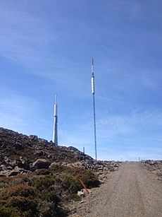
Mount Barrow is a very important site for television and FM radio signals in north-east Tasmania. Many broadcasting and telecommunication towers are located here. These structures are designed to withstand ice building up on them, which can happen in cold weather. They have special shields to prevent damage from falling ice.
Because the land is so rugged, the signals reach these sites using microwave links. This is different from the usual fibre optic cables. Electrical power gets to the facilities through power lines that run up the eastern side of the mountain.
 | Jewel Prestage |
 | Ella Baker |
 | Fannie Lou Hamer |


