Mount Cleveland (Vermont) facts for kids
Quick facts for kids Mount Cleveland |
|
|---|---|
| Highest point | |
| Elevation | 3,482 ft (1,061 m) |
| Prominence | 362 ft (110 m) |
| Isolation | 0.92 mi (1.48 km) |
| Listing | List of mountains of Vermont |
| Geography | |
| Country | United States |
| State | Vermont |
| County | Addison |
| Town | Lincoln |
| Parent range | Green Mountains |
| Topo map | USGS Lincoln Mountain Quad |
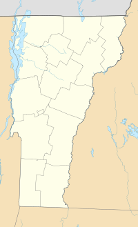
Mount Cleveland is a mountain in the Green Mountains of Vermont, United States. It is found in the Breadloaf Wilderness. This wilderness area is part of the Green Mountain National Forest. The very top of Mount Cleveland is in the town of Lincoln. This town is located in Addison County.
The mountain gets its name from Grover Cleveland. He was a former president of the United States. Mount Cleveland is one of five peaks in Vermont's special Presidential Range.
Contents
Water Flow from Mount Cleveland
Mount Cleveland is part of a large watershed. A watershed is an area of land where all the water drains to a common point. For Mount Cleveland, this water eventually flows into Lake Champlain.
Lake Champlain's water then travels north into the Richelieu River in Quebec. From there, it joins the Saint Lawrence River. Finally, it flows into the Gulf of Saint Lawrence and out to the ocean.
- The north side of Mount Cleveland sends its water into Stetson Brook. This brook flows into the Mad River. The Mad River then joins the Winooski River. The Winooski River empties into Lake Champlain.
- Water from the south and east sides of the mountain goes into Austin Brook. This brook also flows into the Mad River.
- The west side of Mount Cleveland drains into the New Haven River. This river then flows into Otter Creek. Otter Creek also empties into Lake Champlain.
Hiking Mount Cleveland
The famous Long Trail goes right over the top of Mount Cleveland. The summit is about 3,482 feet (1,061 m) high.
Reaching the Summit
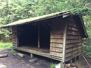
You can start your hike on the Cooley Glen Trail. The start of this trail is in the town of Lincoln. The Cooley Glen Trail leads to the Cooley Glen Shelter. This part of the hike is about 3.2 miles (5.1 km) long. From the shelter, Mount Cleveland is only 0.5 miles (0.80 km) south on the Long Trail.
Loop Hikes and Other Peaks
Another trail, the Emily Proctor Trail, starts at the same place as the Cooley Glen Trail. It leads to the Emily Proctor Shelter. This shelter is about 5.2 miles (8.4 km) south of Mount Cleveland on the Long Trail.
Many hikers enjoy a loop trail that starts and ends at the Cooley Glen Trailhead. This loop is about 12.4-mile (20.0 km) long. It takes you to three peaks in the Presidential Range:
- Mount Cleveland
- Mount Roosevelt
- Mount Wilson
A fourth "president" peak, Mount Grant, is also nearby. It is about 0.8 miles (1.3 km) north of the Cooley Glen Shelter on the Long Trail.
 | Misty Copeland |
 | Raven Wilkinson |
 | Debra Austin |
 | Aesha Ash |


