Mount Wilson (Vermont) facts for kids
Quick facts for kids Mount Wilson |
|
|---|---|
| Highest point | |
| Elevation | 3,745 ft (1,141 m) |
| Prominence | 200 ft (61 m) |
| Listing | #92 New England 100 Highest |
| Geography | |
| Country | United States |
| State | Vermont |
| County | Addison |
| Town | Ripton |
| Parent range | Green Mountains |
| Topo map | USGS Lincoln Mountain Quad |
| Climbing | |
| Easiest route | maintained hiking trail |
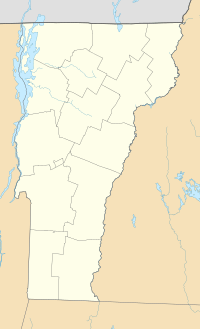
Mount Wilson is a mountain located in the Green Mountains of Vermont, a state in the United States. Its top, called the summit, is found in the town of Ripton within Addison County. This mountain is part of the Breadloaf Wilderness area, which is inside the Green Mountain National Forest.
The mountain gets its name from Woodrow Wilson, who was a former president of the United States. Mount Wilson is one of five peaks in Vermont's Presidential Range. It stands next to Bread Loaf Mountain to its southwest. Standing at 3,745 feet (about 1,141 meters) tall, Mount Wilson is the 12th highest peak in Vermont. It is also counted among the hundred highest peaks in all of New England.
Contents
Water Flow from Mount Wilson
Mount Wilson is a very important spot for water. It helps feed two large river systems: Lake Champlain and the Connecticut River. A watershed is an area of land where all the water drains into a common river, lake, or ocean.
Water from the southeast side of Mount Wilson flows into the beginning parts (called headwaters) of the White River. This river then joins the Connecticut River. The Connecticut River eventually flows into Long Island Sound in Connecticut.
On the northeast side, water from Mount Wilson flows into Clark Brook. This brook also joins the White River.
The northwest side of Mount Wilson sends its water into the headwaters of the New Haven River. This river then flows into Otter Creek, which leads to Lake Champlain. From Lake Champlain, the water travels north into Canada through the Richelieu River. It then reaches the Saint Lawrence River and finally empties into the Gulf of Saint Lawrence.
Hiking Trails on Mount Wilson
Mount Wilson is a popular spot for hikers. The famous Long Trail actually goes right over the top of Mount Wilson. There are several smaller trails that connect to this part of the Long Trail, making it easy to reach.
Clark Brook Trail
The Clark Brook Trail starts in the town of Granville. After hiking about 3.0 miles (4.8 km) on this trail, you will reach the Long Trail. From that meeting point, Mount Wilson is just 0.8 miles (1.3 km) south along the Long Trail.
Emily Proctor Trail
Another way to reach Mount Wilson is by using the Emily Proctor Trail. This trail begins in the town of Lincoln. It ends at the Emily Proctor Shelter after about 3.5 miles (5.6 km). From this shelter, Mount Wilson is 0.9 miles (1.4 km) north on the Long Trail. If you go the other way from the shelter, Bread Loaf Mountain is 0.7 miles (1.1 km) away.
Cooley Glen Trail and Loop Hike
The Cooley Glen Trail starts at the same place as the Emily Proctor Trail. This trail leads to the Cooley Glen Shelter. This shelter is about 4.8 miles (7.7 km) north of Mount Wilson on the Long Trail.
Many hikers enjoy a long loop hike that includes Mount Wilson. This loop can start and end at the Emily Proctor Trailhead. It is about 12.4 miles (20.0 km) long. This hike lets you visit three peaks in the Presidential Range: Mount Wilson, Mount Roosevelt, and Mount Cleveland. There is a fourth president, Mount Grant, which is a short side trip. It is about 0.8 miles (1.3 km) north of the Cooley Glen Shelter on the Long Trail.
 | William Lucy |
 | Charles Hayes |
 | Cleveland Robinson |


