Mount Walker, Queensland facts for kids
Quick facts for kids Mount WalkerQueensland |
|||||||||||||||
|---|---|---|---|---|---|---|---|---|---|---|---|---|---|---|---|
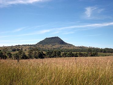
Mount Walker viewed from Rosewood Warrill View Road, 2015
|
|||||||||||||||
| Population | 129 (2021 census) | ||||||||||||||
| • Density | 3.862/km2 (10.00/sq mi) | ||||||||||||||
| Postcode(s) | 4340 | ||||||||||||||
| Area | 33.4 km2 (12.9 sq mi) | ||||||||||||||
| Time zone | AEST (UTC+10:00) | ||||||||||||||
| Location |
|
||||||||||||||
| LGA(s) | Scenic Rim Region | ||||||||||||||
| State electorate(s) | Scenic Rim | ||||||||||||||
| Federal Division(s) | Wright | ||||||||||||||
|
|||||||||||||||
Mount Walker is a small country area in the Scenic Rim Region of Queensland, Australia. It is known as a "locality," which is like a small district.
In 2021, about 129 people lived in Mount Walker.
Contents
Geography of Mount Walker
The western edge of Mount Walker is next to the Bremer River.
The Mount Walker Mountain
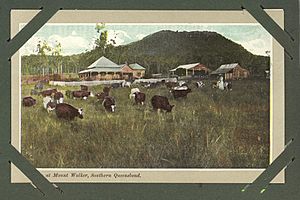
The mountain called Mount Walker is located in the eastern part of this area. It rises 471 meters (about 1,545 feet) above sea level.
The very top parts of Mount Walker mountain are wild and undeveloped. Most of the land in the area is used for grazing animals like cattle. Some parts also have farms where crops are grown using irrigation.
History of Mount Walker
The mountain was first named Mount Forbes by an explorer named John Oxley. He named it after Sir Francis Forbes, who was a very important judge.
However, the mountain later became known as Mount Walker. People believe it was named after a shepherd who worked at the nearby Franklyn Vale pastoral station. The entire area of Mount Walker then got its name from this mountain.
Churches and Schools in Mount Walker
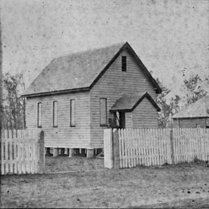
The Mount Walker German Baptist Church opened in 1872. For a while, it was the main church for all German Baptist churches in the area. This changed around 1879 when another church took over.
Mount Walker State School opened its doors on April 15, 1878. It taught children for many years before closing in December 1967. The school was located on Rosewood Warrill View Road.
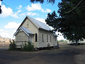
The Mount Walker Church of Christ started in 1884. It celebrated its 125th birthday in 2009, which is a very long time!
Another church, the Mount Walker Congregational Church, opened in 1896. It closed sometime before 1940.
Mount Walker Post Office
A post office opened in Mount Walker on October 1, 1916. Before that, there was a smaller "receiving office" for mail since 1874. The post office eventually closed in 1957.
Population of Mount Walker
In 2016, Mount Walker had 134 people living there. The average age of people was 42 years old. Most people were born in Australia and spoke English at home.
By 2021, the population of Mount Walker was 129 people.
Education Near Mount Walker
There are no schools directly within Mount Walker itself.
For primary school, students usually go to Mutdapilly State School or Warrill View State School. These schools are located in nearby towns.
For high school, the closest government school is Rosewood State High School, which is to the north in Rosewood.
Amenities in Mount Walker
The Mount Walker Church of Christ is on Hinrichsen Road. It holds church services every Sunday.
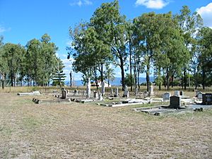
Mount Walker also has a public cemetery. This is a place where people are buried. It is located on Rosewood-Warrill View Road.
 | May Edward Chinn |
 | Rebecca Cole |
 | Alexa Canady |
 | Dorothy Lavinia Brown |


