Rosevale, Queensland facts for kids
Quick facts for kids RosevaleQueensland |
|||||||||||||||
|---|---|---|---|---|---|---|---|---|---|---|---|---|---|---|---|

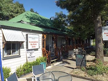
Rosevale Retreat Hotel, 2015
|
|||||||||||||||
| Population | 212 (2021 census) | ||||||||||||||
| • Density | 1.586/km2 (4.11/sq mi) | ||||||||||||||
| Postcode(s) | 4340 | ||||||||||||||
| Elevation | 105 m (344 ft) | ||||||||||||||
| Area | 133.7 km2 (51.6 sq mi) | ||||||||||||||
| Time zone | AEST (UTC+10:00) | ||||||||||||||
| Location |
|
||||||||||||||
| LGA(s) | Scenic Rim Region | ||||||||||||||
| State electorate(s) | Scenic Rim | ||||||||||||||
| Federal Division(s) | |||||||||||||||
|
|||||||||||||||
Rosevale is a small country area in Queensland, Australia. It is part of the Scenic Rim Region. In 2021, about 212 people lived there.
Contents
Rosevale's Geography
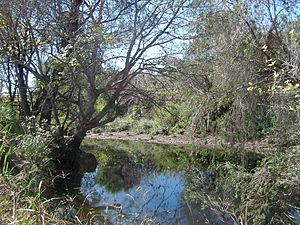
The Bremer River flows through Rosevale. It enters from the southwest (near Moorang) and leaves towards the north (near Mount Walker West and Mount Walker).
Rosevale's History
The name Rosevale comes from Rossvale. This was the name of a large farming area first used in the 1850s by William Ross.
The Rosevale Retreat Hotel was built in 1852. It started as a home and is now the oldest hotel building in Queensland! It became a licensed hotel in 1887.
Rosevale State School opened on November 24, 1884. It closed down on December 31, 2010. The school was located at 628 Sellars Road.
St Stephen's Anglican Church opened around 1887 but closed around 1962.
Over the years, Rosevale has been part of different local government areas, including the Shire of Mutdapilly, Shire of Moreton, and the Shire of Boonah.
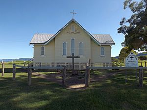
The Lutheran church in Rosevale burned down in 1928. In 1929, a church building from Peak Crossing was moved to Rosevale to become the new Lutheran church.
You can find more detailed history about the area at St Patrick's Church, Rosevale#History.
Rosevale's Population
The number of people living in Rosevale has changed over the years:
- In 2011, there were 268 people.
- In 2016, there were 208 people.
- In 2021, there were 212 people.
Historic Places in Rosevale
Rosevale has several places that are important for their history. These are called heritage-listed sites:
- St Patrick's Catholic Church and Graveyard on Rosewood – Aratula Road.
- St Paul's Lutheran Church at 572 Rosevale Road.
- Rosevale Retreat Hotel at 903 Rosevale Road.
Education in Rosevale
There are no schools directly in Rosevale. Students usually go to schools in nearby towns.
- For primary school, the closest government schools are Warrill View State School in Warrill View (to the east) and Aratula State School in Aratula (to the south).
- For high school, students can attend Rosewood State High School in Rosewood (to the north) or Boonah State High School in Boonah (to the south-east).
 | John T. Biggers |
 | Thomas Blackshear |
 | Mark Bradford |
 | Beverly Buchanan |


