
Mount Webster facts for kids
Quick facts for kids Mount Webster |
|
|---|---|

The view from Mount Willey along the spine of the Presidential Range, from Jefferson (left background) to Mount Webster (right foreground).
|
|
| Highest point | |
| Elevation | 1,192 m (3,911 ft) |
| Prominence | 46 m (151 ft) |
| Geography | |
| Location | Bean's Purchase, Coös County / Hart's Location, Carroll County, New Hampshire, U.S. |
| Parent range | Presidential Range |
| Topo map | USGS Crawford Notch |
Mount Webster is a cool mountain in New Hampshire, USA. It sits right on the edge between two counties: Coös County and Carroll County. This mountain used to be called Notch Mountain. It got its new name from a famous American leader, Daniel Webster.
Mount Webster is the most southwestern mountain in the Presidential Range. This range is part of the larger White Mountains. To its northeast is Mount Jackson. If you look southwest, you'll see Mount Willey across a valley called Crawford Notch.
Contents
About Mount Webster
Mount Webster is a mountain in the White Mountains of New Hampshire. It stands tall at 1,192 meters (about 3,911 feet) high. This makes it a noticeable peak in the area. The mountain is part of the Presidential Range. This range is known for its peaks named after U.S. presidents and other important figures.
Where the Water Goes
The western side of Mount Webster is like a giant funnel. All the water from this side flows directly into the Saco River. This river then travels all the way to the Gulf of Maine. The Gulf of Maine is part of the Atlantic Ocean. It is located near Saco, Maine.
The northern and southeastern parts of the mountain also send their water to the Saco River. Water from the north flows through a waterfall called Silver Cascade. Water from the southeast goes through a stream called Webster Brook.
Hiking the Appalachian Trail
Mount Webster is an important spot for hikers. It sits on the western edge of a protected area. This area is called the Presidential Range - Dry River Wilderness.
The famous Appalachian Trail runs right over the top of Mount Webster. This trail is super long, about 3,500 kilometers (2,170 miles). It starts in Georgia and ends all the way up in Maine. It's a National Scenic Trail. This means it's a special path for people to enjoy nature.
Daniel Webster, the Namesake
Mount Webster is named after Daniel Webster (1782–1852). He was a very important American statesman. A statesman is a skilled and respected leader in government. Daniel Webster served in the U.S. House of Representatives and the U.S. Senate. He also worked as the U.S. Secretary of State. This job is like the country's top diplomat. He was known for his amazing speeches.
Gallery
-
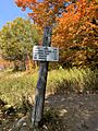
A sign at the start of the Webster-Jackson trail

