
Mount Sterling, Kentucky facts for kids
Quick facts for kids
Mount Sterling, Kentucky
|
|
|---|---|

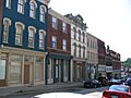
Downtown Mt. Sterling
|
|
| Motto(s):
"Ringing with Unity and Pride"
|
|

Location in Montgomery County, Kentucky
|
|
| Country | United States |
| State | Kentucky |
| County | Montgomery |
| Established | 1792 |
| Incorporated | 1852 |
| Area | |
| • Total | 4.51 sq mi (11.68 km2) |
| • Land | 4.49 sq mi (11.62 km2) |
| • Water | 0.02 sq mi (0.06 km2) |
| Elevation | 974 ft (297 m) |
| Population
(2020)
|
|
| • Total | 7,558 |
| • Estimate
(2023)
|
7,571 |
| • Density | 1,684.05/sq mi (650.19/km2) |
| Time zone | UTC-5 (Eastern (EST)) |
| • Summer (DST) | UTC-4 (EDT) |
| ZIP code |
40353
|
| Area code(s) | 859 |
| FIPS code | 21-54084 |
| GNIS feature ID | 0498865 |
Mount Sterling, also known as Mt. Sterling, is a city in Kentucky, United States. It is located in Montgomery County. In 2020, about 7,558 people lived there. Mount Sterling is the main city and the county seat of Montgomery County. This means it's where the county's government offices are located.
Contents
History of Mount Sterling
Mount Sterling got its name from two things. One is an old burial mound called "Little Mountain." The other is the town of Stirling in Scotland. Hugh Forbes, who first developed the area, chose the name. In 1792, the Kentucky Assembly officially made it a town. They misspelled it as "Mt. Sterling," and the name stuck!
The area was once a thick forest in central Kentucky. Explorers and hunters found a large, tree-covered mound. They called it "the Little Mountain." Later, people found out it was an ancient burial site. Today, this spot is at the corner of Queen and Locust streets in Mt. Sterling.
The first small house was built here in 1779. More people started settling around 1790. Hugh Forbes began selling land and creating roads. One of these roads is now Locust Street. In 1796, Mount Sterling became the county seat of the new Montgomery County. At that time, the town had 33 plots of land, four stores, and three places to eat.
A courthouse was built, and it was the first of seven courthouses in Mt. Sterling. A jail and a town water pump were also added. A big brick market house was built where farmers could sell their goods. This made the town an important place for trade. Churches for Baptists, Presbyterians, and Methodists were also started in the town's early years.
During the American Civil War, soldiers from both the Union Army and the Confederate States Army took turns occupying the town many times. The Battle of Mount Sterling happened in June 1864. The Confederate soldiers were defeated. This was the last battle fought in Montgomery County during the war.
Geography and Location
Mt. Sterling is located in the northwest part of Montgomery County. It is about 34 miles (55 km) east of Lexington. It is also about 91 miles (146 km) west of Huntington, West Virginia.
U.S. Route 60 goes through the city as Main Street. It leads northeast to Owingsville and southwest to Winchester. U.S. Route 460 crosses US 60 in the center of Mt. Sterling. It goes northwest to Paris and southeast to Frenchburg.
Kentucky Route 11 also goes through the center of Mt. Sterling with US 460. It leads north to Flemingsburg and south to Clay City. Interstate 64 passes through the northern part of Mt. Sterling. You can get on it from exits 110 (US 460) and 113 (US 60). This highway connects Mt. Sterling to Lexington and Huntington.
The city covers about 4.52 square miles (11.71 km2). Only a small part of this, about 0.02 square miles (0.05 km2), is water. Hinkston Creek flows through the city center. It then goes north and west to the South Fork of the Licking River.
Climate in Mount Sterling
The weather in Mount Sterling has hot, humid summers. The winters are usually mild to cool. This type of weather is called a humid subtropical climate. On climate maps, it is shown as "Cfa."
| Climate data for Mount Sterling, Kentucky (1991–2020 normals, extremes 1892–present) | |||||||||||||
|---|---|---|---|---|---|---|---|---|---|---|---|---|---|
| Month | Jan | Feb | Mar | Apr | May | Jun | Jul | Aug | Sep | Oct | Nov | Dec | Year |
| Record high °F (°C) | 80 (27) |
80 (27) |
89 (32) |
92 (33) |
98 (37) |
104 (40) |
110 (43) |
105 (41) |
104 (40) |
97 (36) |
83 (28) |
78 (26) |
110 (43) |
| Mean maximum °F (°C) | 65.2 (18.4) |
69.5 (20.8) |
75.7 (24.3) |
82.4 (28.0) |
87.9 (31.1) |
92.8 (33.8) |
94.8 (34.9) |
93.5 (34.2) |
91.6 (33.1) |
84.2 (29.0) |
74.3 (23.5) |
66.3 (19.1) |
96.6 (35.9) |
| Mean daily maximum °F (°C) | 41.8 (5.4) |
45.6 (7.6) |
55.7 (13.2) |
66.8 (19.3) |
75.6 (24.2) |
83.4 (28.6) |
86.5 (30.3) |
85.7 (29.8) |
80.1 (26.7) |
68.5 (20.3) |
55.9 (13.3) |
45.4 (7.4) |
65.9 (18.8) |
| Daily mean °F (°C) | 31.7 (−0.2) |
34.5 (1.4) |
43.1 (6.2) |
53.3 (11.8) |
63.1 (17.3) |
71.2 (21.8) |
74.8 (23.8) |
73.1 (22.8) |
66.6 (19.2) |
55.0 (12.8) |
43.6 (6.4) |
35.2 (1.8) |
53.8 (12.1) |
| Mean daily minimum °F (°C) | 21.6 (−5.8) |
23.5 (−4.7) |
30.5 (−0.8) |
39.8 (4.3) |
50.6 (10.3) |
59.0 (15.0) |
63.1 (17.3) |
60.6 (15.9) |
53.1 (11.7) |
41.6 (5.3) |
31.3 (−0.4) |
25.0 (−3.9) |
41.6 (5.3) |
| Mean minimum °F (°C) | 2.1 (−16.6) |
4.6 (−15.2) |
13.3 (−10.4) |
24.3 (−4.3) |
35.6 (2.0) |
46.4 (8.0) |
53.5 (11.9) |
49.7 (9.8) |
40.3 (4.6) |
27.7 (−2.4) |
16.4 (−8.7) |
9.6 (−12.4) |
−1.9 (−18.8) |
| Record low °F (°C) | −20 (−29) |
−27 (−33) |
−12 (−24) |
18 (−8) |
26 (−3) |
39 (4) |
42 (6) |
43 (6) |
25 (−4) |
15 (−9) |
−8 (−22) |
−20 (−29) |
−27 (−33) |
| Average precipitation inches (mm) | 3.52 (89) |
3.66 (93) |
4.36 (111) |
4.40 (112) |
4.53 (115) |
4.80 (122) |
5.38 (137) |
3.36 (85) |
3.61 (92) |
3.22 (82) |
3.38 (86) |
4.28 (109) |
48.50 (1,232) |
| Average snowfall inches (cm) | 3.3 (8.4) |
2.0 (5.1) |
2.2 (5.6) |
0.0 (0.0) |
0.0 (0.0) |
0.0 (0.0) |
0.0 (0.0) |
0.0 (0.0) |
0.0 (0.0) |
0.0 (0.0) |
0.2 (0.51) |
1.1 (2.8) |
8.8 (22) |
| Average precipitation days (≥ 0.01 in) | 11.7 | 11.3 | 12.9 | 12.8 | 12.5 | 11.9 | 11.6 | 9.4 | 8.9 | 9.2 | 9.7 | 12.0 | 133.9 |
| Average snowy days (≥ 0.1 in) | 2.1 | 1.7 | 1.0 | 0.0 | 0.0 | 0.0 | 0.0 | 0.0 | 0.0 | 0.0 | 0.2 | 0.7 | 5.7 |
| Source: NOAA | |||||||||||||
Population and People
| Historical population | |||
|---|---|---|---|
| Census | Pop. | %± | |
| 1800 | 83 | — | |
| 1810 | 325 | 291.6% | |
| 1830 | 561 | — | |
| 1840 | 585 | 4.3% | |
| 1850 | 533 | −8.9% | |
| 1860 | 744 | 39.6% | |
| 1870 | 1,040 | 39.8% | |
| 1880 | 2,087 | 100.7% | |
| 1890 | 3,629 | 73.9% | |
| 1900 | 3,561 | −1.9% | |
| 1910 | 3,932 | 10.4% | |
| 1920 | 3,995 | 1.6% | |
| 1930 | 4,350 | 8.9% | |
| 1940 | 4,782 | 9.9% | |
| 1950 | 5,294 | 10.7% | |
| 1960 | 5,370 | 1.4% | |
| 1970 | 5,083 | −5.3% | |
| 1980 | 5,820 | 14.5% | |
| 1990 | 5,362 | −7.9% | |
| 2000 | 5,876 | 9.6% | |
| 2010 | 6,895 | 17.3% | |
| 2020 | 7,558 | 9.6% | |
| 2023 (est.) | 7,571 | 9.8% | |
| U.S. Decennial Census | |||
In 2000, there were 5,876 people living in Mount Sterling. These people lived in 2,478 households. About 1,536 of these households were families. The city had about 1,709 people per square mile (659.8/km2).
Most of the people in the city were White (89.09%). About 8.73% were African American. A small number were Native American or Asian. Some people were from other races, or from two or more races. About 1.68% of the population was Hispanic or Latino.
About 28.9% of households had children under 18. About 44.8% were married couples. Around 14.2% were households with a female head and no husband. Many households (33.3%) were people living alone. About 17.4% of these were people aged 65 or older.
The average age in the city was 37 years old. About 22.7% of the people were under 18. About 17.4% were 65 or older. For every 100 females, there were about 86 males.
The average income for a household was $27,050. For families, the average income was $54,074. About 19.4% of the people lived below the poverty line. This included 29.4% of those under 18.
Arts and Culture in Mount Sterling
Since the 1700s, "Court Day" has been a big annual trading event. It is still a very popular event today. It happens on the third Monday in October and the weekend before. Around 130,000 people come from all over the country. They enjoy arts, crafts, food, and music during this four-day event.
The Gateway Regional Arts Center is a place for art. It offers classes and shows art. It is located in a historic building that used to be the First United Methodist Church. This building is listed on the National Register of Historic Places.
Historic Places in Mount Sterling
Many places in Mount Sterling are listed as historic. They are important because of their history or architecture.
- Bondurant House
- Chesapeake and Ohio Railroad Passenger and Baggage Depots
- Church of the Ascension
- Confederate Monument of Mt. Sterling
- East Mt. Sterling Historic District
- Enoch Smith House
- Gaitskill Mound Archeological Site
- John Bell Hood House
- KEAS Tabernacle Christian Methodist Episcopal Church
- Machpelah Cemetery
- Methodist Episcopal Church South
- Miss Emma Hicks Bungalow
- Monarch Milling Company
- Mt. Sterling Commercial District
- Northwest Residential District
- Ralph Morgan Stone House
- W. T. Fitzpatrick House
- William Chiles House
- Wright-Greene Mound Complex
Education in Mount Sterling
Mount Sterling has a public library. It is a part of the Montgomery County Public Library system. The city's schools are run by Montgomery County Public Schools. The city is home to Montgomery County High School.
Famous People from Mount Sterling
Many notable people have come from Mount Sterling:
- Lawrence Chenault (born 1877), an African American film actor.
- Henry Daniel (1786–1873), a congressman from Kentucky.
- Amos Davis (1794–1835), another congressman from Kentucky.
- Ernie Fletcher (born 1952), who was the governor of Kentucky from 2003 to 2007.
- Nancy Green (1834–1923), known as the original Aunt Jemima.
- Robert E. Payne (born 1941), a United States district judge.
- Josephine B. Sneed (1899–1986), a commissioner for Cook County, Illinois.
- Jeremy Sumpter (born 1989), an actor.
- James L. White (1947–2015), a screenwriter famous for the movie Ray.
- Andrew T. Wood (1834–1915), a lawyer and politician.
Images for kids
-
Downtown Mt. Sterling
-

Location in Montgomery County, Kentucky
See also
 In Spanish: Mount Sterling (Kentucky) para niños
