Mystic, Connecticut facts for kids
Quick facts for kids
Mystic, Connecticut
|
||
|---|---|---|
| Village of Mystic | ||
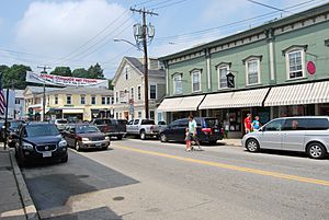
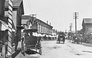
Main Street, downtown Mystic
|
||
|
||
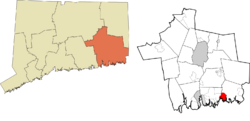
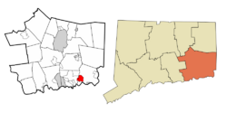 New London County and Connecticut New London County and Connecticut |
||
| Country | ||
| U.S. state | ||
| County | New London | |
| Region | Southeastern CT | |
| Towns | Groton, Stonington | |
| Area | ||
| • Total | 4.082 sq mi (10.57 km2) | |
| • Land | 3.649 sq mi (9.45 km2) | |
| • Water | 0.433 sq mi (1.12 km2) | |
| Elevation | 10 ft (3 m) | |
| Population
(2020)
|
||
| • Total | 4,348 | |
| • Density | 1,192/sq mi (460/km2) | |
| Time zone | UTC−5 (Eastern (EST)) | |
| • Summer (DST) | UTC−4 (EDT) | |
| ZIP Codes |
06355, 06372, 06388
|
|
| Area code | 860 | |
| FIPS code | 09-49810 | |
| GNIS feature ID | 209165 | |
Mystic is a village and a special area defined by the census (CDP) in the towns of Groton and Stonington, Connecticut, United States.
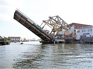
Mystic was once a very important seaport in Connecticut. Over 600 ships were built here in 135 years, starting in 1784. Today, Mystic is home to Mystic Seaport, the biggest museum about the sea in the United States. It has saved many old sailing ships, like the whaling ship Charles W. Morgan. The village is located on the Mystic River, which flows into Fishers Island Sound. The Mystic River Bascule Bridge crosses the river right in the middle of the village. The name "Mystic" comes from the Pequot word "missi-tuk," which means a large river where the water is moved by tides or wind. In 2020, about 4,348 people lived here.
Contents
History of Mystic
Before the 1600s, the Pequot people lived in this part of southeastern Connecticut. They controlled a large area of land. This land stretched towards the Pawcatuck River in the east and the Connecticut River in the west.
The Pequot War greatly affected the Mystic area between 1636 and 1638. In May 1637, Captains John Underhill and John Mason led a group of colonists. They were joined by their allies, the Narragansetts and Mohegans. They attacked a Pequot village in Mystic. This event became known as the Mystic massacre. On September 21, 1638, the colonists signed the Treaty of Hartford. This treaty officially ended the Pequot War.
English Settlers Arrive
After the Pequot War, the Pequot people no longer controlled the Mystic area. More English settlers began to move in. By the 1640s, the Connecticut Colony started giving land to soldiers who fought in the Pequot War. John Winthrop the Younger was one of these people. He received a lot of land in southeastern Connecticut. Other early settlers in Mystic included Robert Burrows and George Denison. They owned land in the Mystic River Valley.
The number of settlers grew slowly. The governments of Connecticut and Massachusetts Bay started to argue over their borders. This caused confusion about who was in charge between the Mystic River and the Pawcatuck River. In the 1640s and 1650s, "Connecticut" meant the towns along the Connecticut River. It also included other areas they claimed. However, Massachusetts Bay claimed to control Stonington and even parts of Rhode Island.
The two colonies asked the United Colonies of New England to help solve their disagreement. This group was formed in 1643 to settle such disputes. They decided to set the border between Massachusetts Bay and Connecticut at the Thames River. This meant Connecticut would be west of the river. Massachusetts Bay would have the land to the east, including the Mystic River.
Over the next ten years, more colonists settled around the Mystic River. John Mason, one of the captains who fought the Pequots, was given 500 acres (2.0 km2) on the east side of the Mystic River. He also received the island that is now named after him. However, he never lived there. In 1653, John Gallup, Jr. received 300 acres (1.2 km2) about halfway up the east side of the Mystic River.
In the same year, others joined John Gallup and settled near the Mystic River. George Denison, a soldier from Oliver Cromwell's army, received 300 acres (1.2 km2) just south of Gallup's land in 1654. Thomas Miner moved to Massachusetts with John Winthrop. He was given many land plots, with his main one on Quiambaug Cove, just east of the Mystic River. Other families who received land included Reverend Robert Blinman, the Beebe brothers, Thomas Parke, and Connecticut Governor John Hayne.
Not all these men lived on their land. Many sold it for money or hired someone to farm it. However, many men did bring their wives and children. This showed they planned to build a community in the Mystic River Valley.
There was one known case of a woman who came to the Mystic River Valley on her own. Widow Margaret Lake received land from the Massachusetts Bay authority. She was the only woman to get land in her own name. She also did not live on her land but hired people to take care of it. She lived in Lakes Pond. Her daughter was married to John Gallup, and her sister was married to Massachusetts Bay Governor John Winthrop.
By 1675, many more people had settled in the Mystic River Valley. Roads and businesses started to appear. The Pequot Trail was a main road used to travel around the Mystic River. It was very important for settlers. They used it to move animals, crops, furs, and other goods to and from their farms. However, families living on the east side of the Mystic River could not use the Pequot Trail easily. As early as 1660, Robert Burrows was allowed to start a ferry in the middle of the river. This made his home known as "Half-way House."
The Pequot Trail also connected settlers to their church. People in Stonington found it hard to go to church in Mystic or Groton. This led them to create their own church. The town of Stonington was then allowed to build its own church. This building became known as the Road Church.
Colonists started public schools in this area around 1679. John Fish became the first schoolmaster in Stonington. He taught classes in his home. Education was very important to the New England colonists. It helped children and servants learn to read and write. Most families in New England had six or more children, so Fish had many students.
Mystic's Growth in the 1700s
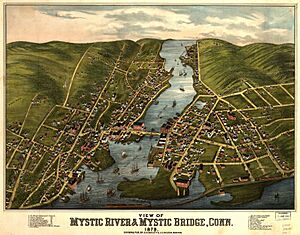
By the early 1700s, three villages began to grow along the Mystic River. The largest village was called Mystic (now Old Mystic). It was also known as the Head of the River because it was where several small rivers joined to form the Mystic River. Two other villages were further down the river. One was called Stonington and was known as Lower Mystic. By the early 1800s, it had twelve houses along Willow Street, which ended at the ferry. This is now the Stonington side of the village of Mystic. On the other side of the river, in the town of Groton, was the village that became known as Portersville. This is the Groton side of the village of Mystic.
Historic Places in Mystic
Mystic has three special areas called historic districts. These are places that are important to history. They include:
- The Mystic Bridge Historic District around U.S. Route 1 and Route 27.
- The Rossie Velvet Mill Historic District between Pleasant Street and Bruggeman Place.
- The Mystic River Historic District around U.S. Route 1 and Route 215.
Other historic sites in Mystic are old ships and buildings:
- Joseph Conrad (ship) at Mystic Seaport Museum
- Charles W. Morgan (ship) at Mystic Seaport Museum
- Emma C. Berry (sloop) at Mystic Seaport Museum
- L. A. Dunton (schooner) at Mystic Seaport Museum
- Pequotsepos Manor on Pequotsepos Road
- Sabino (steamer) at Mystic Seaport Museum
Mystic's Geography
Mystic covers about 4.08 square miles (10.6 km2). Most of this area, about 3.65 square miles (9.45 km2), is land. The rest, about 0.43 square miles (1.1 km2), is water. The village is on both the east and west sides of the estuary (where the river meets the sea) of the Mystic River. Mason's Island is at the south end of the estuary. The rocks under Mystic are mostly "gneissic, crystalline terrane." This type of rock stretches from eastern Massachusetts through Rhode Island and southeastern Connecticut.
Things to Do in Mystic
Mystic is a very popular place for tourists to visit in New England. It has many fun attractions:
- The Mystic Aquarium & Institute for Exploration is here. It is known for its research and helping marine animals. It is also famous for its popular beluga whales.
- The main part of town has many restaurants. They are on both sides of the bascule bridge, where U.S. Route 1 crosses the Mystic River.
- You can take sailing trips on the old sailing ship Argia.
- You can also take short day trips or longer evening cruises on the 1908 steamer Sabino. These trips start from Mystic Seaport.
Mystic Seaport is the country's leading museum about the sea. It is one of the best maritime museums in the world. It was started in 1929. It is home to four ships that are National Historic Landmarks. This includes the 1841 whaling ship Charles W. Morgan, which is the oldest merchant ship in the country. The museum has over 500 historic boats, a large research library, and a gallery of sea art. It also has a special display showing Mystic as it looked in the 1800s. There is a working shipyard where ships are fixed, a planetarium, and a recreated 19th-century seafaring village.
The Mystic Museum of Art is at 9 Water Street. It shows art by artists from the Mystic Art Colony. It also features other modern American art. The 2013 Moondance International Film Festival was held in Mystic.
Mystic's Population
| Historical population | |||
|---|---|---|---|
| Census | Pop. | %± | |
| 1990 | 2,618 | — | |
| 2000 | 4,001 | 52.8% | |
| 2010 | 4,205 | 5.1% | |
| 2020 | 4,348 | 3.4% | |
In 2000, there were 4,001 people living in Mystic. There were 1,797 households and 995 families. About 20.3% of households had children under 18. About 45.6% were married couples. The average household had 2.10 people. The average family had 2.76 people.
The median age in Mystic was 43 years old. For every 100 females, there were about 92.7 males. The median income for a household was $62,236. For a family, it was $70,625. About 3.1% of the population lived below the poverty line. This included 1.9% of those under 18.
Getting Around Mystic
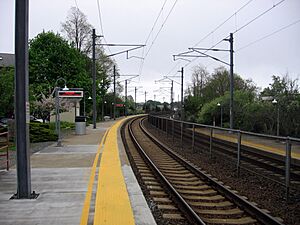
Amtrak trains stop at the Mystic station. Bus service is provided by Southeast Area Transit. The Groton-New London Airport is nearby for private and chartered flights.
Schools in Mystic
The part of Mystic in Stonington Town is in the Stonington School District. The part in Groton Town is in the Groton School District.
Famous People from Mystic
- Mary Jobe Akeley, a naturalist who studied nature.
- Matt Harvey, a former Major League Baseball pitcher.
- Sam Lacy, a sportswriter.
- Stephen Macht, an actor.
- William Ledyard Stark, a politician from Nebraska.
- Paul Menhart, a former Major League Baseball pitcher.
- Asa Packer, a pioneer in railroads.
- Jonathan Skrmetti, the Attorney General for Tennessee.
See also
 In Spanish: Mystic (Connecticut) para niños


