
Groton, Connecticut facts for kids
Quick facts for kids
Town of Groton, Connecticut
|
|||||
|---|---|---|---|---|---|

USS Nautilus (SSN-571) moored in Groton at the Submarine Force Museum
|
|||||
|
|||||
| Nickname(s):
The Submarine Capital of the World
|
|||||
 New London County and Connecticut New London County and Connecticut Southeastern Connecticut Planning Region and Connecticut Southeastern Connecticut Planning Region and Connecticut |
|||||
| Country | |||||
| U.S. state | |||||
| County | New London | ||||
| Region | Southeastern CT | ||||
| Incorporated | 1705 | ||||
| Government | |||||
| • Type | Council-manager | ||||
| Area | |||||
| • Total | 45.3 sq mi (117.3 km2) | ||||
| • Land | 31.0 sq mi (80.4 km2) | ||||
| • Water | 14.2 sq mi (36.9 km2) | ||||
| Population
(2020)
|
|||||
| • Total | 38,411 | ||||
| • Density | 848.1/sq mi (327.46/km2) | ||||
| Time zone | UTC−5 (Eastern) | ||||
| • Summer (DST) | UTC−4 (Eastern) | ||||
| ZIP Code |
06340
|
||||
| Area code(s) | 860/959 | ||||
| FIPS code | 09-34250 | ||||
| GNIS feature ID | 0213437 | ||||


Groton (pronounced GRAH-tuhn) is a town in New London County, Connecticut. It is located along the Thames River. Groton is famous for being the home of General Dynamics Electric Boat. This company builds submarines for the United States Navy.
The Naval Submarine Base New London is also in Groton. It is a very important base for submarines. Another big employer in town is the pharmaceutical company Pfizer. The University of Connecticut has a campus in Groton called Avery Point. In 2020, about 38,411 people lived in Groton.
Contents
Groton's Past: A Look at History

Groton became its own town in 1705. Before that, it was part of New London, Connecticut.
General Dynamics Electric Boat has been a key part of Groton's history. They have built submarines for the Navy since 1899. This has created many jobs in the Groton and New London areas. The first Baptist church in Connecticut was founded in Groton. It was called the Old Mystic Baptist Church.
Early Days: Native Americans and First Settlers
Long ago, the Nehantic Native Americans lived here. They settled between the Thames and Pawcatuck rivers. Later, the Pequots moved into the area. They built three villages in what is now Groton. These villages were at Groton Heights, Fort Hill, and Mystic.
The Pequots were skilled at making canoes. They used them to travel on the rivers. The Thames River was on the west side. The Mystic River was on the east. To the south was Fishers Island Sound, part of Long Island Sound. The land between the rivers was hilly. But Poquonnock Plains was a flat area that stretched to the sound.
The Pequots first met white settlers in 1614. They traded furs for items like steel knives. In 1633, the Dutch bought land from the Pequots. They set up a fur trading post. However, a conflict started when the Dutch accidentally killed the Pequot chief. This led to attacks from the Pequot tribe.
The first European settlers in Groton were farmers. They had to clear trees to grow crops. Livestock like cattle, pigs, and sheep were also very important. In 1660, wolves were a big problem. The settlers offered money for each wolf killed.
Even though the land was not the best for farming, Groton had good access to waterways. This helped with trade. Many people in Groton started building ships. They sailed to Boston and Plymouth. They traded for food, tools, and clothes. John Leeds was one of the first shipbuilders. He built a 20-ton brigantine, a type of sailing ship. Other builders like Thomas Starr and Thomas Latham also built large ships. These strong ships were used for profitable trade with islands in the Caribbean.
The American Revolution in Groton
Times became tough for Groton after the French and Indian War. New taxes like the Sugar Act of 1764 and the Stamp Act of 1765 were put in place. The British Parliament also closed the port of Boston. This hurt Groton's trade.
On September 6, 1781, a major battle happened in Groton. It was called the Battle of Groton Heights. A small group of American militia fought against many British soldiers. The British were led by Benedict Arnold. The Americans were led by William Ledyard. No one at Fort Griswold expected an attack.
About 1,700 British soldiers landed near the Thames River. Across the river in New London, Benedict Arnold's group destroyed supplies. One ship in New London was full of gunpowder. It caught fire and caused a huge blaze. This fire destroyed many buildings in New London.
Meanwhile, 800 British soldiers moved towards Fort Griswold in Groton. Only 164 American militia were defending the fort. The British asked them to surrender, but William Ledyard refused. The British then attacked. This led to a bloody battle. The British eventually entered the fort. They overpowered the small American group. William Ledyard surrendered, but he was killed by the British.
A memorial was built in 1830 for the 88 men and boys who died at the fort. This monument is 135 feet (41 meters) tall. It is now a symbol of Groton. You can see it on the town's official seal.
Growth in the 1800s

After the Revolutionary War, Groton began to rebuild its trade. Shipbuilders started working again. Many new ships were built between 1784 and 1807. The shipyards along the Mystic River were very busy. These ships sailed to places like Florida. The profits made Mystic the busiest part of town.
In 1812, the United States declared war on Great Britain. This was the War of 1812. Many American navy ships were stuck in the Thames River. People in Groton worried about another attack like the one in 1781. Many residents moved inland for safety. Those who stayed demanded protection. They built a small fort called Fort Rachel. The British never attacked Groton, but they blocked trade.
Some men from Mystic captured a British barge in 1814. They also captured a British sloop. Seventeen men from Mystic tried a new weapon called the spar torpedo. They tried to sink a British ship, the HMS Ramillies, but they were not successful. The war ended on February 21, 1815. Groton's ships could then go back to sea.
After the War of 1812, whaling became very important. Before 1820, seal hunting was also popular. By 1830, whaling was Mystic's main business. By 1846, Groton was a major whaling port. Whaling was dangerous, but many young boys went to sea to seek their fortune. They hoped to become ship captains one day.
Ebenezer Morgan had a very successful whaling trip in 1865. He sold his cargo for $150,000. He later became very wealthy. William H. Allen was another famous whaler from Groton. He commanded a whale ship for 25 years.
Late 1800s: Fast Ships and Ironclads
In 1849, the discovery of gold in California created a need for faster ships. This led to the creation of the clipper ship. These were very fast sailing ships. The most famous clipper ship built in Mystic was the Andrew Jackson. In 1859, it sailed from New York City to San Francisco in a record 89 days.
During the Civil War, the U.S. Navy wanted new ironclad warships. A company in Groton was chosen to build one. It was called Galena. It was launched on Valentine's Day in 1862. Many people thought it would sink, but it floated well. However, in battle, the Galena was hit many times. Many crew members were killed or wounded. During the Civil War, 56 steamships were built for the government in the Mystic River shipyards.
After the war, shipbuilding moved to Noank, which is part of Groton. Palmer Shipyard was a large shipyard there. It had a marine railway to pull ships out of the water for repairs. This brought a lot of business. Later, iron ships became popular. This brought more workers to Groton.
The Naval Submarine Base New London was started in Groton in 1872. It was first called the New London Navy Yard. Submarines began to be based there in 1915. In 1916, it officially became a submarine base.
Groton used to include the town of Ledyard. Ledyard separated from Groton in 1836. The original center of Groton is now called Center Groton. It is in the middle of the town.
The 1900s: Submarine Capital
In the 20th century, shipbuilding moved to the Thames River. Electric Boat became Groton's biggest employer. In 1931, the USS Cuttlefish was the first submarine built in Groton. During World War II, Electric Boat built submarines very quickly. They completed one every two weeks.
In 1954, Electric Boat launched the USS Nautilus. This was the world's first nuclear-powered submarine. Today, the Nautilus is a museum ship. You can visit it at the U.S. Navy Submarine Force Library and Museum. Groton is often called the "Submarine Capital of the World." This is because of its long history with submarines. It also has one of the largest submarine bases in the world.
A trolley line called the Groton and Stonington Street Railway served Groton starting in 1904. It was replaced by buses in 1928.
Groton's Geography and Climate
Groton covers about 117.3 square kilometers (45.3 square miles). About 80.4 square kilometers (31.0 square miles) is land. The rest, about 36.9 square kilometers (14.2 square miles), is water.
Main Areas in Groton
Groton has several important communities and areas:
- Burnett's Corner — A historic area.
- Center Groton — The original center of town.
- City of Groton — A separate city within the town.
- Groton Heights or Groton Bank — A historic part of the city.
- Groton Long Point — A community on the coast.
- Long Hill
- Mystic — Part of this famous village is in Groton.
- Noank — A village known for its maritime history.
- Old Mystic
- Poquonock Bridge
- Fort Hill
- Submarine Base area — The area around the submarine base.
Other places include Bluff Point, Eastern Point, and Mumford Cove.
Weather in Groton
| Climate data for Groton–New London Airport (GON) (1981-2010), snow data from Norwich, Connecticut (1981-2010). | |||||||||||||
|---|---|---|---|---|---|---|---|---|---|---|---|---|---|
| Month | Jan | Feb | Mar | Apr | May | Jun | Jul | Aug | Sep | Oct | Nov | Dec | Year |
| Record high °F (°C) | 65 (18) |
67 (19) |
78 (26) |
88 (31) |
91 (33) |
95 (35) |
101 (38) |
99 (37) |
93 (34) |
83 (28) |
75 (24) |
69 (21) |
101 (38) |
| Mean daily maximum °F (°C) | 37.5 (3.1) |
40 (4) |
46.5 (8.1) |
55.4 (13.0) |
64.5 (18.1) |
73.3 (22.9) |
78.2 (25.7) |
78.4 (25.8) |
72.3 (22.4) |
61.5 (16.4) |
53 (12) |
42.4 (5.8) |
58.6 (14.8) |
| Daily mean °F (°C) | 29.5 (−1.4) |
32 (0) |
37.8 (3.2) |
47 (8) |
56 (13) |
65.4 (18.6) |
70.6 (21.4) |
70.4 (21.3) |
63.7 (17.6) |
52.7 (11.5) |
44.5 (6.9) |
34.7 (1.5) |
50.4 (10.1) |
| Mean daily minimum °F (°C) | 21.6 (−5.8) |
23.9 (−4.5) |
29.1 (−1.6) |
38.7 (3.7) |
47.6 (8.7) |
57.6 (14.2) |
62.9 (17.2) |
62.3 (16.8) |
55.1 (12.8) |
43.9 (6.6) |
35.9 (2.2) |
27 (−3) |
42.1 (5.6) |
| Record low °F (°C) | −14 (−26) |
−12 (−24) |
0 (−18) |
14 (−10) |
30 (−1) |
38 (3) |
47 (8) |
41 (5) |
29 (−2) |
22 (−6) |
8 (−13) |
−10 (−23) |
−14 (−26) |
| Average precipitation inches (mm) | 3.27 (83) |
2.86 (73) |
4.16 (106) |
4.41 (112) |
3.85 (98) |
4.11 (104) |
3.77 (96) |
4.16 (106) |
4 (100) |
3.86 (98) |
4.31 (109) |
3.73 (95) |
46.49 (1,180) |
| Average snowfall inches (cm) | 8.8 (22) |
8.0 (20) |
3.6 (9.1) |
0.8 (2.0) |
0 (0) |
0 (0) |
0 (0) |
0 (0) |
0 (0) |
0 (0) |
0.2 (0.51) |
6.6 (17) |
28 (70.61) |
| Average precipitation days (≥ 0.05) | 6 | 5 | 6 | 7 | 8 | 8 | 6 | 6 | 6 | 7 | 7 | 7 | 79 |
| Average snowy days (≥ 0.05) | 3 | 3 | 2 | 0 | 0 | 0 | 0 | 0 | 0 | 0 | 0 | 2 | 10 |
| Source: | |||||||||||||
People of Groton
| Historical population | |||
|---|---|---|---|
| Census | Pop. | %± | |
| 1800 | 4,302 | — | |
| 1810 | 4,451 | 3.5% | |
| 1820 | 4,664 | 4.8% | |
| 1830 | 4,805 | 3.0% | |
| 1840 | 2,953 | −38.5% | |
| 1850 | 3,833 | 29.8% | |
| 1860 | 4,450 | 16.1% | |
| 1870 | 5,124 | 15.1% | |
| 1880 | 5,128 | 0.1% | |
| 1890 | 5,539 | 8.0% | |
| 1900 | 5,962 | 7.6% | |
| 1910 | 6,495 | 8.9% | |
| 1920 | 9,227 | 42.1% | |
| 1930 | 10,722 | 16.2% | |
| 1940 | 10,910 | 1.8% | |
| 1950 | 21,896 | 100.7% | |
| 1960 | 29,937 | 36.7% | |
| 1970 | 38,244 | 27.7% | |
| 1980 | 41,062 | 7.4% | |
| 1990 | 45,144 | 9.9% | |
| 2000 | 39,907 | −11.6% | |
| 2010 | 40,115 | 0.5% | |
| 2020 | 38,411 | −4.2% | |
| Population 1756–2000 2010 population |
|||
In 2000, Groton had 39,907 people. There were about 15,473 households. Many families lived in the town. The population was mostly White (83.61%). There were also African American (6.95%), Asian (3.33%), and Native American (0.83%) residents. About 5.01% of the population was Hispanic or Latino.
The average age of people in Groton was 32 years old. About 24.8% of the population was under 18. About 12.1% were 65 or older.
Industries and Jobs in Groton
.jpg)
Groton has two very important companies: General Dynamics Electric Boat and Pfizer. The Electric Boat plant is on the Thames River. It employs about 10,500 people. Pfizer is a huge pharmaceutical company. They have a large research and development center in Groton. It covers about 137 acres (0.55 square kilometers).
Major Employers
Here are some of the biggest employers in Groton:
- Naval Submarine Base New London
- General Dynamics Electric Boat
- Pfizer
- Town of Groton
- Theater Aviation (2) Sustainment
- City of Groton
- Fairview Retirement Community
- PCC Structurals
- Chelsea Groton Bank
- Mystic Marriott
Schools and Learning in Groton
Groton has many schools for students of all ages.
Public Schools
Groton Public Schools manages the local schools. They have elementary, middle, and high schools.
Other High Schools
- Marine Science Magnet High School
- E.T. Grasso/Southeastern Technical High School — A technical school for students in Groton and nearby towns.
Higher Education
- University of Connecticut — Has its Avery Point campus in Groton.
Getting Around Groton
Groton has a local bus service called Southeast Area Transit District (SEAT). You can take buses to nearby New London and Norwich.
There is a train line in Groton, but no passenger trains stop there. The closest passenger train station is in New London. You can catch Amtrak and Shoreline East trains there.
For air travel, Groton has the Groton-New London Airport. It is a state-owned airport. It does not have regular passenger flights. The closest airports with scheduled flights are in Rhode Island and Hartford.
Famous People from Groton
Many notable people have connections to Groton:
- Robert G. Albion (1896–1983) — A well-known historian of the sea.
- Brian Anderson (born 1976) — A professional skateboarder.
- James Avery (1620–1700) — A military captain.
- Waightstill Avery (1741–1821) — A politician and soldier.
- James Cook Ayer (1818–1878) — A successful businessman.
- Anna Warner Bailey (1758–1851) — A Revolutionary War hero.
- Ambrose Burfoot (born 1946) — A famous marathon runner.
- Dave Campo — An NFL coach and a graduate of Fitch Senior High School.
- Silas Deane (1737–1789) — A delegate to the Continental Congress.
- Jesse Hahn (born 1989) — A professional baseball pitcher.
- Matt Harvey (born 1989) — A professional baseball pitcher.
- John J. Kelley (1930–2011) — A Boston Marathon winner and Olympic runner.
- Husband E. Kimmel (1882–1968) — A U.S. Navy admiral.
- John Ledyard (1751–1789) — A famous explorer.
- William Ledyard (1738–1781) — The commander of Fort Griswold.
- Fran Mainella — A former National Park Service Director.
- Paul Menhart — A former professional baseball pitcher.
- Lou Palazzi (1921–2007) — An NFL player and umpire.
- Thomas Rogers (1792–1856) — A builder of locomotives.
- Samuel Seabury (1729–1796) — The first American Episcopal bishop.
- Tookoolito (1838–1876) — A famous Inuit guide.
- Cassin Young (1894–1942) — A U.S. Navy officer who received the Medal of Honor.
Places to Visit in Groton
- Branford House and Alexey von Schlippe Gallery of Art
- Fort Griswold — A historic fort from the Revolutionary War.
- Groton Monument — A tall monument honoring those who died at Fort Griswold.
- Gungywamp — An interesting archaeological site.
- New London Ledge Light — A lighthouse.
- Pequot Fort — An old fort site.
- Jabez Smith House
- U.S. Navy Submarine Force Library and Museum — Home to the USS Nautilus submarine.
- Edward Yeomans House
- Ebenezer Avery House
Images for kids
-
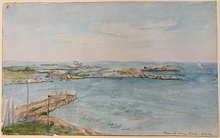
From the Ocean House, Groton (around 1860)
-
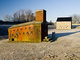
The shot furnace at Fort Griswold
-
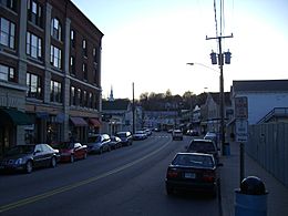
The Groton part of downtown Mystic


See also
 In Spanish: Groton (Connecticut) para niños
