Narborough, Leicestershire facts for kids
Quick facts for kids Narborough |
|
|---|---|
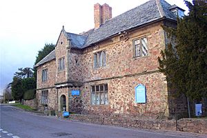
 Narborough Hall |
|
| Population | 8,448 (parish; 2011 Census) |
| OS grid reference | SP540975 |
| Civil parish |
|
| District |
|
| Shire county | |
| Region | |
| Country | England |
| Sovereign state | United Kingdom |
| Post town | Leicester |
| Postcode district | LE19 |
| Dialling code | 0116 |
| Police | Leicestershire |
| Fire | Leicestershire |
| Ambulance | East Midlands |
| EU Parliament | East Midlands |
| UK Parliament |
|
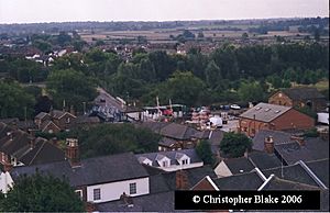
Narborough is a large village in Leicestershire, England. It is about 6 miles (10 km) southwest of the city of Leicester. In 2011, about 8,498 people lived in the village and its nearby area, called a civil parish.
The name Narborough comes from an old English phrase, north burh. This means "north fort" or "north stronghold". This suggests there might have been an old fort here long ago.
Narborough is surrounded by other villages. These include Enderby, Whetstone, Littlethorpe, Cosby, and Huncote.
Contents
Where is Narborough?
Narborough is located near important roads and a railway line. The M1 motorway passes by the east side of the village. The railway line from Leicester to Birmingham also runs through Narborough, right next to the River Soar.
A main road in the village, Coventry Road, follows an ancient Roman road. This old road connects to the modern B4114, which links Birmingham and Leicester.
The village is often seen as two main parts. There is the older village center in the south. Then there is the newer Pastures estate in the northeast. The B4114 road separates these two areas.
Getting Around Narborough
Bus Services
You can catch Arriva Midlands buses in Narborough. Services 50 and X84 connect the village to places like Rugby, Enderby, Croft, and Leicester city centre. There is also a special park and ride service nearby. It uses electric buses to take people into Leicester city centre.
Train Services
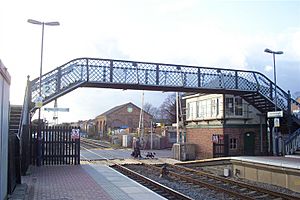
Narborough railway station is right in the middle of the village. From here, you can catch a train about once an hour. Trains go north to South Wigston and Leicester. They also go south and west to Hinckley, Nuneaton, and Birmingham.
What's in Narborough?
To the northeast of Narborough is Carlton Park. This is a business park where many companies have offices. For example, Alliance & Leicester used to have its main office here. They employed over 1,800 people. Carlton Park also has a large health club called David Lloyd.
The offices for Blaby District Council are also near the village center.
Narborough has several schools for younger students. These include Greystoke Primary School, The Pastures, and Red Hill Field. After primary school, most students go to Brockington College in Enderby.
The village also has two large doctor's offices: The Limes Medical Centre and Narborough Health Centre. You can find many shops, pubs, restaurants, and other useful places in Narborough.
Places of Worship
Narborough has several churches. There is the Anglican Parish Church of All Saints. You can also find a Congregational Church on School Lane. The Catholic church, St. Pius X, is on Leicester Road.
Since 2001, Narborough has also been home to The Buddhist House. This is the main office for the Amida Trust, which is a Pureland Buddhist school.
Village Industry
The Empire Stone Works company started in Narborough in 1900. This factory made special pre-cast concrete. This concrete could be colored and shaped to look like natural stone. It was used for parts of buildings like window sills and decorative edges.
The factory was the biggest employer in Narborough, with over 300 workers. It even had its own railway tracks to move materials. The company stopped working in 1994. One of its last big projects was the MI6 building in London. This building is famous for appearing in many James Bond films.
See also
 In Spanish: Narborough / Enderby para niños
 | Selma Burke |
 | Pauline Powell Burns |
 | Frederick J. Brown |
 | Robert Blackburn |


