Nassau, The Bahamas facts for kids
Quick facts for kids
Nassau
|
||
|---|---|---|
|
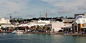
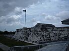
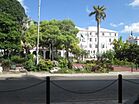
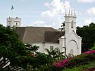
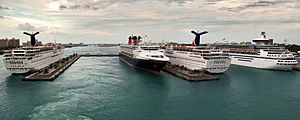
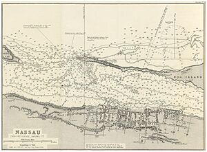
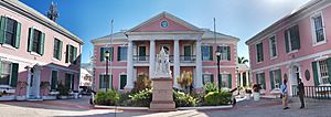
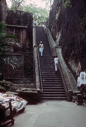
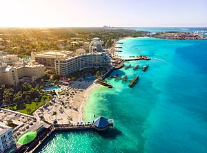
Top: Nassau skyline; Middle: Nassau Terminal Royal Place, Fort Charlotte; Bottom: Parliament Square, Christ Church Cathedral
|
||
|
||
| Nickname(s):
Isle of June
|
||
| Country | The Bahamas | |
| Island | New Providence | |
| Founded and Rebuilt/Renamed | Founded in 1670 as Charles Town, rebuilt as Nassau in 1695 | |
| Area
(for New Providence)
|
||
| • Total | 200 km2 (80 sq mi) | |
| Population
(2010)(for New Providence)
|
||
| • Total | 246,329 | |
| • Density | 1,190/km2 (3,080/sq mi) | |
| Time zone | UTC−5 (EST) | |
| • Summer (DST) | UTC−4 (EDT) | |
| Area code(s) | 242 | |
Nassau is the capital and largest city of The Bahamas. It is located on New Providence island. In 2010, the island had a population of over 246,000 people. This was more than 70% of all people living in The Bahamas. By 2022, the population grew to over 296,000.
Nassau is often called a primate city. This means it is much larger and more important than any other city in the country. It is the main center for business, education, law, government, and media.
Lynden Pindling International Airport is the main airport for The Bahamas. It is about 16 kilometers (10 miles) west of Nassau's city center. The airport has daily flights to and from major cities in Canada, the Caribbean, the United Kingdom, and the United States. Nassau is also where the country's main government buildings and courts are located. The city was named after William III of England, who was a prince from the House of Orange-Nassau.
Nassau started to grow a lot in the late 1700s. Many Loyalists and their workers moved to The Bahamas after the American War of Independence. Most of them settled in Nassau. They soon outnumbered the people who already lived there. As Nassau's population grew, the city spread across the island. Before the 1900s, most of New Providence was wild land. Loyalists later started farms there.
After the British stopped the international slave trade in 1807, they helped thousands of Africans who were freed from slave ships. These people were settled on New Providence and other islands. Many people of African descent lived in areas south of Nassau, like Grants Town and Bain Town. Most people of European descent lived along the northern coast.
Contents
History of Nassau
The town we now call Nassau was founded in 1670. British noblemen brought settlers to New Providence island. They built a fort and named the town Charles Town after King Charles II of England. At this time, there were often wars with Spain. Charles Town was used as a base for privateers, who were like legal pirates, against the Spanish.
In 1684, the Spanish attacked and burned the town. It was rebuilt in 1695 by Governor Nicholas Trott. He renamed it Nassau to honor King William III of England. King William was part of the House of Nassau, a royal family from Germany.
After Governor Trott left, Nassau faced tough times. In 1703, Spanish and French forces briefly took over Nassau. The city also suffered during the War of the Spanish Succession with more Spanish attacks. For many years, there was no proper governor.
By 1713, The Bahamas had become a safe place for pirates. Nassau was known as New Providence. It offered fresh food, water, and good protection in its many waterways. Nassau's harbor was perfect for defense and could hold about 500 ships. However, it was too shallow for large warships. Pirates like Benjamin Hornigold and Henry Jennings became unofficial leaders of this "pirate republic." Famous pirates like Charles Vane, Calico Jack Rackham, Anne Bonny, Mary Read, and the famous Blackbeard also spent time in Nassau.
In 1718, the British government decided to take back control. They sent Captain Woodes Rogers as the new Royal governor. He worked hard to stop the pirates and improve the government and trade. Rogers cleaned up Nassau and rebuilt the fort. In 1720, the Spanish tried to attack Nassau again but failed.
During the wars in the Thirteen Colonies (which later became the United States), Nassau's economy grew. Money from privateering helped build a new fort, street lights, and many beautiful houses. Swamps where mosquitoes bred were also filled in.
In 1776, during the American War of Independence, American Continental Marines briefly took over Nassau. They launched their first attack on Fort Montagu. In 1778, American raiders again took ships and supplies from Nassau. In 1782, Spain captured Nassau for the last time. Don Juan de Cagigal attacked with 5,000 men. But in 1783, Andrew Deveaux, an American Loyalist, recaptured the island for the British. He did this with only 220 men against 600 trained soldiers.
Lord Dunmore was governor from 1787 to 1796. He oversaw the building of Fort Charlotte and Fort Fincastle in Nassau.
During the American Civil War, Nassau was an important port. Ships called blockade runners used it to trade with the Southern states.
In the 1920s and 1930s, Nassau benefited from Prohibition in the United States. This was a time when alcohol was illegal in the US.
After the Cuban Revolution in 1959, tourism to Nassau grew even more. This was because the United States made it harder for Americans to visit Cuba. Today, Nassau's close location to the US makes it a very popular tourist spot.
Geography and Climate
Nassau is located on New Providence Island. Its harbor has a mix of old and colonial buildings. It is also a very busy port. The warm, tropical weather and beautiful nature make Nassau a popular place for tourists.
Nassau grew right behind its port. New Providence island is mostly flat and low. It has some small hills but nothing that stopped people from settling there. In the middle of the island, there are several shallow lakes connected to the ocean tides.
Nassau is very close to the United States. It's about 290 kilometers (181 miles) east-southeast of Miami, Florida. This closeness helped make it a popular vacation spot. Especially after the US stopped travel to Cuba in 1963. The Atlantis resort on nearby Paradise Island brings in more tourists than any other hotel in Nassau. This huge resort employs over 6,000 Bahamians. It is the largest employer in the country, besides the government.
Nassau's Weather
Nassau has a tropical monsoon climate. This means it has hot, wet summers and mild, dry winters. Temperatures stay pretty much the same all year. In the wet season (May to October), daytime highs are around 30-32°C (86-90°F). In the dry season (November to April), daytime temperatures are between 25-27°C (77-81°F). It rarely gets colder than 15°C (59°F).
| Climate data for Nassau (Lynden Pindling International Airport) 1991–2020, elevation: 7 m or 23 ft, extremes 1980–present | |||||||||||||
|---|---|---|---|---|---|---|---|---|---|---|---|---|---|
| Month | Jan | Feb | Mar | Apr | May | Jun | Jul | Aug | Sep | Oct | Nov | Dec | Year |
| Record high °C (°F) | 31.5 (88.7) |
31.8 (89.2) |
33.0 (91.4) |
34.5 (94.1) |
35.3 (95.5) |
36.5 (97.7) |
36.0 (96.8) |
35.9 (96.6) |
35.2 (95.4) |
34.5 (94.1) |
33.4 (92.1) |
31.7 (89.1) |
36.5 (97.7) |
| Mean daily maximum °C (°F) | 26.1 (78.9) |
26.6 (79.9) |
27.2 (80.9) |
28.7 (83.7) |
30.2 (86.4) |
31.8 (89.2) |
32.7 (90.9) |
32.8 (91.0) |
32.2 (89.9) |
30.6 (87.0) |
28.3 (82.9) |
26.8 (80.3) |
29.5 (85.1) |
| Daily mean °C (°F) | 22.2 (71.9) |
22.4 (72.4) |
23.1 (73.6) |
24.6 (76.3) |
26.2 (79.2) |
28.1 (82.5) |
28.9 (84.1) |
28.9 (84.1) |
28.3 (82.9) |
27.1 (80.7) |
24.7 (76.4) |
23.2 (73.7) |
25.6 (78.2) |
| Mean daily minimum °C (°F) | 18.2 (64.8) |
18.5 (65.3) |
19.1 (66.4) |
21.0 (69.8) |
22.4 (72.3) |
24.2 (75.6) |
25.0 (77.0) |
25.0 (77.0) |
24.7 (76.4) |
23.6 (74.5) |
21.2 (70.1) |
19.6 (67.2) |
21.9 (71.4) |
| Record low °C (°F) | 7.9 (46.3) |
8.5 (47.3) |
9.8 (49.6) |
12.6 (54.7) |
14.5 (58.1) |
17.7 (63.8) |
20.6 (69.1) |
19.0 (66.2) |
18.9 (66.0) |
15.0 (59.0) |
12.7 (54.9) |
9.7 (49.5) |
7.9 (46.3) |
| Average precipitation mm (inches) | 45 (1.76) |
48 (1.90) |
54 (2.13) |
74 (2.91) |
139 (5.48) |
220 (8.66) |
158 (6.23) |
211 (8.31) |
196 (7.70) |
151 (5.93) |
87 (3.41) |
43 (1.70) |
1,426 (56.12) |
| Average precipitation days (≥ 1.0 mm) | 7 | 5 | 6 | 7 | 10 | 15 | 16 | 18 | 17 | 13 | 9 | 7 | 130 |
| Average dew point °C (°F) | 18.0 (64.4) |
17.9 (64.3) |
18.2 (64.7) |
19.7 (67.4) |
21.8 (71.3) |
24.1 (75.4) |
24.7 (76.4) |
24.8 (76.7) |
24.5 (76.1) |
23.1 (73.5) |
20.2 (68.4) |
19.2 (66.5) |
21.3 (70.4) |
| Mean monthly sunshine hours | 226 | 224 | 251 | 282 | 282 | 240 | 267 | 260 | 222 | 236 | 219 | 211 | 2,920 |
| Source: Bahamas Department of Meteorology | |||||||||||||
| Climate data for Nassau (Lynden Pindling International Airport), elevation: 7 m or 23 ft, 1961–1990 normals and extremes | |||||||||||||
|---|---|---|---|---|---|---|---|---|---|---|---|---|---|
| Month | Jan | Feb | Mar | Apr | May | Jun | Jul | Aug | Sep | Oct | Nov | Dec | Year |
| Record high °C (°F) | 30.2 (86.4) |
31.5 (88.7) |
31.0 (87.8) |
32.9 (91.2) |
33.5 (92.3) |
34.0 (93.2) |
34.1 (93.4) |
35.0 (95.0) |
34.0 (93.2) |
33.2 (91.8) |
32.2 (90.0) |
30.4 (86.7) |
35.0 (95.0) |
| Mean daily maximum °C (°F) | 25.2 (77.4) |
25.3 (77.5) |
26.5 (79.7) |
27.7 (81.9) |
29.2 (84.6) |
30.7 (87.3) |
31.7 (89.1) |
31.8 (89.2) |
31.3 (88.3) |
29.7 (85.5) |
27.7 (81.9) |
25.9 (78.6) |
28.6 (83.4) |
| Daily mean °C (°F) | 21.1 (70.0) |
21.1 (70.0) |
22.2 (72.0) |
23.4 (74.1) |
25.3 (77.5) |
26.9 (80.4) |
27.9 (82.2) |
27.9 (82.2) |
27.3 (81.1) |
25.9 (78.6) |
23.8 (74.8) |
21.9 (71.4) |
24.6 (76.2) |
| Mean daily minimum °C (°F) | 16.7 (62.1) |
16.9 (62.4) |
17.7 (63.9) |
19.0 (66.2) |
21.0 (69.8) |
22.9 (73.2) |
23.7 (74.7) |
23.8 (74.8) |
23.6 (74.5) |
22.2 (72.0) |
20.0 (68.0) |
17.7 (63.9) |
20.4 (68.8) |
| Record low °C (°F) | 5.2 (41.4) |
7.7 (45.9) |
7.0 (44.6) |
9.2 (48.6) |
13.1 (55.6) |
15.0 (59.0) |
17.9 (64.2) |
18.0 (64.4) |
15.3 (59.5) |
13.3 (55.9) |
10.6 (51.1) |
5.3 (41.5) |
5.2 (41.4) |
| Average precipitation mm (inches) | 47.2 (1.86) |
40.3 (1.59) |
39.8 (1.57) |
53.8 (2.12) |
116.3 (4.58) |
232.9 (9.17) |
157.7 (6.21) |
215.9 (8.50) |
171.4 (6.75) |
175.5 (6.91) |
56.6 (2.23) |
51.8 (2.04) |
1,359.2 (53.53) |
| Average rainy days | 8 | 6 | 6 | 5 | 10 | 15 | 17 | 17 | 17 | 16 | 9 | 8 | 134 |
| Average relative humidity (%) | 78.0 | 78.0 | 76.0 | 74.0 | 77.0 | 79.0 | 77.0 | 79.0 | 81.0 | 80.0 | 78.0 | 78.0 | 77.9 |
| Mean monthly sunshine hours | 220.1 | 212.8 | 257.3 | 276.0 | 269.7 | 231.0 | 272.8 | 266.6 | 213.0 | 223.2 | 222.0 | 213.9 | 2,878.4 |
| Mean daily sunshine hours | 7.1 | 7.6 | 8.3 | 9.2 | 8.7 | 7.7 | 8.8 | 8.6 | 7.1 | 7.2 | 7.4 | 6.9 | 7.9 |
| Source: NOAA | |||||||||||||
| Jan | Feb | Mar | Apr | May | Jun | Jul | Aug | Sep | Oct | Nov | Dec |
|---|---|---|---|---|---|---|---|---|---|---|---|
| 24 °C | 24 °C | 24 °C | 25 °C | 26 °C | 28 °C | 29 °C | 29 °C | 29 °C | 28 °C | 26 °C | 25 °C |
How Nassau Grew
In the 1800s, Nassau became more of a city. People from rural areas moved there. After the 1950s, the city grew outwards. In 1788, the heart of Nassau was just a few blocks near the harbor. But it slowly expanded east, south, and west. Areas like Grants Town and Bain Town became home to most people of African descent.
People of European descent built houses along the coast. This was from Fort Montagu in the east to Saunders Beach in the west. During the 1900s, the city spread further. This growth formed a semicircle around the original town. This area was the main place where people lived until after World War II. Wealthier residents continued to build homes further east and west.
In the last 40 years, new neighborhoods have been built. These are mostly planned communities for middle-income families. Since the 1960s, the government has helped build affordable housing. These new areas are in the outer parts of the city.
City Center: The Heart of Nassau
Nassau's city center is a busy place. Thousands of people visit every day. They come to shop, eat, see the sights, and enjoy the tropical weather. The busiest parts are Bay Street and Woodes Rogers Walk. These are located across from the port.
The area starts near Junkanoo Beach in West Bay. You can find hotels and restaurants there. The British Colonial Hotel marks the start of Bay Street. The Pirates of Nassau Museum is right across from the British Colonial Hilton. The next few blocks of Bay Street are full of shops, restaurants, and clubs.
Important historical places are also nearby. These include Vendue House, Christ Church Cathedral, and the Nassau Public Library. The main tourist area ends after about seven blocks. But smaller, local shops continue down East Bay Street.
The Straw Market is a popular spot for tourists. A new market opened in 2011 after a fire destroyed the old one. The market is open on all sides. It has many stores selling Bahamian crafts.
Cable Beach: Hotel Hotspot
Cable Beach is known as Nassau's hotel district. Five hotels are located along this strip. Two of them are all-inclusive resorts. The area also has many restaurants, mostly inside the hotels or across the street. There are some shops, mainly at the Wyndham and Baha Mar resorts. In 2017, the Baha Mar resort opened. It is a luxury resort and casino. It added over 2,000 hotel rooms to the area. It also has the largest gaming and convention center in the Caribbean.
People of Nassau
Nassau is home to many people. In 2010, it had about 128,420 females and 117,909 males. There were over 70,000 households. The average family size was 3.5 people. Nassau's population is large compared to the rest of The Bahamas. This is because many people have moved from the smaller Family Islands to the capital city. This has caused the population of the smaller islands to decrease. Meanwhile, Nassau has grown very quickly.
Getting Around Nassau
By Air
Lynden Pindling International Airport is Nassau's main airport. It is on the western side of the city. There used to be another airport on Paradise Island, but it closed in 1999. Its runway is now part of the resort there.
By Water
Ferries (boats) help people travel around Nassau. They also go to nearby islands like Paradise Island.
Prince George Wharf is the main seaport in Nassau. It serves many cruise ships that visit the city. For shipping around the Family Islands, mailboats use Potters Cay. International shipping happens at the Arawak Port Department on Arawak Cay. You can also take fast boat trips to Exuma, Spanish Wells, and Harbour Island every day.
By Road
Public jitney buses and taxis are available for transport in and around Nassau. You can also rent cars in the city and at the airport.
Some major roads in Nassau include:
- Bay Street
- Eastern Road
- Baillou Hill Road
- East Street
- Adelaide Road
- Shirley Street
- Soldier Road
- Carmicheal Road
- Prince Charles Drive
- John F Kennedy Drive
- Fox Hill Road
- Wulff Road
- Robinson Road
Bay Street is the most important road for tourists. It runs along the entire island from east to west. It also offers beautiful views of the beach. The downtown area and the cruise ship port are within walking distance.
In The Bahamas, cars drive on the left side of the road. However, many cars are imported from the US and have the steering wheel on the left.
Culture in Nassau
UNESCO Creative City
Nassau is part of the UNESCO Creative Cities Network. It is recognized as a city of Crafts and Folk Art. It is one of only three Caribbean cities to receive this special honor.
Junkanoo Festival
The main festival in Nassau is Junkanoo. It is a lively and colorful street parade. People wear bright costumes and dance to the sounds of cowbells, drums, and whistles. The name 'Junkanoo' comes from its founder, John Canoe. The celebration happens on December 26, July 10, and January 1. It starts very early in the morning (around 1:00 a.m.) and finishes around 10 a.m. At the end of the parade, judges give cash prizes. These are for the best music, costumes, and overall group performance. Participants spend all year making their handmade costumes. They use colored crepe paper and cardboard.
Sister Cities
Nassau has sister cities. These are cities that have a special partnership. Nassau's sister cities are:
- Detroit, Michigan, United States
- Winston-Salem, North Carolina, United States
Hospitals and Healthcare
Nassau has several hospitals and medical clinics:
- Doctors Hospital - a private hospital founded in 1955.
- Epcot Medical Center
- Lyford Cay Hospital
- Princess Margaret Hospital - the main public hospital in Nassau and The Bahamas. It opened in 1952.
- Sandilands Psychiatric Hospital - a hospital for mental health.
- Sandilands Rehabilitation Centre - a facility for mental health, childhood and teen health, addiction, and care for older adults.
Nassau is also home to the Nassau Container Port. This port is located on Arawak Cay.
Famous People from Nassau
Many notable people are from Nassau:
- Derrick Atkins (born 1984), a world medalist in sprinting (100m).
- Deandre Ayton (born 1998), an NBA basketball player.
- Andretti Bain (born 1985), an Olympic medalist in sprinting (400m).
- Stanley Burnside (born 1947), a cartoonist and painter.
- Jazz Chisholm Jr. (born 1998), a Major League Baseball player.
- Sean Connery (1930–2020), a Scottish actor famous for playing James Bond.
- Kyle Edmund (born 1995), a British professional tennis player.
- Nick Kyrgios (born 1995), an Australian professional tennis player.
- Nathaniel McKinney (born 1982), a world medalist in relay sprinting (400m).
- Ramon Miller (born 1987), an Olympic medalist in sprinting (400m).
- Shaunae Miller-Uibo (born 1994), an Olympic medalist in sprinting (400m and 200m).
- Hubert Minnis (born 1954), a politician.
- Avard Moncur (born 1978), an Olympic medalist in sprinting (400m).
- Mike Oldfield (born 1953), an English musician.
- Sidney Poitier (1927–2022), a Bahamian-American actor, film director, and diplomat.
- Antoan Richardson (born 1983), a Major League Baseball outfielder and coach.
- Denis Shapovalov (born 1999), a Canadian tennis player.
- Tonique Williams-Darling (born 1976), an Olympic medalist in sprinting (400m).
See also
 In Spanish: Nasáu para niños
 | William M. Jackson |
 | Juan E. Gilbert |
 | Neil deGrasse Tyson |


