National Register of Historic Places listings in DuPage County, Illinois facts for kids
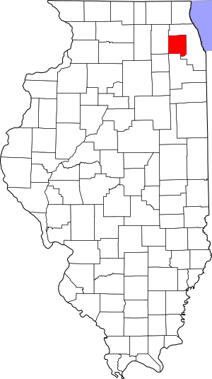
Welcome to DuPage County, Illinois! Did you know that many special places here are protected because of their history? These places are listed on the National Register of Historic Places. It's like a special club for buildings, sites, and objects that are important to American history, architecture, archaeology, engineering, or culture. When a place is on this list, it means it's recognized for its unique story and value.
In DuPage County, there are 48 places on this list. They include old schools, beautiful homes, and even parts of a canal! Let's explore some of these amazing historic spots.
Contents
- Historic Places in DuPage County
- Adams Memorial Library
- Ardmore Avenue Train Station
- George Baker House
- Orland P. Bassett House
- Big Woods School
- Blanchard Hall
- Bloomingdale School–Village Hall
- Butler School
- Chicago Sanitary and Ship Canal Historic District
- Robert A. and Mary Childs House
- Churchville School
- William and Helen Coffeen House
- Avery Coonley School
- Dell Rhea's Chicken Basket
- Downtown Hinsdale Historic District
- DuPage County Courthouse
- DuPage Theatre and DuPage Shoppes
- William H. Emery, Jr. House
- First Church of Lombard
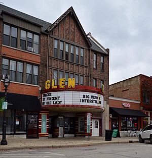
- Glen Ellyn Downtown North Historic District
- Glen Ellyn Downtown South Historic District
- Glen Ellyn Main Street Historic District
- Grand Theatre
- Graue Mill
- William L. Gregg House
- Hauptgebaude
- Frank B. Henderson House
- Immanuel Evangelical Church
- Lake Ellyn Park
- McAuley School District No. 27
- Naperville Historic District
- Francis Stuyvesant Peabody Estate
- Francis Stuyvesant Peabody House
- John L. Pentecost House
- Pine Craig
- Randecker's Hardware Store
- Robinwood
- Robbins Park Historic District
- Alfred A. Schiller House
- William and Jennette Sloane House
- Stacy's Tavern
- Trinity Episcopal Church
- Turner Town Hall
- Villa Avenue Train Station
- Wayne Village Historic District
- William Whitney House
- Images for kids
Historic Places in DuPage County
Adams Memorial Library
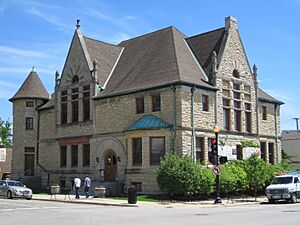
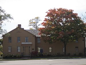
The Adams Memorial Library is in Wheaton. It was designed by a famous architect named Charles Sumner Frost in 1891. For many years, it was the only library in the area. Later, in 1965, it became the DuPage County Historical Museum.
Ardmore Avenue Train Station
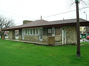
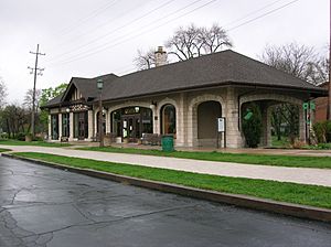
This old train station is located in Villa Park. It's special because it's one of the few remaining stations from the old Chicago Aurora and Elgin Railroad. Imagine all the people who passed through here long ago!
George Baker House
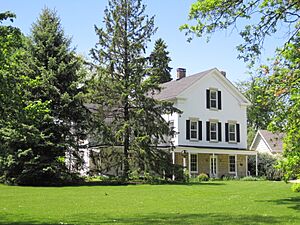
Found in Milton Township, this house belonged to George Baker. He was one of the very first settlers in DuPage County. This home tells a story of the early days of the area.
Orland P. Bassett House
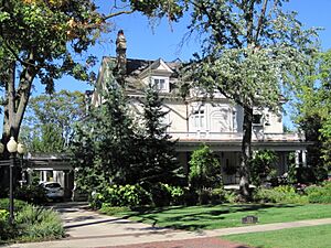
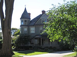
In Hinsdale, you'll find the home of Orland P. Bassett. He was famous for being the first person to sell the beautiful American Beauty rose all over the country. His company grew to be the biggest employer in Hinsdale.
Big Woods School
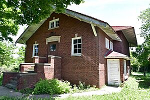
The Big Woods School is located in Aurora. This building has seen many students come and go over the years. It's a reminder of how education used to be in the past.
Blanchard Hall
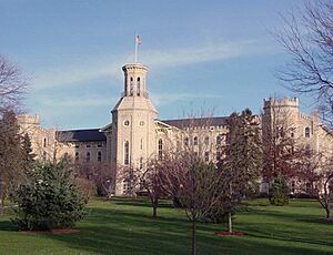
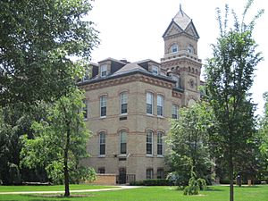
Blanchard Hall is a very old building on the Wheaton College campus in Wheaton. It's named after the college's founder, Jonathan Blanchard. The building's design was inspired by the grand buildings at Oxford University in England.
Bloomingdale School–Village Hall
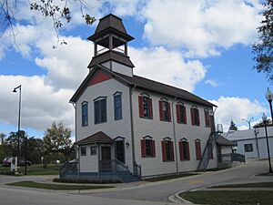
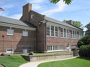
This building in Bloomingdale has a double history! It started as a two-classroom schoolhouse in the early 1900s. Then, from 1938 to 1977, it served as the Bloomingdale Village Hall.
Butler School
The Butler School in Oak Brook is a charming two-room schoolhouse. It's built in the Georgian Revival style, which looks a bit like old English buildings. The name "Oak Brook" for the area was first used during a meeting held right here!
Chicago Sanitary and Ship Canal Historic District
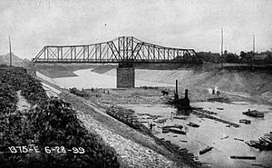
This isn't just one building; it's a whole historic district! The Chicago Sanitary and Ship Canal is a big waterway that connects to the Illinois Waterway. It played a huge role in shipping and sanitation for the region. This part of the canal runs through Willow Springs and Lemont.
Robert A. and Mary Childs House
In Hinsdale, this house was home to Robert A. Childs, a veteran of the Civil War and a U.S. Representative. He and his wife Mary lived here.
Churchville School
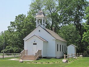
The Churchville School in Bensenville is a very old schoolhouse. It was built way back in 1846! Imagine learning your ABCs in a building that's almost 200 years old.
William and Helen Coffeen House
This historic home is located in Hinsdale. It belonged to William and Helen Coffeen. The house is a great example of the architecture from its time.
Avery Coonley School
The Avery Coonley School in Downers Grove is special because it was a "progressive" school. This means it focused on new ways of teaching and learning. The school's beautiful outdoor areas were designed by a famous landscape architect named Jens Jensen.
Dell Rhea's Chicken Basket
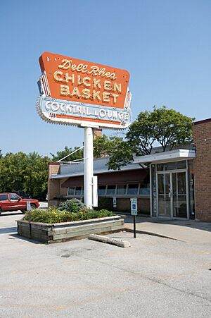
If you love history and good food, check out Dell Rhea's Chicken Basket in Willowbrook. This restaurant is on the famous historic U.S. Route 66. It's a classic roadside stop that has been serving travelers for many years.
Downtown Hinsdale Historic District
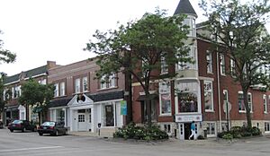
This isn't just one building, but a whole area in Hinsdale that is considered historic. It includes many buildings that show what the downtown area looked like long ago.
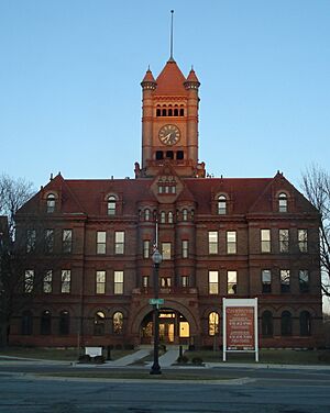
DuPage County Courthouse
The old DuPage County Courthouse is in Wheaton. This building served as the center of justice for the county for many years. It's a significant landmark in the area's history.
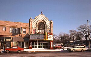
DuPage Theatre and DuPage Shoppes
The DuPage Theatre and DuPage Shoppes were once a lively part of Lombard. Sadly, the theater was taken down in 2007. However, its memory lives on as a historic listing.
William H. Emery, Jr. House
This house in Elmhurst belonged to William H. Emery, Jr. It's recognized for its architectural style and its place in the community's history.
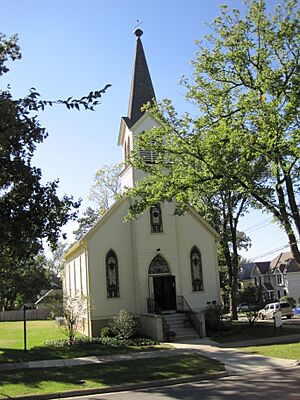
First Church of Lombard
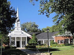
The First Church of Lombard, located at Maple and Main Streets in Lombard, is a beautiful historic church. It has been a central part of the community for a long time.
Glen Ellyn Downtown North Historic District
This historic district covers a part of downtown Glen Ellyn. It includes important streets like Main Street and Crescent Boulevard. The buildings here tell the story of Glen Ellyn's growth.
Glen Ellyn Downtown South Historic District
Another historic area in Glen Ellyn is the Downtown South Historic District. It features buildings along Main and Duane Streets. These districts help preserve the unique character of the town.
Glen Ellyn Main Street Historic District
This district focuses on Main Street in Glen Ellyn. It's recognized for its collection of historic buildings that show the town's development over the years.
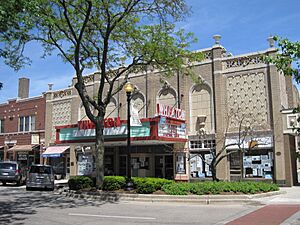
Grand Theatre
The Grand Theatre is in Wheaton. Old theaters like this were once the main places for entertainment, showing movies and live performances. It's a piece of Wheaton's cultural past.
Graue Mill
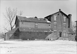
Graue Mill, near Oak Brook, is a historic grist mill. A grist mill uses water power to grind grain into flour. It's a fascinating look back at how food was processed long ago.
William L. Gregg House
The William L. Gregg House is in Westmont. This house is a significant part of Westmont's history and offers a glimpse into the lives of early residents.
Hauptgebaude
Hauptgebaude is a building located in Elmhurst. Its name means "main building" in German, suggesting its importance to the institution or area it served.
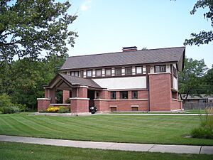
Frank B. Henderson House
This historic home in Elmhurst belonged to Frank B. Henderson. It's recognized for its architectural design and its connection to the community's past.
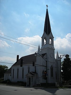
Immanuel Evangelical Church
The Immanuel Evangelical Church is a historic church in Hinsdale. Churches often serve as important community centers and landmarks, and this one is no exception.
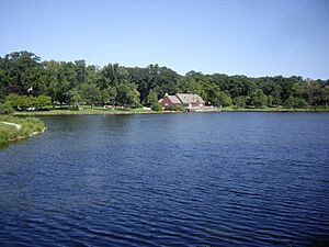
Lake Ellyn Park
Lake Ellyn Park in Glen Ellyn is more than just a park; it's a historic site! Parks are important for communities, and this one has been a beloved spot for many years.
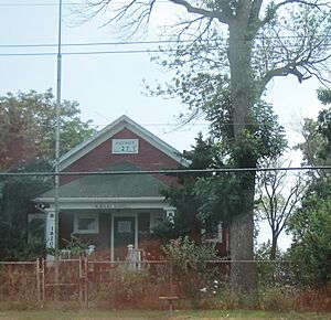
McAuley School District No. 27
This historic school building is located in West Chicago. It represents an important part of the area's educational history.
Naperville Historic District
The Naperville Historic District covers a large part of downtown Naperville. It includes many old buildings that tell the story of how Naperville grew from a small settlement into a bustling city.
Francis Stuyvesant Peabody Estate
The Francis Stuyvesant Peabody Estate in Oak Brook is a grand historic property. It includes Mayslake Hall, a beautiful building that shows the wealth and style of its original owner.
Francis Stuyvesant Peabody House
Another property connected to Francis Stuyvesant Peabody is this house in Hinsdale. It's a different home from the estate in Oak Brook, showing his presence in different parts of the county.
John L. Pentecost House
The John L. Pentecost House is in Elmhurst. This home is recognized for its historical significance and its architectural features.
Pine Craig
Pine Craig, located in Naperville, is also known as the Martin-Mitchell Mansion. It's part of the Naper Settlement, a living history museum. This house gives us a look into the past lives of Naperville residents.
Randecker's Hardware Store
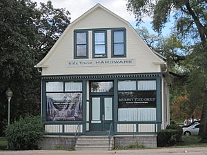
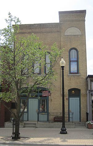
In Bloomingdale, Randecker's Hardware Store is a historic business. Old hardware stores like this were once central to local communities, providing tools and supplies for everyday life.
Robinwood
Robinwood is a historic property located in Elmhurst. It's recognized for its unique character and its contribution to the area's history.
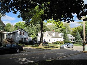
Robbins Park Historic District
This historic district in Hinsdale includes Robbins Park and the surrounding area. It's a place where you can see many historic homes and green spaces.
Alfred A. Schiller House
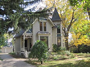
The Alfred A. Schiller House is in Glen Ellyn. This home is a great example of the architectural styles popular when it was built.
William and Jennette Sloane House
This house, belonging to William and Jennette Sloane, is located in Elmhurst. It's another important historic home in the county.
Stacy's Tavern
Stacy's Tavern in Glen Ellyn is a very old building that used to be a tavern and an inn. Travelers would stop here for food, drinks, and a place to rest. It's a wonderful example of early American hospitality.
Trinity Episcopal Church
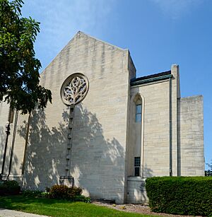
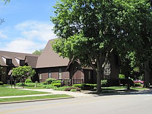
The Trinity Episcopal Church in Wheaton is a beautiful historic church. It has been a place of worship and community gathering for many years.
Turner Town Hall
The Turner Town Hall is in West Chicago. Town halls are important buildings where local government decisions are made and community events are held.
Villa Avenue Train Station
Another historic train station, the Villa Avenue Train Station is in Villa Park. Like the Ardmore Avenue station, it tells a story of how people traveled and goods were moved in the past.
Wayne Village Historic District
The Wayne Village Historic District in Wayne is a charming area with an irregular pattern of historic buildings along Army Trail Road. It shows the unique development of this village.
William Whitney House
The William Whitney House is in Hinsdale. This home is recognized for its historical value and its place in the town's architectural heritage.
Images for kids


