National Register of Historic Places listings in Ross County, Ohio facts for kids
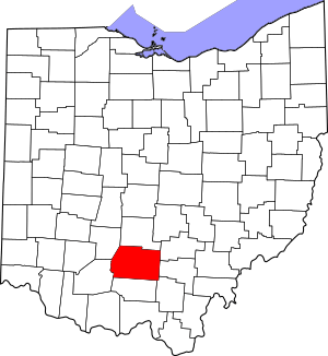
This page lists amazing and important places in Ross County, Ohio, that are part of the National Register of Historic Places. Think of the National Register as a special list of buildings, sites, and objects across the United States that are worth saving because they are important to history, architecture, archaeology, engineering, or culture.
These places could be anything from old houses and churches to ancient Native American mounds and even bridges! When a place is added to this list, it means it's recognized as a significant part of our past. It also helps protect these sites and sometimes provides money to help keep them in good shape.
In Ross County, Ohio, there are 44 places on this special list. Two of these are even more important and are called National Historic Landmarks. This means they have a very high level of national historical significance. One place was on the list but has since been removed. You can see where many of these places are on an online map!
Cool Historic Places in Ross County
Many of these places are very old and tell stories about the people who lived here long ago. Some are ancient mounds built by Native Americans, while others are historic homes or buildings from the early days of Ohio.
| Name on the Register | Image | Date listed | Location | City or town | Description | |
|---|---|---|---|---|---|---|
| 1 | Adena (Thomas Worthington House) |
(#70000515) |
Box 831 Adena Rd. 39°21′18″N 83°00′49″W / 39.355°N 83.013611°W |
Chillicothe | This beautiful house was the home of Thomas Worthington. He was Ohio's sixth governor! It's a National Historic Landmark. | |
| 2 | Adena Mound |
(#75001529) |
947-999 Orange St. 39°21′20″N 83°00′29″W / 39.355556°N 83.008°W |
Chillicothe | An ancient mound built by early Native Americans. It was studied by archaeologists. | |
| 3 | Levi Anderson House |
(#76001524) |
West of Chillicothe on Anderson Station Rd. 39°21′38″N 83°04′32″W / 39.360556°N 83.075556°W |
Union Township | A historic home in Union Township. | |
| 4 | Howard Baum Site (33RO270) |
(#86001663) |
South of Bourneville along Paint Creek 39°15′53″N 83°09′12″W / 39.264722°N 83.153333°W |
Twin Township | An important archaeological site near Paint Creek. | |
| 5 | Austin Brown Mound |
(#74001613) |
Near Brown Chapel, northwest of Chillicothe 39°28′56″N 83°05′53″W / 39.482222°N 83.098194°W |
Deerfield Township | Another ancient mound, showing the rich history of early people in the area. | |
| 6 | Buchwalter House-Applethorpe Farm |
(#83002053) |
292 Whissler Rd., north of Hallsville 39°27′10″N 82°49′14″W / 39.452778°N 82.820556°W |
Colerain Township | A historic farm property. | |
| 7 | T.C. Campbell Mound |
(#74001610) |
1 mile (1.6 km) southwest of Bainbridge 39°13′26″N 83°16′55″W / 39.223889°N 83.281944°W |
Paxton Township | Also known as the "Rockhold Mound," it's part of an ancient earthwork system. | |
| 8 | Canal Warehouse |
(#73001522) |
Main and Mulberry Sts. 39°20′03″N 82°58′44″W / 39.334167°N 82.978889°W |
Chillicothe | This building was once used for storing goods transported by canal. | |
| 9 | Cedar-Bank Works |
(#74001614) |
Eastern bank of the Scioto River, north of Chillicothe 39°24′04″N 82°58′36″W / 39.401111°N 82.976667°W |
Green Township | An ancient earthwork site along the Scioto River. | |
| 10 | Chillicothe Business District |
(#79001931) |
Roughly bounded by Water, 4th, Walnut and Hickory Sts. 39°20′03″N 82°58′56″W / 39.334167°N 82.982222°W |
Chillicothe | This area includes many historic buildings in the heart of Chillicothe. | |
| 11 | Chillicothe Veterans Administration Hospital |
(#12000110) |
17273 State Route 104, north of Chillicothe 39°23′19″N 83°01′07″W / 39.38868°N 83.018668°W |
Union Township | A hospital with a long history of caring for veterans. | |
| 12 | Chillicothe Water and Power Company Pumping Station |
(#79001932) |
Enderlin Circle 39°20′22″N 82°58′55″W / 39.339444°N 82.981944°W |
Chillicothe | This station helped provide water and power to the city. | |
| 13 | Chillicothe's Old Residential District |
(#73001523) |
Roughly bounded by 4th, S. Mulberry, S. Walnut and 7th Sts. 39°19′43″N 82°59′04″W / 39.328611°N 82.984444°W |
Chillicothe | A neighborhood with many old and beautiful homes. | |
| 14 | Frankfort Works Mound |
(#73001530) |
Western side of Frankfort 39°24′17″N 83°11′14″W / 39.404633°N 83.187275°W |
Frankfort | An ancient mound located in Frankfort. | |
| 15 | Gartner Mound and Village Site |
(#05000752) |
Along the Scioto River, 6 miles (9.7 km) north of Chillicothe 39°24′46″N 82°59′00″W / 39.412639°N 82.983333°W |
Green Township | This site includes both a mound and evidence of an ancient village. | |
| 16 | Grandview Cemetery |
(#78002180) |
240 S. Walnut St. 39°19′28″N 82°59′10″W / 39.324444°N 82.986111°W |
Chillicothe | A historic cemetery where many important people from Chillicothe's past are buried. | |
| 17 | Great Seal Park Archeological District |
(#74001615) |
In Great Seal State Park, 3 miles (4.8 km) from Chillicothe 39°22′N 82°56′W / 39.37°N 82.94°W |
Springfield Township | This park contains important archaeological sites. | |
| 18 | Dr. John Harris Dental School |
(#73001521) |
Main St. 39°13′38″N 83°16′21″W / 39.227222°N 83.2725°W |
Bainbridge | This museum tells the story of early dental education. | |
| 19 | Higby House |
(#79001933) |
South of Chillicothe on Three Locks Rd. 39°11′50″N 82°51′58″W / 39.197222°N 82.866111°W |
Franklin Township | A historic house in Franklin Township. | |
| 20 | High Banks Works |
(#73001524) |
Eastern bank of the Scioto River, southeast of Chillicothe 39°17′48″N 82°55′03″W / 39.296667°N 82.9175°W |
Liberty Township | Another significant ancient earthwork site along the Scioto River. | |
| 21 | Highbank Farm |
(#80003215) |
Southeast of Chillicothe at 28532 Old U.S. Route 35 39°16′15″N 82°53′49″W / 39.270833°N 82.896944°W |
Liberty Township | A historic farm property. | |
| 22 | Hopeton Earthworks |
(#66000623) |
On a terrace of the Scioto River at Hopetown, 1 mile (1.6 km) east of the main Mound City group 39°23′11″N 82°58′45″W / 39.386389°N 82.979167°W |
Springfield Township | These ancient earthworks are a National Historic Landmark. They show the amazing engineering skills of early cultures. | |
| 23 | Hopewell Mound Group |
(#74001616) |
Northern bank of the North Fork of Paint Creek 39°21′40″N 83°05′24″W / 39.361111°N 83.09°W |
Union Township | A large group of mounds built by the ancient Hopewell culture. | |
| 24 | Kinzer Mound |
(#74001617) |
Address Restricted |
South Salem | An ancient mound. Its exact location is kept private to protect it. | |
| 25 | Henry Mace House |
(#98000101) |
17380 State Route 104, N. 39°23′32″N 83°00′45″W / 39.392222°N 83.0125°W |
Union Township | A historic house. | |
| 26 | Mary Worthington Macomb House |
(#76001525) |
490 S. Paint St. 39°19′19″N 82°58′48″W / 39.321944°N 82.98°W |
Chillicothe | A historic home in Chillicothe. | |
| 27 | McCafferty Run Farmstead |
(#04000945) |
17114 and 17226 State Route 104 39°23′25″N 83°00′43″W / 39.390278°N 83.011944°W |
Union Township | A historic farm property. | |
| 28 | Charles Metzger Mound |
(#73001526) |
2 miles (3.2 km) southwest of Yellow Bud, on a hilltop above Deer Creek 39°26′58″N 83°02′16″W / 39.449444°N 83.037778°W |
Union Township | An ancient mound located on a hilltop. | |
| 29 | Mound City Group National Monument |
(#66000119) |
North of Chillicothe 39°22′33″N 83°00′16″W / 39.375833°N 83.004444°W |
Union Township | This site has many ancient mounds and is a National Monument. It's a great place to learn about the Hopewell culture. | |
| 30 | Mountain House |
(#78002181) |
Highland Ave. 39°19′55″N 82°59′29″W / 39.331944°N 82.991389°W |
Chillicothe | A historic house in Chillicothe. | |
| 31 | Oak Hill |
(#73001527) |
Dun Rd. 39°19′35″N 83°01′28″W / 39.326389°N 83.024444°W |
Scioto Township | A historic property known as Oak Hill. | |
| 32 | Renick House, Paint Hill |
(#73001528) |
17 Mead Dr. 39°19′24″N 82°59′26″W / 39.323333°N 82.990556°W |
Chillicothe | A historic house called Renick House. | |
| 33 | Seip Earthworks and Dill Mounds District |
(#74001611) |
Southern side of U.S. Route 50, 3 miles (4.8 km) east of Bainbridge 39°14′16″N 83°13′13″W / 39.237778°N 83.220139°W |
Paxton Township | This district includes important ancient earthworks and mounds. | |
| 34 | Seip House |
(#81000450) |
345 Allen Ave. 39°20′30″N 82°59′37″W / 39.341667°N 82.993611°W |
Chillicothe | A historic house in Chillicothe. | |
| 35 | South Salem Academy |
(#79001937) |
Church St. 39°20′10″N 83°18′38″W / 39.336111°N 83.310556°W |
South Salem | An old academy building, important for education in the past. | |
| 36 | South Salem Covered Bridge |
(#75001530) |
West of South Salem on Lower Twin Rd. across Buckskin Creek 39°20′03″N 83°18′52″W / 39.334167°N 83.314444°W |
Buckskin Township | A beautiful old covered bridge crossing Buckskin Creek. | |
| 37 | Spruce Hill Works |
(#72001039) |
On a hill overlooking Bourneville 39°16′33″N 83°08′15″W / 39.275833°N 83.1375°W |
Twin Township | Ancient earthworks located on a hill. | |
| 38 | David Stitt Mound |
(#72001040) |
Address Restricted |
Chillicothe | An ancient mound whose location is kept private. | |
| 39 | Story Mound State Memorial |
(#73001529) |
East of the junction of Cherokee and Delano Streets 39°20′31″N 82°59′58″W / 39.341944°N 82.999444°W |
Chillicothe | A preserved ancient mound in Chillicothe. | |
| 40 | Tanglewood |
(#79001934) |
177 Belleview Ave. 39°19′39″N 82°59′19″W / 39.3275°N 82.988611°W |
Chillicothe | A historic house in Chillicothe. | |
| 41 | Vanmeter Church Street House |
(#79001935) |
178 Church St. 39°20′10″N 82°59′29″W / 39.336111°N 82.991389°W |
Chillicothe | A historic house on Church Street. | |
| 42 | Anthony and Susan Cardinal Walke House |
(#07000065) |
381 Western Ave. 39°20′06″N 82°59′55″W / 39.335°N 82.998611°W |
Chillicothe | A historic house named after its former owners. | |
| 43 | Wesley Chapel |
(#79001936) |
Off U.S. Route 23 at Hopetown 39°22′40″N 82°58′22″W / 39.377778°N 82.972778°W |
Springfield Township | A historic chapel in Hopetown. |
Places No Longer on the List
Sometimes, a place might be removed from the National Register. This can happen if the building is destroyed, or if it changes so much that it loses its historic value.
| Name on the Register | Image | Date listed | Date removed | Location | City or town | Summary | |
|---|---|---|---|---|---|---|---|
| 1 | Kendrick-Barrett House |
(#73001525) |
|
475 Western Ave. 39°20′03″N 83°00′09″W / 39.3343°N 83.0025°W |
Springfield Township | This house was once on the list but was later removed. |


