
National Register of Historic Places listings in west Denver facts for kids
This article is about the amazing historic places in West Denver, Colorado! These special spots are listed on the National Register of Historic Places. This list helps protect buildings, parks, and other places that are important to history.
West Denver is the part of the city that is west of the Platte River. In all of Denver, there are 304 places on the National Register. West Denver has 46 of these cool historic sites. Some of them even stretch into other parts of the city! One place used to be on the list but was later removed.
| Adams - Alamosa - Arapahoe - Archuleta - Baca - Bent - Boulder - Broomfield - Chaffee - Cheyenne - Clear Creek - Conejos - Costilla - Crowley - Custer - Delta - Denver - Dolores - Douglas - Eagle - El Paso - Elbert - Fremont - Garfield - Gilpin - Grand - Gunnison - Hinsdale - Huerfano - Jackson - Jefferson - Kiowa - Kit Carson - La Plata - Lake - Larimer - Las Animas - Lincoln - Logan - Mesa - Mineral - Moffat - Montezuma - Montrose - Morgan - Otero - Ouray - Park - Phillips - Pitkin - Prowers - Pueblo - Rio Blanco - Rio Grande - Routt - Saguache - San Juan - San Miguel - Sedgwick - Summit - Teller - Washington - Weld - Yuma |
What is the National Register of Historic Places?
The National Register of Historic Places is like a special club for important historical places in the United States. It's run by the National Park Service. When a place is added to this list, it means it's recognized as being important to the history, architecture, or culture of the country.
Why are places listed?
Places are listed for many reasons. They might be very old, have a unique design, or be connected to important events or people. Being on the list helps people understand and appreciate these places. It also encourages their protection for future generations to enjoy.
How does it help?
Being on the National Register doesn't stop private owners from changing their property. However, it does offer some benefits. For example, it can help with getting grants or tax breaks for restoring and taking care of the historic site. It also makes people more aware of how special these places are.
Historic Places in West Denver
West Denver is home to many fascinating historic sites. These places tell stories about the past. Let's explore a few of them!
Cool Buildings and Churches
Many historic buildings in West Denver show off different styles of architecture. They remind us of how people lived and built things long ago.
All Saints Episcopal Church
The All Saints Episcopal Church is a beautiful building located at 2222 West 32nd Avenue. It was added to the National Register in 1978. Churches like this often have unique designs and play a big role in their community's history.

Denver Tramway Powerhouse
The Denver Tramway Powerhouse is at 1416 Platte Street. It was listed in 2001. This building was once a powerhouse for the city's streetcar system. Imagine a time when electric streetcars were a main way to get around Denver!

Highlands Masonic Lodge
The Highlands Masonic Lodge is found at 3220 Federal Boulevard. It became a historic site in 1995. Masonic lodges are often known for their interesting architecture and their role in community life.

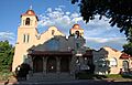
Our Lady of Mount Carmel Church
Our Lady of Mount Carmel Church is a significant church at 3517-3549 Navajo Street. It was added to the National Register in 2017. This church has been an important part of the community for many years.
_from_northeast_in_2009.jpg)
St. Dominic's Church
St. Dominic's Church is located at 3005 West 29th Avenue. It was listed in 1996. This church is another example of the beautiful and historic religious buildings in West Denver.

St. Joseph's Polish Roman Catholic Church
The St. Joseph's Polish Roman Catholic Church at 517 East 46th Avenue was added to the list in 1983. This church shows the history of different cultural groups settling in Denver.

Historic Parks and Bridges
West Denver also has historic parks and bridges that are important parts of the city's past and present.
19th Street Bridge
The 19th Street Bridge is a historic bridge on 19th Street. It was listed in 1985. This bridge is special because it connects West Denver to the Union Station area in Downtown Denver. Bridges are vital for connecting different parts of a city.

Berkeley Lake Park
Berkeley Lake Park is a large park roughly bordered by Berkeley Lake, Tennyson Street, West 46th Avenue, and Sheridan Boulevard. It became a historic district in 1986. Parks like this offer green spaces and recreation, and their design can be historically important.

Fort Logan National Cemetery
Fort Logan National Cemetery is a very important place at 3698 South Sheridan Boulevard. It was added to the National Register in 2016. This cemetery is a final resting place for many veterans and has a rich history related to military service.

Highland Park
Highland Park is another historic park. It's generally bounded by Highland Park Place, Federal Boulevard, and Fairview Place. It was listed in 1986. Parks are often designed with specific styles that reflect the time they were created.

Inspiration Point
Inspiration Point is a scenic spot roughly bounded by West 50th Avenue, Sheridan Boulevard, West 49th Avenue, and Fenton Street. It was added to the list in 1986. This area likely offers great views and has been a popular spot for a long time.

Rocky Mountain Lake Park
Rocky Mountain Lake Park is a park roughly bounded by Interstate 70, Federal Boulevard, West 46th Avenue, and Lowell Boulevard. It was listed in 1986. This park, like others, provides a natural escape within the city.

South Platte River Bridges
The South Platte River Bridges are located on Interstate 25 at milepost 210.53. These bridges were added to the National Register in 2002. They are important for transportation and show engineering achievements. These bridges also connect to other parts of Denver.

Other Interesting Historic Places
West Denver also has historic schools, homes, and business areas that tell unique stories.
Berkeley School
The Berkeley School at 5025-5055 Lowell Boulevard was listed in 1996. Historic schools are important because they show how education has changed over time.

Bryant-Webster Elementary School
Bryant-Webster Elementary School at 3635 Quivas Street was added in 1995. This is another example of a historic school building that has served the community for many years.

Dickinson Branch Library
The Dickinson Branch Library at 1545 Hooker Street was listed in 2002. Libraries are important community hubs, and historic ones often have beautiful architecture.

Elitch Theatre
The Elitch Theatre at West 38th Avenue and Tennyson Street was added in 1978. This theater is a significant part of Denver's entertainment history. Many famous performers might have graced its stage!

Loretto Heights Academy
Loretto Heights Academy is a large historic campus at 3001 South Federal Boulevard. It was listed in 1975. This site has a long history as an educational institution.

Old Highland Business District
The Old Highland Business District around 15th and Boulder Streets was listed in 1979. Historic business districts show how commerce and daily life used to happen in the city.

Oriental Theater
The Oriental Theater at 4329-39 West 44th Avenue was added in 1997. Like the Elitch Theatre, this building is important for Denver's cultural and entertainment history.

Overland Cotton Mill
The Overland Cotton Mill at 1314 West Evans Avenue was listed in 2001. This mill is a reminder of Denver's industrial past and how goods were produced.

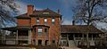
Rocky Mountain Hotel
The Rocky Mountain Hotel at 2301 7th Street was added in 1983. Historic hotels often have interesting stories about the people who stayed there and the events that took place.

Tilden School for Teaching Health
The Tilden School for Teaching Health is at the junction of West Fairview Place and Grove Street. It was listed in 1995. This school played a role in health education.

Former Listing
Sometimes, a place is removed from the National Register. This can happen if it is destroyed or if it no longer meets the requirements.
Wheeler House
The Wheeler House was once located at 1917 West 32nd Avenue. It was listed in 2000 but was removed from the list in 2010 because it was demolished in 2005. This shows that historic places need to be cared for to remain part of our history.

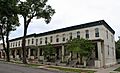
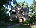
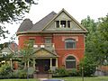
Images for kids
-
Building at 1389 Stuart Street
-
Building at 1390 Stuart Street
-
Building at 1435 Stuart Street
-
Building at 1444 Stuart Street
-

Building at 1471 Stuart Street
-
William J. Dunwoody House
-
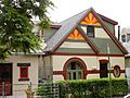
Fourth Church of Christ, Scientist
-
Hanigan-Canino Terrace
-
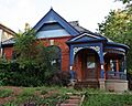
Highland Park Historic District
-
Niblock-Yacovetta Terrace
-
Frederick W. Neef House
-
Potter Highlands Historic District
-

Romeo Block
-

Amos H. Root Building
-
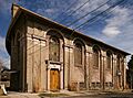
St. Patrick Mission Church
-
George Schmidt House
-
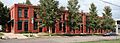
Stonemen's Row Historic District
-

Tallmadge and Boyer Block
-
West Forty-sixth Avenue Parkway
-
William Norman Bowman House-Yamecila
-
Avoca Lodge
-

St. Elizabeth's Retreat Chapel


