Navajo section facts for kids
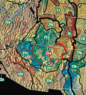
The Navajo Section is a special part of the Colorado Plateaus. Think of it as a big natural area. It's part of an even larger region called the Intermontane Plateaus.


Contents
The Navajo Section is in the northeastern part of Arizona and the northwestern part of New Mexico. It gets its name from the Navajo Nation. About half of this area is on the Navajo Reservation.
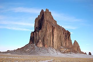
This area has wide, rolling plains. These plains are made of rocks that are easy to wear away. You'll also see cuestas (ridges) and tablelands. These are flat areas on top of gently sloped, strong sandstone layers. One of the most famous sights here is Shiprock. It's a huge, tall rock formation called a monadnock. Shiprock is about 7,177 feet (2,188 m) tall. It stands out near the town of Shiprock, New Mexico.
How High is the Land?
The lowest spot in the Navajo Section is about 4,700 feet (1,400 m) high. This is near the Four Corners area. The San Juan River basin is also nearby. The highest point is 9,916 feet (3,022 m) at Chromo Mountain. This mountain is on the Continental Divide near Chama, New Mexico.
What Areas are Nearby?
The Navajo Section is next to several other interesting areas:
- The Canyon Lands Section is to the north.
- The Rio Grande rift of the Basin and Range Province is to the east.
- The Acoma-Zuni Section is to the south.
- The Grand Canyon Section is to the west.
How the Land Was Formed
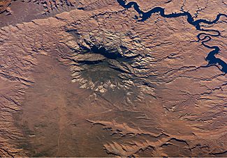
This area is mostly made of flat layers of sandstone. There are also some layers of shale. These rocks formed during the late Cretaceous and early Cenozoic ages. Some parts of the section have many volcanic necks and buttes.
Because the weather is dry and the sandstone is soft, many rock formations have worn away. This has created unique features. You can see long cuestas, shallow canyons and valleys, and narrow fan terraces. There are also wavy plateaus, separate mesas, steep hills, and some shale badlands.
- San Juan Basin
Near the Four Corners area, there's a steeply tilted rock fold called The Hogback. It stretches southwest from where the San Juan River enters the area. The San Juan River flows into the San Juan Basin. The western part of this basin shows rocks from the Fruitland and Menefee Formations. High, stepped terraces are found above the San Juan River. These are old flood plains from the Pleistocene era.
 | Madam C. J. Walker |
 | Janet Emerson Bashen |
 | Annie Turnbo Malone |
 | Maggie L. Walker |


