Navajo Mountain facts for kids
Quick facts for kids Navajo Mountain |
|
|---|---|
| Navajo: Naatsisʼáán | |

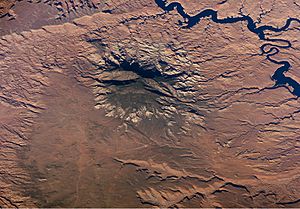
Navajo Mountain and Lake Powell, looking southeast from the Kaiparowits Plateau
|
|
| Highest point | |
| Elevation | 10,348 ft (3,154 m) NAVD 88 |
| Prominence | 4,226 ft (1,288 m) |
| Geography | |
| Location | |
| Topo map | USGS Navajo Begay |
| Geology | |
| Mountain type | Laccolith |
| Climbing | |
| Easiest route | Radio Towers Road |
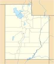
Navajo Mountain (called Naatsisʼáán by the Navajo people) is a special peak located in San Juan County, Utah. Part of the mountain also reaches into Coconino County, Arizona. It is the highest point on the Navajo Nation, which is the largest Native American reservation in the United States. This mountain holds a very important place in the traditions of three local Native American tribes.
Contents
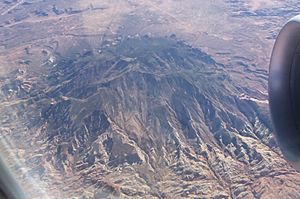
Navajo Mountain is a unique, stand-alone mountain. It was formed by a process called a laccolith. This happens when hot, melted rock (called igneous rock) pushes up into layers of sedimentary rock underground. The melted rock creates a dome shape, lifting the layers above it.
Over a very long time, the softer rock layers on top wore away. This erosion exposed the harder igneous rock at the mountain's core. You can see similar formations in other mountains on the Colorado Plateau, like the Henry Mountains and the La Sal Mountains.
Rocks and Layers of the Mountain
The Colorado Plateau is mostly made of flat layers of sedimentary rock. These layers tell us about Earth's ancient climates. They show times when the area was covered by oceans or vast deserts over 1.8 billion years.
The very top of Navajo Mountain, which is about 10,388 feet (3,166 meters) high, is made of Dakota Sandstone. This rock was formed during the Cretaceous Period, which was roughly 66 to 138 million years ago. Other types of rock layers you can see on the mountain's surface include those from the Jurassic Period. These include the Morrison Formation, Entrada Sandstone, Carmel Formation, and Navajo Sandstone.
The Navajo Mountain area is very special to the Navajo people. They call it Naatsisʼáán, which means "Earth Head" or "Pollen Mountain." In their origin stories, Navajo Mountain and nearby Rainbow Bridge National Monument are important as the first places where their people settled.
Changes Over Time
After the Navajo people were defeated by United States forces in 1863, new borders were drawn. The land also changed a lot physically. For example, Rainbow Bridge National Monument was created in 1910. Later, in 1963, Glen Canyon was filled to create Lake Powell. These changes made the area easier for tourism.
Today, the Navajo Nation still controls access to Navajo Mountain. If you want to hike in the area, you need a special permit from the Navajo Nation. Climbing the mountain itself is not allowed.
Other Tribes and Their Connections
Before it became part of the Navajo Nation, the area was home to the Ancestral Puebloans. Their descendants, the Hopi people, call Navajo Mountain Tokonave, meaning "Heart of the Earth." There are ancient ruins near Navajo Mountain that are still important to certain Hopi clans. Even today, Hopi priests make journeys to sacred places in the area.
Before 1933, the area around the mountain was known as the Paiute Strip. This was because many San Juan Paiutes lived there. The mountain itself was even called Paiute Mountain for a time.
The community of Navajo Mountain, Utah is located to the east of the mountain.
Unique Plants and Animals
Navajo Mountain is home to a rare plant called the Navajo Mountain beardtongue (Penstemon navajoa). This plant mostly grows on the higher slopes of the mountain and is not found in many other places.
 | Jewel Prestage |
 | Ella Baker |
 | Fannie Lou Hamer |


