New Albany, Indiana facts for kids
Quick facts for kids
New Albany, Indiana
|
|||
|---|---|---|---|
| City of New Albany | |||
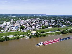
New Albany as seen from the Ohio River
|
|||
|
|||
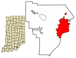
Location of New Albany in Floyd County, Indiana.
|
|||
| Country | United States | ||
| State | Indiana | ||
| County | Floyd | ||
| Area | |||
| • Total | 15.64 sq mi (40.50 km2) | ||
| • Land | 15.47 sq mi (40.06 km2) | ||
| • Water | 0.17 sq mi (0.45 km2) | ||
| Elevation | 469 ft (143 m) | ||
| Population
(2020)
|
|||
| • Total | 37,841 | ||
| • Density | 2,446.72/sq mi (944.70/km2) | ||
| Time zone | UTC−5 (EST) | ||
| • Summer (DST) | UTC−4 (EDT) | ||
| ZIP codes |
47150-47151
|
||
| Area code(s) | 812 & 930 | ||
| FIPS code | 18-52326 | ||
| GNIS feature ID | 2395181 | ||
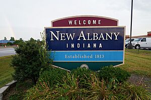
New Albany /ˈɑːlbəni/ is a city in Floyd County, Indiana, United States. It's located along the Ohio River, right across from Louisville, Kentucky. In 2020, about 37,841 people lived here. New Albany is the main city and county seat of Floyd County. It's bordered by I-265 to the north and the Ohio River to the south. The city is part of the larger Louisville, Kentucky area. The current mayor is Jeff Gahan, a Democrat, who was re-elected in 2023.
Contents
History of New Albany
Early Days of the City
| Historical population | |||
|---|---|---|---|
| Census | Pop. | %± | |
| 1830 | 2,079 | — | |
| 1840 | 4,226 | 103.3% | |
| 1850 | 8,181 | 93.6% | |
| 1860 | 12,647 | 54.6% | |
| 1870 | 15,396 | 21.7% | |
| 1880 | 16,423 | 6.7% | |
| 1890 | 21,059 | 28.2% | |
| 1900 | 20,628 | −2.0% | |
| 1910 | 20,629 | 0.0% | |
| 1920 | 22,992 | 11.5% | |
| 1930 | 25,819 | 12.3% | |
| 1940 | 25,414 | −1.6% | |
| 1950 | 29,346 | 15.5% | |
| 1960 | 37,812 | 28.8% | |
| 1970 | 38,402 | 1.6% | |
| 1980 | 37,103 | −3.4% | |
| 1990 | 36,322 | −2.1% | |
| 2000 | 37,603 | 3.5% | |
| 2010 | 36,372 | −3.3% | |
| 2020 | 37,841 | 4.0% | |
| Source: US Census Bureau | |||
After the American Revolutionary War, the land where New Albany now stands became part of the United States. George Rogers Clark had captured this territory in 1779. He was given large areas of land in Southern Indiana for his service. Clark later sold some of this land to his soldiers. The New Albany area ended up with Col. John Paul.
New Albany was founded in July 1813. Three brothers from New York—Joel, Abner, and Nathaniel Scribner—arrived at the Falls of the Ohio. They named the new settlement after their hometown, Albany, New York. They bought the land from Col. John Paul. The city's layout was planned by John Graham. In 1814, Joel and Mary Scribner built their home, the Scribner House, which you can still see today.
New Albany officially became a town in 1817. It was part of Clark County at that time. In 1819, New Albany became the main government center for the new Floyd County. A courthouse was built in 1824.
New Albany grew very quickly. It was the largest city in Indiana from 1816 until 1860. That's when Indianapolis became bigger. Before the Civil War, New Albany was the wealthiest part of Indiana. Many rich people lived there. The steamboat industry was very important for the city's economy. Many shipbuilders operated here, making steamboats like the Robert E. Lee. Other businesses, like machine shops and foundries, also grew. The American Plate Glass Works was another big business.
In 1847, New Albany was connected to Lake Michigan by the Monon railroad. In 1853, the New Albany High School opened. It was the first public high school in Indiana. New Albany was also the first in the state to create a combined school district.
In 1859, the Indiana State Fair was held in New Albany. The fairgrounds were later used as Camp Noble during the Civil War. It was a place for soldiers to gather.
New Albany During the Civil War
During the American Civil War, New Albany was a key location. It served as a supply center for Union troops. It also became a medical care center for wounded soldiers. About 1,500 wounded soldiers were treated in New Albany during the war. Many buildings were turned into hospitals.
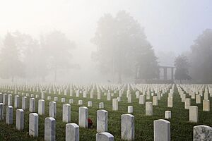
In 1862, Abraham Lincoln created one of the first national cemeteries in New Albany. This was for burying the many soldiers who died. Even during the war, a new courthouse was built in 1865. This building was used until the 1960s.
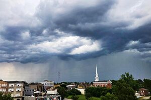
The Town Clock Church, now called Second Baptist Church, was a stop on the Underground Railroad. This was a secret network that helped enslaved people find freedom. The church's original steeple was damaged in 1915. A new steeple was finally added in 2016.
During the Civil War, New Albany faced economic challenges. Businesses were boycotted by both sides. Indianapolis became Indiana's largest city in 1860. New Albany's steamboat industry ended by 1870. The last steamboat built here was the Robert E. Lee.
After the steamboat industry declined, New Albany saw an industrial boom. Railroads brought new opportunities. The city became a center for pork packing and locomotive repair. A bridge was built across the Ohio River in 1886. This connected New Albany with Kentucky by rail and road. The American Plate Glass Works employed many people. When it moved in 1893, New Albany's economy suffered.
New Albany in the 20th Century
In the early 1900s, New Albany became known for making plywood and veneer. The New Albany Veneering Company was the biggest employer. By 1920, New Albany was the world's largest producer of plywood and veneer. Other companies like Indiana Veneer Panel Company also operated here.
On March 23, 1917, a tornado hit the north side of New Albany. It sadly killed at least 46 people.
Interstate 64 was built through New Albany in 1961. This led to the construction of the Sherman Minton Bridge. The bridge cost $14.8 million. It was named after Sherman Minton, a U.S. Senator and Supreme Court Justice from nearby Georgetown. The bridge was called the "most beautiful long-span bridge of 1961."
Innovations in Education
Charles A. Prosser lived in New Albany for much of his life. He is known as the "father of vocational education" (education that teaches job skills). The Charles Allen Prosser School of Technology was named after him.
In the mid-to-late 1900s, New Albany became a leader in using electronic media for education. New Albany High School started WNAS-FM in 1949. This is the oldest continuously operating high school radio station in the country. In the late 1960s, Slate Run Elementary School started WSRS. This was a student-produced TV service for classrooms. It was one of the first in an elementary school.
The Ohio River Flood of 1937
In January 1937, a huge flood hit the region. The Ohio River rose to 60.8 feet in New Albany. Most of the town was under 10 or more feet of water for almost three weeks. This flood was the worst disaster the city had ever faced.
After the flood, New Albany was the first city in the region to build large flood walls. These walls protect the city from future floods. New Albany's flood walls became examples for other cities like Louisville.
Geography of New Albany
New Albany is located at 38°18′07″N 85°49′17″W / 38.301935°N 85.821442°W.
According to the 2010 census, New Albany covers about 15.11 square miles (39.13 square kilometers). Most of this area, about 14.94 square miles (38.70 square kilometers), is land. The rest, about 0.17 square miles (0.44 square kilometers), is water.
People of New Albany
Population in 2020
In 2020, there were 37,841 people living in New Albany. About 78.3% of the people were White (not Hispanic). About 9.2% were Black or African American. Other groups included Native American (0.5%), Asian (0.9%), and people from two or more races (7.6%). About 5.1% of the population was Hispanic or Latino.
In 2023, the average household income in New Albany was $54,152. This is lower than the Indiana state average of $69,477. About 18.4% of people in New Albany lived below the poverty line. This is higher than the state average of 12.3%.
Population in 2010
In 2010, there were 36,372 people living in the city. There were 15,575 households and 9,175 families. The city had about 2,434.5 people per square mile (940.0 per square kilometer). There were 17,315 housing units.
About 85.8% of the people were White. About 8.7% were African American. Other groups included Native American (0.2%), Asian (0.7%), and people from other races (1.7%). About 3.7% of the population was Hispanic or Latino.
About 29.9% of households had children under 18. About 35.4% were married couples. The average household had 2.27 people. The average family had 2.89 people.
The average age in the city was 37.1 years. About 22.9% of residents were under 18. About 13.9% were 65 or older. The population was 47.5% male and 52.5% female.
Fun Things to Do in New Albany
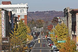
New Albany's Main Street has many beautiful old mansions from the late 1800s. These homes show how important the city was during its shipbuilding days. A great example is the Culbertson Mansion. It's a three-story building in the French Second Empire style. Today, it's an Indiana state memorial.
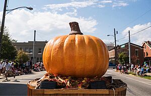
Every October, New Albany hosts the Harvest Homecoming festival. It's one of the biggest yearly events in Indiana! The fun starts on the first weekend of October. The main part, with rides, shows, and booths downtown, lasts from Thursday to Sunday of the second weekend. The 2020 festival was canceled due to the coronavirus pandemic.
Education in New Albany
Indiana University Southeast is one of the eight campuses of the Indiana University system. It's located on the northern edge of New Albany. The Purdue Polytechnic Institute also has a campus in the city.
The New Albany-Floyd County Consolidated School Corporation runs the public schools. The Children's Academy of New Albany is the public preschool program.
Elementary schools in the city include:
- Fairmont Elementary School
- Green Valley Elementary School
- Mount Tabor Elementary School
- S. Ellen Jones Elementary School
- Slate Run Elementary School
Grant Line Elementary School is in an area close to New Albany.
Middle schools in the city include:
- Hazelwood Middle School
- Nathaniel Scribner Middle School.
New Albany High School is the city's main high school.
The Greater Louisville Regional Japanese Saturday School holds classes at Indiana University Southeast. It helps Japanese students keep up with their studies.
The city also has a free public library, the New Albany-Floyd County Public Library.
Famous People from New Albany
Many interesting people have connections to New Albany, including:
- Jamey Aebersold – a jazz musician
- William Wallace Atterbury – a Brigadier General in World War I
- Carl Braden – a Civil Rights activist
- Pomeroy Cannon – an actor
- Hannah Grace Colin – a dancer and singer
- Rob Conway – a professional wrestler
- Josh Dallas – an actor who went to New Albany High School
- Billy Herman – a Hall of Fame baseball player
- Houndmouth – an American alternative blues band
- Edwin Hubble – a famous astronomer, the Hubble Space Telescope is named after him
- Karen Kamensek – a Grammy-nominated conductor
- J. Warren Kerrigan – an actor
- Romeo Langford – a professional basketball player
- Dusty Ray Bottoms – a drag queen and musical artist
- John MacLeod – a college and pro basketball coach
- Sherman Minton – a United States Supreme Court Justice
- Rondale Moore – a football player
- Lucy Higgs Nichols – an escaped slave and Civil War nurse
- Charles Allen Prosser – known as the "father of Vocational education"
- Craig Pumphrey – a police officer and martial artist
- Joseph Ritter – a Roman Catholic archbishop and Cardinal
- Roscoe Sarles – an Indy Car driver
- Thomas Smith – a Justice of the Indiana Supreme Court
- Mike Sodrel – a former congressman
- Camille Wright Thompson – a silver medalist in swimming at the 1976 Summer Olympics
- Ashbel P. Willard – the 11th Governor of Indiana
- Fuzzy Zoeller – a PGA golfer
See also
 In Spanish: New Albany (Indiana) para niños
 | William L. Dawson |
 | W. E. B. Du Bois |
 | Harry Belafonte |


