New England water resource region facts for kids
Quick facts for kids New England water resource region |
|
|---|---|

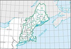
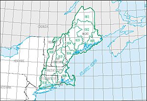
The New England region, with its 11 4-digit sub-region hydrologic unit boundaries.
|
|
| Countries | Canada, United States |
| States | Includes all of Maine, New Hampshire and Rhode Island, and parts of Connecticut, Massachusetts, New York, and Vermont |
| Basin features | |
| Basin size | 73,753 sq mi (191,020 km2) |
The New England water resource region is a special area. It is one of 21 main areas in the United States. These areas help scientists study how water flows across the land. They are like big puzzle pieces that show where rivers and streams drain.
This region is part of a system used by the United States Geological Survey. This system divides the country into smaller and smaller water units. Each unit helps track where water goes.
Contents
What is a Water Resource Region?
A water resource region is a large geographic area. It includes all the land where water flows into a major river. Or, it can be where water flows into a group of rivers. Think of it like a giant funnel. All the rain and snow that falls in that area eventually flows to the same place.
The New England Region
The New England water resource region has a special code: 01. This code helps scientists identify it easily. It is a very large area.
How Big is it?
This region covers about 73,753 square miles (191,010 square kilometers). That's a huge amount of land! It is divided into 11 smaller sections. These sections are called sub-regions. Each sub-region also has its own special code, from 0101 to 0111.
Where is it Located?
The New England region includes all of Maine, New Hampshire, and Rhode Island. It also covers parts of Connecticut, Massachusetts, New York, and Vermont.
Water from this region flows into several important places:
- The Bay of Fundy
- The Atlantic Ocean (between Maine and Connecticut)
- Long Island Sound (north of the New York-Connecticut border)
- The Saint-François River, which flows into the Saint Lawrence River
Exploring New England's Water Subregions
The New England region is made up of 11 smaller water areas. Each one is unique. Here's a look at some of them:
| Subregion Code | Subregion Name | Main Rivers or Areas | States Covered | Map |
|---|---|---|---|---|
| 0101 | St. John subregion | The St. John River Basin. | Located in Maine. | |
| 0102 | Penobscot subregion | The Penobscot River Basin. | Located in Maine. | |
| 0103 | Kennebec subregion | The Kennebec River Basin. | Located in Maine. | |
| 0104 | Androscoggin subregion | The Androscoggin River Basin. | Located in Maine and New Hampshire. | |
| 0105 | Maine Coastal subregion | Coastal areas from Maine to New Brunswick. Includes the St. Croix River. | Located in Maine. | |
| 0106 | Saco subregion | Coastal areas from Cape Small, Maine, to the Merrimack River. | Located in Maine, New Hampshire, and Massachusetts. | |
| 0107 | Merrimack subregion | The Merrimack River Basin. | Located in Massachusetts and New Hampshire. | |
| 0108 | Connecticut subregion | The Connecticut River Basin. | Located in Connecticut, Massachusetts, New Hampshire, and Vermont. | |
| 0109 | Massachusetts-Rhode Island Coastal subregion | Coastal areas including the Pawcatuck River Basin. | Located in Connecticut, Massachusetts, and Rhode Island. | |
| 0110 | Connecticut Coastal subregion | Coastal areas flowing into Long Island Sound. | Located in Connecticut, Massachusetts, New York, and Rhode Island. | |
| 0111 | St. Francois subregion | The Riviere St. Francois Basin. | Located in Vermont. |
 | Delilah Pierce |
 | Gordon Parks |
 | Augusta Savage |
 | Charles Ethan Porter |


