
Ocetá Páramo facts for kids
Quick facts for kids Ocetá Páramo |
|
|---|---|

Ciudad de Piedra and frailejones on the Ocetá Páramo
|
|
| Ecology | |
| Realm | Neotropic |
| Biome | Páramo |
| Borders | Pisba National Natural Park and Siscuinsí Lake |
| Animals | Andean condor, black agouti, eastern cottontail, mountain paca, spectacled bear, white-tailed deer |
| Geography | |
| Area | 57.711 km2 (22.282 sq mi) |
| Country | |
| State | Monguí, Mongua, Tópaga Sugamuxi Province, Boyacá |
| Elevation | 2,950 metres (9,680 ft) to 3,950 metres (12,960 ft) |
| Coordinates | 5°42′39.5″N 72°47′52.2″W / 5.710972°N 72.797833°W |
| Geology | Paleocene: Socha Formation Cretaceous: Guaduas, Guadalupe & Chipaque Formations Basin: El Cocuy sub-basin Orogen: Eastern Ranges Mountain range: Andes |
| Rivers | Calicanto, Morro & Tejar Rivers |
| Climate type | Cf |
The Ocetá Páramo (which means Páramo de Ocetá in Spanish) is a special kind of ecosystem. It is found high up in the mountains, above where forests grow but below where there is permanent snow. This amazing páramo is located in the Eastern Ranges of the Colombian Andes mountains. It sits at heights between 2,950 meters (9,680 feet) and 3,950 meters (12,960 feet).
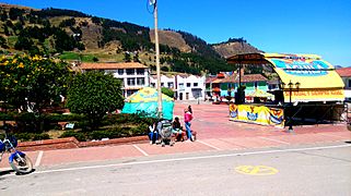
The Ocetá Páramo covers parts of the towns of Monguí, Mongua, and Tópaga. These towns are in the Sugamuxi Province of the Boyacá region. The páramo is famous for its unique plants called frailejones, which are small shrubs. It also has many other plants and animals that live in the Andes. You can take a full-day hike from Monguí or Mongua to explore this beautiful area.
Long ago, before the Spanish arrived, the Muisca lived in the Páramo de Ocetá. They thought this region was very sacred. There are many myths and legends from those times and from when the Spanish came. In the lower parts of the páramo, Muisca women used to give birth in small, man-made pools called Tortolitas. Many people believe the Ocetá Páramo is one of the most beautiful páramos in the world and a true treasure of Colombia.
Contents
What is the Ocetá Páramo?
The Ocetá Páramo is often called the most beautiful páramo in the world. It is also seen as one of Colombia's national treasures. It is about 230 kilometers (140 miles) from Bogotá, the capital city of Colombia. It is also 93 kilometers (58 miles) from Tunja, the capital of the Boyacá region.
Colombia has more páramos than any other country. Over 60% of this special Andean ecosystem is found within Colombia. The Boyacá region alone has 18.3% of all the páramos in the country.
Where is the Ocetá Páramo located?
The Ocetá Páramo is in the Eastern Ranges of the Colombian Andes. It is found at altitudes between 2,950 meters (9,680 feet) and 3,950 meters (12,960 feet). The páramo covers an area of about 5,771.1 hectares (14,261 acres).
It is located east of the Altiplano Cundiboyacense, a high plateau. To its southwest is the Pisba National Natural Park, and to its north is Siscuinsí Lake. Further northeast, you can find the Sierra Nevada del Cocuy mountains. To the southwest is Lake Tota.
What is the climate like in Ocetá Páramo?
The weather in the Ocetá Páramo can change a lot. Winter nights can be as cold as 0°C (32°F). Sunny days can reach up to 17°C (63°F). It is very common for foggy blankets to cover the area.
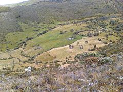
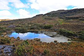
Páramos are often called "sponges" because they collect and store water. They are important sources of water for lower areas. The Ocetá Páramo is no different. In the higher parts of the páramo, there are marshes and small lakes. The largest body of water is the Laguna Negra. The Calicanto, Tejar, and Morro Rivers, along with many small creeks, all start in the Páramo de Ocetá. The Penagos waterfall helps to fill the Laguna Negra.
-
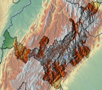
Topography of Boyacá
-
Fog at the Ocetá Páramo
-
Creeks on the páramo
-
Marshes in Ocetá
-
Laguna Negra
-
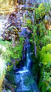
Penagos waterfall


What kind of rocks are in Ocetá Páramo?
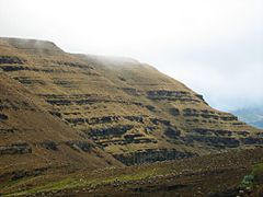
The rocks in the Ocetá Páramo tell a long story about Earth's history. The area is part of the El Cocuy sub-basin. This basin was once a deep valley that later got pushed up by Earth's forces.
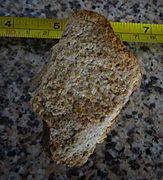
The rocks you can find here include sandstones and shales from the Paleocene period, which are part of the Socha Formation. There are also rocks from the Late Cretaceous period, such as the Guadalupe sandstone and shale formations, the Guaduas Formation, and the dark shales of the Chipaque Formation. The Guaduas Formation is important because it contains coal that is mined in the area.
Over millions of years, the plants in this area changed. About 5 million years ago, the climate became colder. This led to the páramo ecosystem we see today.
-
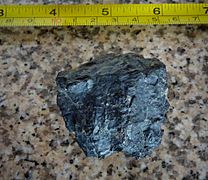
Coal from the Guaduas Formation
-
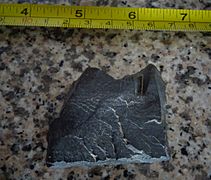
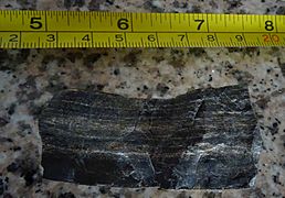
Dark organic shale from the Chipaque Formation
-
Banded shales from the Chipaque Formation
-
Grey shale from the Chipaque Formation
-
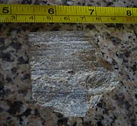
Sandstone from the Guadalupe Group
-
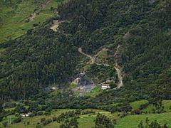
Coal mining close to Monguí


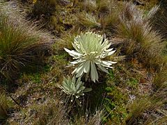
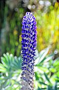
Plants of Ocetá Páramo
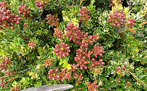
The most well-known plants in a páramo are frailejones. These are plants from the Espeletia group. In the lower parts of the Ocetá Páramo, you will find types like Espeletia barclayana, Espeletia jaramilloi, Espeletia congestiflora, and Espeletia argentea. The Espeletia grandiflora grows across a wider range of altitudes.
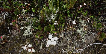
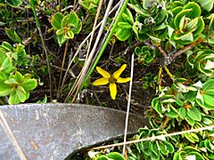
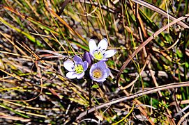
Another plant common in the Eastern Ranges is Chusquea tessellata. Many other plant species have been found here, including different types of mosses and lichen.
-
Pentacalia vernicosa
-
Ageratina tinifolia
-
Calamagrostis effusa and Espeletia
-
Bidens andicola
-
L. luisanae
-
Viola sp.


Animals of Ocetá Páramo
You might be able to spot several animals in the Ocetá Páramo. These include the majestic Andean condor, the black agouti, and the eastern cottontail rabbit. You might also see frogs, the mountain paca, and the white-tailed deer.
The spectacled bear is very rare here and might even be gone from the area. The white-tailed deer was a very important food source for the Muisca people long ago. However, they have been hunted a lot over time.
-
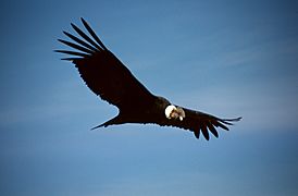
Andean condor
-
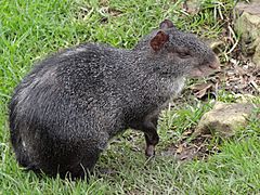
Black agouti
-
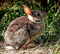
Eastern cottontail
-
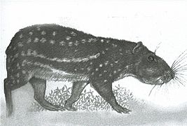
Mountain paca
-
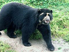
Spectacled bear
-
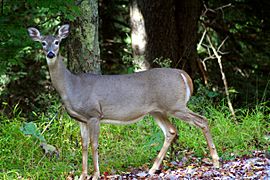
White-tailed deer


Guagua.jpg)


History of Ocetá Páramo
The Páramo de Ocetá was a very sacred place for the Muisca. They lived in the Altiplano Cundiboyacense and nearby areas before the Spanish arrived. The area around Monguí was home to the Sanoa tribe, who were part of the Muisca.
What can you see in Ocetá Páramo?
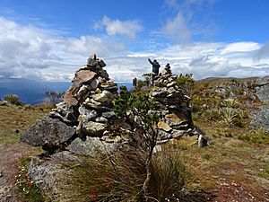
When you hike from Monguí to the highest point of the Ocetá Páramo, you will find many interesting sights. For most of the walk, you can see the Duitama-Sogamoso Valley to the southwest. You can especially see the towns of Tibasosa, Nobsa, and Duitama.
From viewpoints like the Mirador de Cóndores and the Cerro de Águilas, on clear days, you might even see the snowy peaks of the Sierra Nevada del Cocuy. You might also catch a glimpse of the Llanos Orientales, which are the eastern plains.

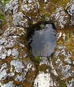
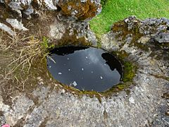
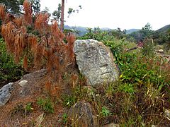
Tortolitas
The Tortolitas (meaning "Sweethearts" in English) are oval-shaped dips in the ground. The Muisca people made them long ago. They used these as "baths" where Muisca women would give birth to their babies. Near the Tortolitas, you can also find Muisca petroglyphs, which are ancient rock carvings.
-
Rock formation where the Tortolitas are made
-
A Tortolita
-
Another Tortolita
-
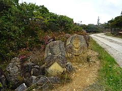
Muisca petroglyphs
-
A Muisca petroglyph
-
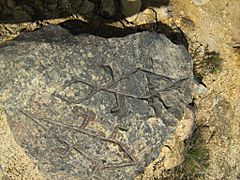
Muisca petroglyphs


Peña de Otí
The Peña de Otí (meaning "Rock of Otí" in English) is a large rock formation. It is made of layers of shale and sandstone from the Socha Formation. You can see it to the southwest from the main path that leads to the Mirador de los Cóndores. The rocks from the Peña de Otí were used to build the churches and a convent in Monguí.
There are many legends about the Peña de Otí. Some say witches dance with the devil there on October 31st. Another story says the scratches on the rock face came from the devil falling off a donkey. A legend also tells that the hill once opened up, showing a golden bridge and church inside. The world would end when the hill closed again.

Caja del Rey
The Caja del Rey (meaning "The King's Box" in English) is a huge rock that looks like a box. It is about 8 meters (26 feet) high, 8 meters (26 feet) wide, and 15 meters (49 feet) long. Legend says that the Muisca leader, cacique Sanoha, once hid a fifteen-year-old girl inside this rock. The top part of the rock has a natural crack that people have made bigger. This rock is also a great spot to see the western area of the páramo.

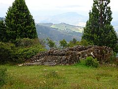
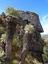
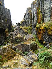
Ciudad de Piedra
Ciudad de Piedra or Ciudad Perdida (meaning "The Stone City" or "Lost City" in English) is a series of tall rock formations. They are about 15 meters (49 feet) high, 20 meters (66 feet) wide, and 200 meters (660 feet) long. Inside the Ciudad de Piedra, there is a flat stone called Mesa de los Sacrificios (Table of Sacrifices). People believe it was used for human sacrifices long ago.
El Pulpito del Diablo (meaning "The Devil's Pulpit" in English) is a raised, flat-topped hill. It is located south of the main hiking path on the Páramo de Ocetá.
-
Entrance to Ciudad de Piedra
-
Ciudad de Piedra
-
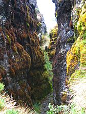
Moss at the Ciudad de Piedra
-
More moss at the Ciudad de Piedra
-
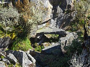
Mesa de los Sacrificios
-
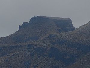
El Pulpito del Diablo


Playa de los Frailejones
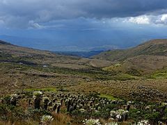
The Playa or Valle de Frailejones or Jardines de Ocetá (meaning "Frailejon Beach or Valley" or "Ocetá Gardens" in English) is a flat area on the páramo. It is covered with a huge number of frailejones. These unique plants grow very slowly, only about 1 centimeter (0.4 inches) each year.

Cerro de Águilas
The Cerro de Águilas (meaning "Eagles Hill" in English) is a hill on the páramo. It is made of layers of shales and sandstone formations from the Guadalupe Group.

Mirador de Cóndores
The Mirador de Cóndores (meaning "Condor Viewpoint" in English) is the highest point of the páramo. From here, you can see the Laguna Negra. It is also a great place to spot Andean condors flying high above.

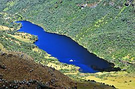
Laguna Negra
Laguna Negra (meaning "Black Lake" in English) is a permanent lake on the páramo. You can see it from the Cerro de Águilas or the Mirador de Cóndores. The lake's water flows towards the town of Mongua, and you can even reach the lake from that village. A local legend says that a young boy lives in the lake. You can hear his singing near the Penagos waterfall.

How to visit Ocetá Páramo
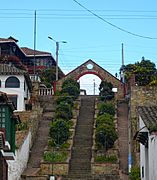
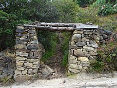
Most people visit the Ocetá Páramo from the town of Monguí. They follow a path called the Camino de la Otra Vida (Path of the Other Life). This is a full-day hike that takes between six and eleven hours. You will climb about 1,000 meters (3,300 feet) and then come back down. A steep and rocky entrance to the páramo is marked by a gate called Portal de la Gloria (Portal of Glory).
You can also explore the páramo on horseback. Some people even enjoy wild camping there. It is a good idea to go with a trained guide. There are many paths, and sudden mist can make it cold and easy to get lost. The best months to visit the páramo are November and December.
Another way to reach the Ocetá Páramo is from Mongua. This route will take you to the Laguna Negra first.
-
Camino La Otra Vida; access from Monguí to the Páramo
-
Portal de la Gloria
-
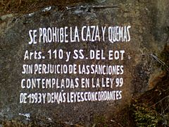
Hunting and making fires is forbidden
-
Wild camping on the Ocetá Páramo
-
Mongua gives an alternative access to the Páramo
-
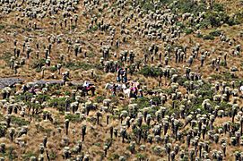
Horseriders on the Páramo


Places named after Ocetá
- A hotel in the town of Monguí
- A hotel in Tunja, the capital of Boyacá
See also
 In Spanish: Páramo de Ocetá para niños
