Oldmans Township, New Jersey facts for kids
Quick facts for kids
Oldmans Township, New Jersey
|
|
|---|---|
|
Township
|
|
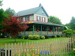
Farm house at Sweet Haven Farms
|
|
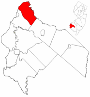
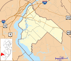
Oldmans Township highlighted in Salem County. Inset map: Salem County highlighted in the State of New Jersey.
|
|
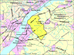
Census Bureau map of Oldmans Township, New Jersey
|
|
| Country | |
| State | |
| County | |
| Incorporated | February 7, 1881 |
| Government | |
| • Type | Township |
| • Body | Township Committee |
| Area | |
| • Total | 20.69 sq mi (53.58 km2) |
| • Land | 19.51 sq mi (50.53 km2) |
| • Water | 1.18 sq mi (3.05 km2) 5.70% |
| Area rank | 137th of 565 in state 9th of 15 in county |
| Elevation | 30 ft (9 m) |
| Population
(2020)
|
|
| • Total | 1,910 |
| • Estimate
(2023)
|
1,928 |
| • Rank | 490th of 565 in state 11th of 15 in county |
| • Density | 97.9/sq mi (37.8/km2) |
| • Density rank | 543rd of 565 in state 11th of 15 in county |
| Time zone | UTC−05:00 (Eastern (EST)) |
| • Summer (DST) | UTC−04:00 (Eastern (EDT)) |
| ZIP Code | |
| Area code(s) | 856 |
| FIPS code | 3403354810 |
| GNIS feature ID | 0882136 |
| Website | |
Oldmans Township is a small community located in Salem County, New Jersey. It's a quiet place where about 1,910 people lived in 2020. The township was officially created on February 7, 1881. Its name comes from an older name, "Alderman's."
Contents
Geography and Location
Oldmans Township covers about 20.69 square miles (53.58 square kilometers). Most of this area is land, with a small part being water.
Communities in Oldmans Township
- Pedricktown is a community located inside Oldmans Township. In 2010, about 524 people lived there.
- Other small communities and places in the township include Auburn, Dolbows Landing, Jumbo, Magnolia, Oldmans Point, Parkertown, and Perkintown.
Neighboring Areas
Oldmans Township shares its borders with:
- Carneys Point Township and Pilesgrove Township in Salem County.
- The Delaware River and Oldmans Creek. Oldmans Creek forms the border with Logan Township and Woolwich Township in Gloucester County.
Population Changes Over Time
| Historical population | |||
|---|---|---|---|
| Census | Pop. | %± | |
| 1890 | 1,432 | — | |
| 1900 | 1,382 | −3.5% | |
| 1910 | 1,364 | −1.3% | |
| 1920 | 1,328 | −2.6% | |
| 1930 | 1,431 | 7.8% | |
| 1940 | 1,722 | 20.3% | |
| 1950 | 1,657 | −3.8% | |
| 1960 | 2,913 | 75.8% | |
| 1970 | 2,088 | −28.3% | |
| 1980 | 1,847 | −11.5% | |
| 1990 | 1,683 | −8.9% | |
| 2000 | 1,798 | 6.8% | |
| 2010 | 1,773 | −1.4% | |
| 2020 | 1,910 | 7.7% | |
| 2023 (est.) | 1,928 | 8.7% | |
| Population sources: 1890–2000 1890–1920 1890 1890–1910 1910–1930 1940–2000 2000 2010 2020 |
|||
The number of people living in Oldmans Township has changed over the years. In 2010, there were 1,773 residents. By 2020, the population grew to 1,910 people.
Education in Oldmans Township
Students in Oldmans Township attend public schools through different districts.
Oldmans Township School District
- This district serves students from kindergarten through eighth grade.
- All students attend Oldmans Township School.
- In the 2018–19 school year, there were about 290 students and 22.5 teachers. This means there were about 13 students for every teacher.
High School Choices
- Most students (over 70% in 2018) from Oldmans Township go to Penns Grove High School. This is part of a special agreement with the Penns Grove-Carneys Point Regional School District.
- The remaining students (about 30%) attend Woodstown High School. This school is part of the Woodstown-Pilesgrove Regional School District.
- Students living west of Interstate 295 go to Penns Grove. Those living east of the highway go to Woodstown.
- Some students also choose to attend Gloucester Catholic High School in Gloucester City.
Getting Around Oldmans Township
Oldmans Township has several roads and a small airport.
Roads and Highways
- As of 2010, the township had about 40.89 miles of roads.
- U.S. Route 130 runs through the northwestern part of the township.
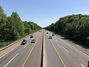
- Interstate 295 goes through the middle of the township and has an exit (Exit 7) here.
- The New Jersey Turnpike also passes through southern Oldmans. It has two rest stops in the township:
- The Clara Barton Service Area (southbound), named after Clara Barton.
- The John Fenwick Service Area (northbound), named after John Fenwick.
Public Transportation
- NJ Transit offers bus service on the 402 route, connecting Pennsville Township to Philadelphia.
Airport
- The Spitfire Aerodrome (airport code 7N7) is a small local airport in the township. It's the only airport of its kind in Salem County.
Famous People from Oldmans Township
Some notable people have lived in or are connected to Oldmans Township:
- Robert W. Camac (1940–2001), a famous horse trainer.
- Jim Leonard (1910–1993), an American football player who played for the Philadelphia Eagles.
- Johnny “Hockey” Gaudreau (1993–2024), a professional hockey player.
- Matthew Gaudreau (1994–2024), also a hockey player.
See also
 In Spanish: Municipio de Oldmans para niños
 | Ernest Everett Just |
 | Mary Jackson |
 | Emmett Chappelle |
 | Marie Maynard Daly |


