Oswego, Kansas facts for kids
Quick facts for kids
Oswego, Kansas
|
|
|---|---|
|
City and County seat
|
|

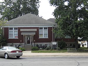
Oswego Carnegie Library (2013)
|
|

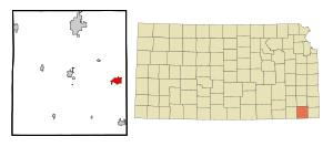
Location within Labette County and Kansas
|
|

|
|
| Country | United States |
| State | Kansas |
| County | Labette |
| Founded | 1865 |
| Incorporated | 1867 |
| Named for | Oswego, New York |
| Government | |
| • Type | Mayor–Council |
| Area | |
| • Total | 2.47 sq mi (6.40 km2) |
| • Land | 2.41 sq mi (6.24 km2) |
| • Water | 0.06 sq mi (0.17 km2) |
| Elevation | 912 ft (278 m) |
| Population
(2020)
|
|
| • Total | 1,668 |
| • Density | 675.3/sq mi (260.63/km2) |
| Time zone | UTC-6 (CST) |
| • Summer (DST) | UTC-5 (CDT) |
| ZIP code |
67356
|
| Area code | 620 |
| FIPS code | 20-53450 |
| GNIS ID | 469468 |
Oswego is a city in Kansas, United States. It is the main city and government center, called the county seat, of Labette County. The city is located along the Neosho River. In 2020, about 1,668 people lived in Oswego.
Contents
History of Oswego
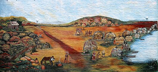
Oswego is built on the land where an Osage village once stood. This village was called No tse Wa spe, which means "Heart Stays." It was also known as "Little Town" by Jesuit missionaries. This name likely came from the "Little Osage" group of the Osage people who lived there.
The Osage villages often moved. However, "Little Town Above" was usually on the bluff overlooking the Neosho River. This is where Oswego is today. Another village, "Little Town Below," was often near Horseshoe Lake.
In the 1850s, "Little Town" was sometimes called "White Hair's Town." This was in honor of a leader named Iron Hawk. He was a Grand Tsi Shu Chief of the Osage Nation. Osage Chiefs often took the name "White Hair" during the 19th century.
Before the American Civil War, some families with mixed Native American and white backgrounds lived near Little Town. One such family was the John Allen Mathews family. They ran a trading post and a blacksmith shop here. John Mathews had trading posts in other places too.
During the Civil War, Mathews' trading post and ranch at Little Town were destroyed. The site of Little Town was empty of white settlers during the war. Many Osage people also left Kansas during this time.
In 1865, new settlers came to this spot. They also called the town "Little Town." Two years later, in 1867, the Oswego town company was formed. They named the town after Oswego, New York. Many of the new settlers came from there.
The town grew quickly because people were given free land if they built a house. Oswego officially became a city in February 1870. It became a larger city in 1880.
The first wooden house was built in September 1865. The first store opened in a log building in 1865. The post office started in 1867. Oswego was on a military road, so it had two supply stores. A blacksmith shop and a hotel also opened. The hotel was a place for travelers and a meeting spot for the county.
The first newspaper, the Oswego Register, started in 1868. The first church was organized in May 1868. The first school opened in 1867. A public library association began in 1877. Today, it is the Oswego Public Library, which is a Carnegie Library.
In 2011, the city expanded its borders. It included the Oswego Municipal Airport within the city limits. This made Oswego stretch into nearby Cherokee County.
Geography of Oswego
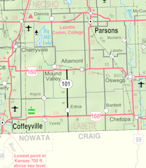
Oswego is about 12 miles (19 km) north of the Oklahoma state line. It is also about 30 miles (48 km) west of the Missouri line. The city sits on bluffs overlooking the Neosho River valley. It is located where U.S. Route 59 and U.S. Route 160 meet.
The city covers about 2.30 square miles (5.96 km2). Most of this area is land, with a small part being water.
Climate in Oswego
The weather in Oswego has hot, humid summers. Winters are generally mild to cool. This type of weather is called a humid subtropical climate. On climate maps, it is shown as "Cfa."
Population of Oswego
| Historical population | |||
|---|---|---|---|
| Census | Pop. | %± | |
| 1870 | 1,196 | — | |
| 1880 | 2,531 | 111.6% | |
| 1890 | 2,574 | 1.7% | |
| 1900 | 2,208 | −14.2% | |
| 1910 | 2,317 | 4.9% | |
| 1920 | 2,386 | 3.0% | |
| 1930 | 1,845 | −22.7% | |
| 1940 | 1,953 | 5.9% | |
| 1950 | 1,997 | 2.3% | |
| 1960 | 2,027 | 1.5% | |
| 1970 | 2,200 | 8.5% | |
| 1980 | 2,218 | 0.8% | |
| 1990 | 1,870 | −15.7% | |
| 2000 | 2,046 | 9.4% | |
| 2010 | 1,829 | −10.6% | |
| 2020 | 1,668 | −8.8% | |
| U.S. Decennial Census | |||
In 2020, Oswego had 1,668 people living in the city. There were 678 households. The average age of people in the city was 42.3 years. About 23% of the population was under 18 years old.
Education in Oswego
Schools in Oswego
The Oswego USD 504 public school district serves the community. It has four schools and teaches over 500 students.
- Oswego Junior Senior High School serves grades 7-12.
- Service Valley Charter Academy is a public school focused on agriculture for grades K–8.
- Neosho Heights Elementary School serves grades PK–6.
Colleges near Oswego
Labette Community College, located in Parsons, Kansas, offers classes at the Oswego High School site.
Pittsburg State University is about 30 miles (48 km) away in Pittsburg, Kansas. It is a larger university.
Museums and Libraries in Oswego
The Oswego Historical Museum and Genealogy Department offers tours. You can see rooms set up in old styles. You can also research family history. The museum has an original log cabin.
The Oswego Public Library (OPL) serves the community. It is a Carnegie Library. The library has many books, DVDs, and audio books. It also offers free Wi-Fi and computers for public use.
Medical Care in Oswego
Oswego was once served by the Oswego Community Hospital. It closed in 2019. Now, residents get medical care from hospitals in nearby cities.
Labette Health in Parsons and Via Christi Hospital in Pittsburg are the closest hospitals. They have emergency rooms that are rated as Level III Trauma Centers.
For more serious injuries, larger hospitals are in Joplin, Missouri. The biggest trauma centers are in Tulsa, Oklahoma.
Fun Things to Do in Oswego
Oswego has five city parks for everyone to enjoy:
- Riverside Park
- Schmoker Park
- John Mathews Park (Little Town Well)
- Hobart Young Park
- Thomas Park (Log Cabin)
Riverside Park
Riverside Park is Oswego's largest park. It covers 80 acres (32 ha) and overlooks a 100-foot (30 m) bluff. It is home to the Labette County Fairgrounds. The park also has the Oswego Community Center, a historic city pool, and walking trails. You can find RV campgrounds and playgrounds here too. There are also tennis courts, horseshoe pits, and two baseball/softball fields.
Many stone buildings in the park were built in the 1930s. This was part of government projects to create jobs.
Oswego City Pool
The Oswego City Pool was built in 1935. It still serves the community today. In the late 2000s, the pool area was updated. New concrete, a fence, diving board stands, and a water slide were added.
Oswego Community Center
The Oswego Community Center was built in 2006. It is a large building, about 10,000 square feet (930 m2). It hosts many community events. These include weddings, county fair exhibits, and luncheons.
Labette County Fairgrounds
The Labette County Fairgrounds are in the southern part of Riverside Park. They have barns, exhibit halls, and Memorial Stadium. The stadium is now used for the Fair's demolition derby. It was once used for high school football games.
Oswego Golf Course
The Oswego Golf Course is just north of the city on U.S. Highway 59. It has a nine-hole course. It was even shown on TV in 2006!
Media in Oswego
Labette Avenue is a weekly newspaper that covers local news and events. It continues the history of older local newspapers. Labette Avenue is based in Oswego and serves the rural areas of Labette County.
The daily Parsons Sun, from nearby Parsons, also covers news in Oswego. The biggest newspaper nearby is the Joplin Globe.
Oswego is in the Joplin-Pittsburg TV and radio market. This means most TV and radio signals come from those two cities. KGGF 690 AM Coffeyville also broadcasts to Southeast Kansas.
Transportation in Oswego
Trains
Oswego is served by the Union Pacific Railroad and the South Kansas and Oklahoma Railroad. These railroads connect Oswego to larger rail networks.
Roads
Two major U.S. Federal Highways, U.S. 160 and U.S. 59, meet in Oswego. The city is also about 35 miles (56 km) from Interstate 44.
Air Travel
The Oswego Municipal Airport is about 3 miles (4.8 km) outside the main part of the city. It serves small planes and the local area. You can buy fuel there.
Famous People from Oswego
- Arthur Evans, who was president of two universities: Henry Kendall College and the University of Oklahoma.
- Bishop Perkins, a United States Representative and Senator.
- Carson Robison, a country music singer and songwriter.
- William Steel, known as the "father" of Crater Lake National Park in Oregon. His family lived near Oswego.
See also
 In Spanish: Oswego (Kansas) para niños
 | Madam C. J. Walker |
 | Janet Emerson Bashen |
 | Annie Turnbo Malone |
 | Maggie L. Walker |


