Padstow, New South Wales facts for kids
Quick facts for kids PadstowNew South Wales |
|||||||||||||||
|---|---|---|---|---|---|---|---|---|---|---|---|---|---|---|---|

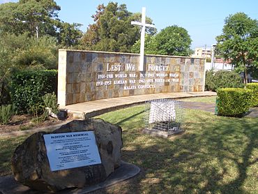
Padstow War Memorial
|
|||||||||||||||
| Population | 13,306 (2016 census) | ||||||||||||||
| Postcode(s) | 2211 | ||||||||||||||
| Elevation | 25 m (82 ft) | ||||||||||||||
| Location | 21 km (13 mi) south-west of Sydney CBD | ||||||||||||||
| LGA(s) | City of Canterbury-Bankstown | ||||||||||||||
| State electorate(s) | East Hills | ||||||||||||||
| Federal Division(s) | Banks | ||||||||||||||
|
|||||||||||||||
Padstow is a friendly suburb located in Sydney, New South Wales, Australia. It is about 21 kilometres south-west of the main city centre. Padstow is part of the City of Canterbury-Bankstown area. It is mostly a place where people live, with homes and families. The suburb is bordered by Salt Pan Creek to the east, which flows into the Georges River. You can also find some light industrial businesses in the northern part of Padstow.
Contents
A Look Back: Padstow's History
Padstow was first called "Padstow Park Estate." This name came from a town called Padstow in Cornwall, England. The English town's name means "the holy place of St Petroc." St Petroc was an important saint in Cornwall.
In the early days, people in Padstow mostly worked by cutting down trees for wood and farming the land. The first post office in Padstow Park opened in 1927. A school followed in January 1929. The railway station opened on December 21, 1931. This made it easier for people to travel and encouraged more homes and businesses to be built, especially after World War II. The suburb's name was officially changed to Padstow in 1939.
Shopping and Local Businesses
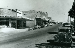
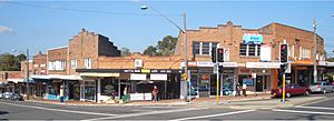
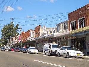
The main shopping area in Padstow is right around the Padstow railway station. Most of the shops are on the southern side, near the corner of Howard Road and Padstow Parade. You can find even more shops on the northern side, along Cahors Road.
Unique Street Names
Have you ever noticed how some street names are a bit unusual? In Padstow, many streets near the railway station have names inspired by Egypt. You'll find streets like Arab Road, Cairo Avenue, Pyramid Avenue, and Sphinx Avenue.
If you head west towards Revesby, you'll discover another interesting group of street names. These are inspired by outer space! Look out for Uranus Road, Mars Street, Neptune Street, Hydrae Street, and Vega Street.
Getting Around: Transport in Padstow
Padstow has good transport links. The Padstow railway station is on the Sydney Trains Airport & South Line. This line connects Padstow to places like Riverwood and Revesby.
There are also several bus routes that go through Padstow. These buses are run by U-Go Mobility. They can take you to many different places, including Bankstown, Miranda, Parramatta, and Hurstville.
Who Lives in Padstow: Demographics
The 2016 census counted 13,306 people living in Padstow.
- About 57% of residents were born in Australia.
- Other common birthplaces included China (7.7%), Vietnam (3.8%), and Lebanon (2.4%).
- Around 50% of people spoke only English at home.
- Other languages spoken included Cantonese (7.4%), Arabic (7.1%), and Mandarin (6.4%).
- The most common religions were Catholic (24%), No Religion (21.3%), and Anglican (12.3%).
Places of Worship
Padstow is home to several churches for different faiths:
- South West Christian Church
- St Therese Catholic Church
- Padstow Baptist Community Church
- Padstow Congregational Church
- Padstow Chinese Congregational Church
- Lifegate Community Church Padstow
- Padstow Anglican Church
- Padstow Uniting Church
Learning in Padstow: Schools
Padstow has five schools for younger students. Four are public schools, and one is a Catholic school. All of them teach students from Kindergarten to Year 6. After Year 6, students usually go to high schools in nearby suburbs like Revesby, Picnic Point, East Hills, or Milperra.
- Padstow North Public School is on Watson Road.
- Padstow Park Public School is the oldest school in the suburb. Its name comes from the original name of Padstow.
- Padstow Heights Public School is located in Padstow Heights.
- St Therese Primary School is a Catholic school that opened in 1962.
- Caroline Chisholm School is a special needs school. It helps students aged 4 to 18 who need extra support with their learning.
Sports and Recreation
Padstow is a great place for sports! It has two junior football (soccer) clubs:
- Padstow United, who play at Playford Park.
- Padstow Hornets, who play at Stuart Street Reserve.
In the past, there were other soccer clubs too, like the Padstow Pirates. Padstow Park is the home ground for the Padstow Panthers Junior Rugby League Club. This park has also hosted other rugby league and soccer clubs.
Padstow is also known for the Doug Frost Swim School. This is where famous swimmer Ian Thorpe first learned to swim! The Padstow Bowling & Recreation Club has two excellent bowling greens.
Local Government and Politics
For federal elections (which decide who represents Padstow in the national parliament), Padstow is mainly in the area called the federal electoral division of Banks. This seat is currently held by David Coleman from the Australian Liberal Party. A small part of Padstow is also in the Division of Hughes.
For state elections (which decide who represents Padstow in the New South Wales parliament), Padstow is in the state electoral district of East Hills. As of 2023, this seat is held by Kylie Wilkinson.
 | Sharif Bey |
 | Hale Woodruff |
 | Richmond Barthé |
 | Purvis Young |


