Papatoetoe facts for kids
Quick facts for kids
Papatoetoe
|
|
|---|---|
|
Suburb
|
|
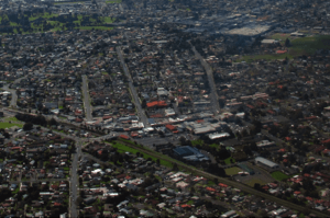
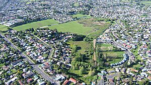
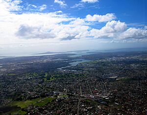
Aerial view of Papatoetoe
|
|
| Country | New Zealand |
| Local authority | Auckland |
| Electoral ward | Manukau ward |
| Local board | Ōtara-Papatoetoe Local Board |
| Area | |
| • Land | 1,134 ha (2,802 acre) |
| Population
(June 2023)
|
|
| • Total | Expression error: Unrecognized punctuation character "[". |
| Train station(s) | Papatoetoe Train Station Puhinui Train Station |
|
|
||
Papatoetoe is a large suburb in Auckland, New Zealand. It is known for having a big population. Papatoetoe is located about 18 kilometres southeast of Auckland CBD, which is the main city centre.
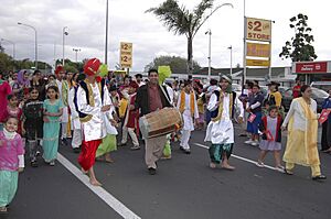
Long ago, Papatoetoe was very important to the Tāmaki Māori people. They used a special canoe path, called a waka portage, to travel between the Tāmaki River and Waokauri Creek. This path helped them reach the Manukau Harbour. In the 1800s, Papatoetoe became a farming area. It grew a lot in the 1950s and 1960s after the Auckland Southern Motorway was built. Today, Papatoetoe has a large community of Indian New Zealanders.
Contents
- Understanding the Name: Papatoetoe's Meaning
- Exploring Papatoetoe's Landscape and Geology
- A Look Back: Papatoetoe's History
- Papatoetoe's Population: Demographics
- Economy and Shopping in Papatoetoe
- Getting Around: Transport in Papatoetoe
- Sports and Recreation in Papatoetoe
- Learning in Papatoetoe: Schools and Education
- Preserving the Past: Papatoetoe Historical Society
- Famous People from Papatoetoe
- Places to See: Papatoetoe's Attractions
Understanding the Name: Papatoetoe's Meaning
The name Papatoetoe means "grounds where toetoe grows". Toetoe are tall, native grasses that used to grow widely in this area. English settlers started using the name Papatoetoe from the 1850s. For a while, it was spelled "Papatoitoi", but the local post office helped make "Papatoetoe" the official spelling.
Exploring Papatoetoe's Landscape and Geology
Papatoetoe is a flat area in South Auckland. It sits south of the Auckland isthmus and east of the Māngere peninsula. You can find some cool volcanic features from the Auckland volcanic field around Papatoetoe.
Volcanic Features: Craters and Wetlands
One interesting feature is Kohuora. This is a tuff ring, which is a type of crater formed by a volcanic eruption. It erupted about 34,000 years ago. Over time, the crater filled with water and dirt, becoming a wetland. Another volcanic feature is Crater Hill, which erupted around 30,000 years ago.
The Tāmaki Māori people had a special name for these low-lying volcanic areas in South Auckland: Nga Tapuwae a Mataoho. This means "The Sacred Footprints of Mataoho", referring to a god who helped create them.
Waterways and Natural Environment
Papatoetoe is located between the Manukau Harbour to the west and the Tāmaki River to the north-east. Important waterways in the area include the Waokauri Creek, the Puhinui Creek to the south, and the Tāmaki River and Ōtara Creek.
Before people settled here, the area was covered in forests. By the 1840s, it had a mix of ferns and scrub, including plants like kānuka, mānuka, and toetoe.
A Look Back: Papatoetoe's History
Māori History: Early Settlements and Trade Routes
The first signs of Tāmaki Māori living near the Manukau Harbour date back to the 1300s. Settlements started appearing in the 1400s. Papatoetoe was a key part of the Waokauri / Pūkaki portage. This portage connected the Manukau Harbour and the Tāmaki River. Māori often used it to avoid other portages that were controlled by people living at Ōtāhuhu / Mount Richmond. Papatoetoe is within the traditional land area, or rohe, of Waiohua, which includes the Tainui/Waiohua iwi Te Ākitai Waiohua.
Unlike other parts of Auckland, Papatoetoe has few fortified pā sites. This is because the land is mostly flat, which isn't ideal for building strong defences. There is one known pā in the area, at Cemetery Crater (Hillside South Park). It's called Te Pā-o-te-tū-tahi-atu, meaning it was a temporary pā.
The Waokauri / Pūkaki portage was used a lot until the 1860s. It was a vital way to transport goods to Papatoetoe.
Colonial Era: European Settlement and Roads
In 1836, a missionary named William Thomas Fairburn arranged a land sale with Tāmaki Māori chiefs. This sale covered most of what is now South Auckland. The idea was to stop fighting in the area. However, it's not clear if the chiefs fully understood or agreed to the sale. Māori continued to live in South Auckland as before. Fairburn's large purchase was later reduced by the Crown in 1842. Much of the land was then given to European settlers.
In 1851, the Tāmaki Bridge was built on the Great South Road. This helped Papatoetoe grow. By 1855, the road was improved, and coach services to Auckland began in 1857. European settlers, mainly Scottish and Irish Presbyterians, started moving to the area in the 1850s. The area was not very populated, with large country houses. The first St Johns Presbyterian Church was built in 1855.
In 1861, Governor George Grey ordered the Great South Road to be extended further south. This was to improve supply lines before the Invasion of the Waikato. In 1863, Governor Grey told all Māori in South Auckland to swear loyalty to the Queen and give up their weapons. Most refused and moved south due to their strong ties to Tainui. After the war, the Crown took over 1.2 million acres of Māori land, including Waiohua land in South Auckland.
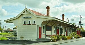
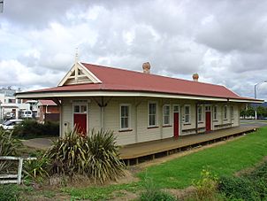
The first local government for the area was the Papatoitoi Highway District, formed in 1865. In 1875, the Papatoetoe railway station opened, connecting Papatoetoe to Auckland. A new town began to grow around the railway station. By the 1880s, dairy farming became popular.
Suburban Growth: From Farms to a City
New housing areas started to appear in Papatoetoe in the early 1900s, mostly east of the railway station. These included the Kolmar Estate (1903) and Green Park Estate (1914). By 1911, Papatoetoe's population had doubled to 400 people. In 1912, a temporary military camp was set up at Puhinui.
In 1918, a public hall was built. The next year, Papatoetoe became a town district because of its growth. In the 1920s, Papatoetoe was one of Auckland's fastest-growing areas. A second shopping area developed on Great South Road, near Hunter's tearooms, which became known as Hunters Corner. During the Great Depression, growth slowed, and Papatoetoe became known for poultry farming.
During World War II, the Cambria Park estate was used to build a military camp for 6,000 United States Army troops. Middlemore Hospital opened in 1947, originally as a temporary military hospital.
Papatoetoe grew enough to become a borough in 1946. In the late 1940s and early 1950s, the Māori Affairs Department encouraged people to move to Papatoetoe. This led to many Urban Māori moving from rural areas.
The building of the Auckland Southern Motorway caused a huge increase in Papatoetoe's population. The population grew four times after World War II. The motorway opened in 1955. In 1958, New Zealand's first modern supermarket opened in Papatoetoe. In 1962, Nestlé opened a factory, becoming a major employer.
Papatoetoe became a city in 1965. In 1989, it joined Manukau City. The Hunters Plaza mall opened in 1991. Population growth slowed in the 1990s and early 2000s. However, it increased significantly after 2006 due to more immigration and new housing rules. Papatoetoe is sometimes called Auckland's Little India. About 40 percent of its people are of Indian background, according to the 2018 census.
Papatoetoe's Population: Demographics
Papatoetoe covers about 11.34 square kilometres. As of 2023, it has an estimated population of about 65,000 people. This means there are about 5,700 people per square kilometre.
In 2018, Papatoetoe had a population of 43,599. This was a big increase from 2013 and 2006. There were 11,469 households. The population included 22,248 males and 21,354 females. About 21.3% of the people were under 15 years old.
Ethnic Diversity in Papatoetoe
Papatoetoe is a very diverse place. In 2018, the ethnic groups were:
Many people in Papatoetoe were born overseas, about 51.6%. This is much higher than the national average of 27.1%.
Religious Beliefs
When asked about religion, 17.9% of people said they had no religion. Many people were Christian (36.4%). Other religions included Hindu (18.2%), Muslim (6.4%), and Buddhist (2.3%).
Education and Work
About 17.7% of people aged 15 or older had a university degree or higher. About 17.8% had no formal qualifications. Most people (52.2%) were employed full-time, and 12.5% worked part-time.
Economy and Shopping in Papatoetoe
Papatoetoe Town Centre: A Revitalisation Plan
In 2009, plans began to improve the town centre around St. George Street. The idea was to build new apartments and sports facilities. This would bring more businesses to the area, which had faced challenges from big shopping malls.
Hunter's Corner: A Hub for Indian Culture
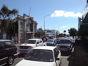
Hunter's Corner is a popular shopping area, especially for people of Indian background. It has about 60 shops, and around 40 of them have an Indian theme or sell Indian goods.
Hunters Plaza: A Modern Shopping Mall
The Hunters Plaza shopping mall opened in 1991 and was updated in 2015. It has 47 stores, including popular ones like Kmart and Woolworths.
Getting Around: Transport in Papatoetoe
Papatoetoe has two train stations: the Papatoetoe railway station and the Puhinui railway station. Both the Eastern Line and the Southern Line trains stop at these stations. During busy times, a train goes towards Britomart (Auckland's main station) about every 5 minutes. It takes about 30 minutes to get to Britomart from Papatoetoe station.
The Puhinui Station Interchange was improved in 2021. It now offers a fast connection to Auckland Airport, taking about 10–12 minutes. It also connects to Manukau.
The Auckland Southern Motorway and Southwestern Motorway connect Papatoetoe to Auckland City and Manukau. These motorways make it easy to travel by car.
Sports and Recreation in Papatoetoe
Papatoetoe is home to many sports clubs, offering different activities for the community.
Football (Soccer)
- Papatoetoe AFC is a football club that plays in the Lotto Sport Italia NRFL Division 1A.
- Papatoetoe United also plays from the sports complex on Great South Road.
Cricket
The Papatoetoe Cricket Club plays in the Auckland Cricket Championship.
Rugby League
The Papatoetoe Panthers are a rugby league club connected with the Auckland Rugby League.
Rugby Union
The Papatoetoe Rugby Football Club was started in 1946. They play their home games at the Papatoetoe Sport Complex on Great South Road.
Tennis
Papatoetoe has two tennis clubs: Papatoetoe Tennis Club and Sunnyside Tennis Club. Both are part of Auckland Tennis. Sunnyside Tennis Club started in 1955 as Puhunui Tennis Club.
Learning in Papatoetoe: Schools and Education
Papatoetoe has several schools for different age groups.
Primary Schools (Years 1-6/8)
Papatoetoe has five main primary schools:
- Holy Cross School is a Catholic school for years 1–8. It opened in 1953.
- Papatoetoe Central School is a state school for years 1–6. It was founded in 1857 and moved to its current location in 1872.
- Papatoetoe East School is a state school for years 1–6. It was established in 1958.
- Papatoetoe South School is a state school for years 1–6.
- Papatoetoe West School is a state school for years 1–6. It opened in 1949.
Other nearby primary schools include Papatoetoe North School, Puhinui School, and South Auckland Seventh-day Adventist School.
Intermediate Schools (Years 7-8)
- Papatoetoe Intermediate School is a state school for years 7–8.
- Kedgley Intermediate is also located near the Papatoetoe area.
Secondary Schools (Years 9-13)
Papatoetoe has two secondary schools:
- Papatoetoe High School is a state secondary school for years 9–13.
- Aorere College is also a state secondary school for years 9–13.
All these schools are coeducational, meaning both boys and girls attend.
Preserving the Past: Papatoetoe Historical Society
The Papatoetoe Historical Society was started in 1988. Its goal is to collect historical objects and information about the Papatoetoe area. They have information on local leaders, schools, street names, and local organisations. The society also has an archive with photos, books, and posters. You can see these collections at the Papatoetoe Historical Society museum.
In 2012, Papatoetoe celebrated 150 years of being a community. The Papatoetoe 150 event was organised by the Historical Society to share local history and promote community groups.
Famous People from Papatoetoe
Many notable people have connections to Papatoetoe:
- Len Brown – Former Mayor of Auckland.
- Barry Crump – A well-known author and poet.
- David Dallas – A popular Hip Hop Artist.
- Dillon Boucher – A New Zealand Basketball Player who lived in Papatoetoe and went to Papatoetoe High School.
- Ricki Herbert – A soccer player who played for the All Whites and was their coach. He played in the 1982 Soccer World Cup Finals.
- Phil Goff – The current Mayor of Auckland, and a former Labour Party Leader and government minister. He lived in Papatoetoe and attended Papatoetoe High School.
- Mike King – A mental health advocate.
- Kyle Jamieson – A New Zealand Cricketer who lived in Papatoetoe.
- Keven Mealamu – A former All Black (New Zealand rugby team player). He lived in Papatoetoe and attended Aorere College.
- David Shearer – A former Labour Party Leader. He lived in Papatoetoe and attended Papatoetoe High School.
- Ish Sodhi – A New Zealand Cricketer who lived in Papatoetoe and attended Papatoetoe High School.
- Tyree Tautogia – Part of the successful rap group Smashproof.
- Gary Troup – Played club cricket in Papatoetoe and represented New Zealand from 1976 to 1986.
- Heather Matthews (née Thompson) – Won a Silver Medal at the 1978 Commonwealth Games (3000 m). She received an MBE for her services to sport.
- Dei Hamo – A musician who attended Aorere College. He mentioned Papatoetoe in his popular song "We Gon' Ride".
Places to See: Papatoetoe's Attractions
Papatoetoe has several interesting places to visit:
- Murals in Old Papatoetoe: You can find colourful murals (large paintings on walls) around the Old Papatoetoe area. These include:
- "Picnic Scene" by Ron van Dam (near Wallace Road corner)
- "Papatoetoe General Store" by Christine Trout (Papatoetoe Mall)
- "Bottle O" by Christine Trout (Papatoetoe Mall)
- "Cameos" by Claudia Pond-Eyley (near Town Hall)
- "Old Papatoetoe Logo" by Ron van Dam (near Shirley Road)
- "St George St – 1930" by Merv Appleton (Rangitoto Road)
- Historical Cemeteries: You can visit old cemeteries at Manukau Memorial Gardens and St John's Presbyterian Church.
- Historic Landmarks: Important old buildings and places include:
- The Old Railway Station
- Cambria House and its historic gardens (on Puhinui Road)
- The Old Children's home (now on Wyllie Road)
 | Tommie Smith |
 | Simone Manuel |
 | Shani Davis |
 | Simone Biles |
 | Alice Coachman |


