Peavine Peak facts for kids
Quick facts for kids Peavine Peak |
|
|---|---|
| Highest point | |
| Elevation | 8,269 ft (2,520 m) |
| Prominence | 2,186 ft (666 m) |
| Geography | |
| Location | Washoe County, Nevada |
| Topo map | USGS Verdi |
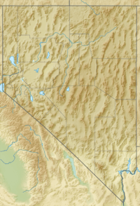
Peavine Peak is the tallest point on Peavine Mountain. It's found in Washoe County, Nevada. This mountain is in the northwest part of the Truckee Meadows. It's about 3.5 miles (5.6 km) east of the California border. Peavine Peak is a very noticeable landmark in the Reno/Sparks area. Early explorers found wild pea vines growing near Peavine Springs. This was on the northeast side of the mountain, close to a place called Poeville. That's how the mountain got its name!
Contents
Geology
What is Peavine Peak Made Of?
A lot of the northern Truckee Meadows area sits on top of material from Peavine Mountain. This material is called alluvium. It's made of sand, gravel, and clay carried by water. You can find this alluvium from Northwest Reno to the University of Nevada-Reno campus. It also stretches towards Proctor Hug High School in Northeast Reno.
As you go higher up the mountain, the ground changes. The dirt becomes coarser, meaning it has bigger pieces. You'll also find diatomaceous material mixed in. This comes from tiny fossilized algae.
Rocks of Peavine Mountain
Where the gentle lower slopes meet the steeper parts of the mountain, the ground changes to solid rock. These rocks are called igneous rocks. They formed from cooled lava or magma.
U.S. Highway 395 crosses an area known as the Alta Formation. This area is mostly made of a rock called pyroxene andesite. Andesite is a type of volcanic rock. It can be found in flows, broken pieces (breccia), and even laharic breccia. Lahar is a type of mudflow from a volcano.
On the sides of Peavine Mountain, the Alta Formation is often broken up by other rocks. These include rhyolite plugs and hornblende andesites. These come from the Kate Peak Formation. Rhyolite is another type of volcanic rock.
The very top parts of the mountain have large areas of granodiorite. This is a strong, coarse-grained igneous rock. You can see many of these rock formations on the upper south side of the mountain.
Another common feature is the "Peavine Sequence." These are Mesozoic-aged rocks. They are metavolcanic rocks, meaning they were once volcanic but have changed over time. They include rhyolite flows, pyroclastics (volcanic ash and fragments), dacite, andesite, and laharic breccias.
History
Native American Presence
Many old sites have been found on Peavine Mountain and nearby areas. These discoveries show that Native American cultures lived here long ago. The main groups were the Washo and Northern Paiute peoples.
Their tools and other items have been found in many places. These include Bull Ranch on the south side of the mountain. They have also been found near White Lake, north of Peavine. Many of these sites are above 6,000 feet (1,829 meters) high.
The items found show connections to the Kings Beach culture (around 500-1500 A.D.). They also show links to the Martis culture (around 2000 B.C. to 500 A.D.). Most of these discoveries are in the Truckee River area.
Modern History and Development
People started looking for minerals here as early as 1856. They found gold in "placer deposits." These were loose gold pieces in stream beds. These small mining operations only lasted as long as there was water in the streams. Miners would leave when the water dried up. This type of mining continued off and on through the 1860s.
A prospector named John Poe arrived around 1862. He was said to be a cousin of the famous writer Edgar Allan Poe. John Poe soon started the Poe Mining Company. He began working at the Paymaster Mine. He also planned and built the town of Poeville. This town was on the northeast side of the mountain. Poeville even had its own post office from 1874 to 1878.
Besides Poeville, two other towns were briefly built on or near Peavine Mountain:
- Webster: This town was named after Daniel Webster. It was planned in August 1873 by people interested in the Peavine mining area.
- Brooklyn: This town was named after the New York Borough. It was settled in March 1875. It was on the southeast side of the mountain, between Reno and Verdi. Charles W. Bever started Brooklyn. By 1876, it had five families and about a dozen buildings. However, its "boom" didn't last long. Later that year, John Poe convinced Bever to move his interest to another mining operation. Brooklyn was then abandoned. In March 1879, the remaining buildings were bought and moved to Reno.
Recreation
Peavine Mountain is very close to the Reno-Sparks area. This makes it a popular spot for people who love the outdoors. The Humboldt-Toiyabe National Forest helps manage the area. They have added many miles of trails for hiking and mountain biking. The different types of land offer a variety of challenges for adventurers.
Peavine is also a favorite place for off-road vehicles. However, access from Northwest Reno has become more limited in the last 15 years. This is mostly because more homes have been built in that area. The Humboldt-Toiyabe National Forest keeps different access points open. Some allow motor vehicles, while others are just for walking. Access from the east and north sides of the mountain is much less restricted.
An access road was built to reach the towers and stations at the peak. This road winds up the north and east sides of the mountain. If the weather is good, most two-wheel-drive cars with decent ground clearance can use this road. It goes all the way to the very top of the mountain.
 | Mary Eliza Mahoney |
 | Susie King Taylor |
 | Ida Gray |
 | Eliza Ann Grier |


