Pelican Lagoon, South Australia facts for kids
Quick facts for kids Pelican LagoonSouth Australia |
|||||||||||||||
|---|---|---|---|---|---|---|---|---|---|---|---|---|---|---|---|

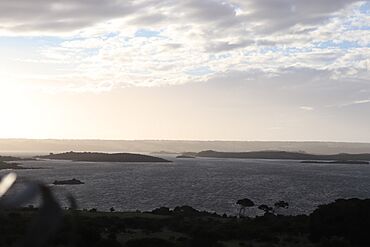
View of Pelican Lagoon
|
|||||||||||||||
| Population | 319 (shared with other localities in the “State Suburb of Island Beach”) (2011 census) | ||||||||||||||
| Established | 2002 | ||||||||||||||
| Postcode(s) | 5222 | ||||||||||||||
| Time zone | ACST (UTC+9:30) | ||||||||||||||
| • Summer (DST) | ACST (UTC+10:30) | ||||||||||||||
| Location |
|
||||||||||||||
| LGA(s) | Kangaroo Island Council | ||||||||||||||
| Region | Fleurieu and Kangaroo Island | ||||||||||||||
| County | County of Carnarvon | ||||||||||||||
| State electorate(s) | Mawson | ||||||||||||||
| Federal Division(s) | Mayo | ||||||||||||||
|
|||||||||||||||
|
|||||||||||||||
| Footnotes | Coordinates Locations Climate Adjoining localities |
||||||||||||||
Pelican Lagoon is a special place, or "locality," in South Australia. It is found on the south coast of the Dudley Peninsula. This peninsula is part of Kangaroo Island. The area looks out over a large body of water. This water is known as the Southern Ocean in Australia. Some international maps might call it the Great Australian Bight.
Pelican Lagoon is about 123 kilometers (76 miles) south of Adelaide. Adelaide is the capital city of South Australia. It is also about 17 kilometers (11 miles) southwest of Penneshaw. Penneshaw is another town on Kangaroo Island.
About Pelican Lagoon
The name "Pelican Lagoon" comes from a nearby seawater lagoon. This lagoon is also called Pelican Lagoon. The boundaries for this area were officially created in March 2002. They were named after this long-known lagoon.
What is Pelican Lagoon Like?
As of 2014, the Pelican Lagoon area covers land at the western end of the Dudley Peninsula. It is next to the seawater lagoon of Pelican Lagoon. The lagoon borders the area on its north, east, and west sides. The locality also includes a narrow strip of land called an isthmus. This isthmus connects the peninsula to the western part of Kangaroo Island. It also borders the island's southern coastline.
How is the Land Used?
The land within Pelican Lagoon is used for different purposes. Some areas are set aside for agriculture, which means farming. Other parts are for conservation. This means protecting nature and wildlife. The Pelican Lagoon Conservation Park is an example of a protected area here. There are also areas for residential use, where people live.
The Threshing Floor
Pelican Lagoon is home to a historic site called a threshing floor. A threshing floor was a special area used in the past. Farmers would beat harvested grain on this floor to separate the edible part from the husks. This threshing floor is very important. It is listed on the South Australian Heritage Register. This means it is protected as a significant historical site.
Government and Representation
Pelican Lagoon is part of different government areas. For federal elections, it is in the Mayo division. For state elections, it is in the Mawson district. Locally, it is managed by the Kangaroo Island Council. This council helps make decisions for the community.
 | Isaac Myers |
 | D. Hamilton Jackson |
 | A. Philip Randolph |


