
Pigeon Mountain (Alberta) facts for kids
Quick facts for kids Pigeon Mountain |
|
|---|---|

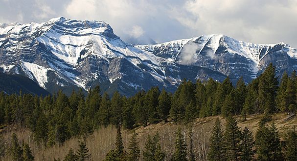
Pigeon Mountain seen from Bow River
|
|
| Highest point | |
| Elevation | 2,394 m (7,854 ft) |
| Prominence | 393 m (1,289 ft) |
| Parent peak | Skogan Peak (2662 m) |
| Listing | Mountains of Alberta |
| Geography | |

Pigeon Mountain
Location in Alberta

Pigeon Mountain
Location in Canada
|
|
| Location | Alberta, Canada |
| Parent range | Kananaskis Range Canadian Rockies |
| Topo map | NTS 82O/03 |
| Geology | |
| Age of rock | Cambrian |
| Climbing | |
| Easiest route | Hiking |
Pigeon Mountain is a mountain peak in the Canadian Rockies of Alberta, Canada. It stands 2,394-metre (7,854-foot) tall. This mountain is located in the Bow River Valley, which is part of Kananaskis Country.
Pigeon Mountain's highest point is lower than its "parent peak," Skogan Peak. Skogan Peak is about 5.0 km (3.1 mi) to the southeast. You can easily see Pigeon Mountain from Highway 1, also known as the Trans-Canada Highway. It's visible when you drive between Canmore and Exshaw.
Contents
Mountain's Past: How Pigeon Mountain Got Its Name
The name Pic de Pigeons was given to this mountain in 1858. It was named by Eugene Bourgeau, a botanist from France. He was part of the Palliser expedition, a journey to explore parts of western Canada.
Bourgeau named it because he saw many flocks of birds near the mountain. He thought they were pigeons. However, pigeons were not native to the Bow Valley back then. So, it's a bit of a mystery what kind of birds he actually saw! The mountain's name was officially accepted in 1956 by the Geographical Names Board of Canada.
Rock Formations: The Geology of Pigeon Mountain
Pigeon Mountain is made of sedimentary rock. This type of rock forms from layers of sand, mud, and tiny bits of plants and animals that settle over time. These layers were laid down a very long time ago, from the Precambrian to the Jurassic periods.
These rocks formed in shallow seas. Later, during an event called the Laramide orogeny, these rock layers were pushed eastward. This powerful movement caused them to slide over younger rocks, creating the mountain shapes we see today.
Weather Patterns: Climate Around Pigeon Mountain
Pigeon Mountain experiences a subarctic climate. This means it has very cold, snowy winters. The summers are usually mild. Temperatures can drop below −20 °C, and with the wind, it can feel even colder, sometimes below −30 °C.
Water from rain and melting snow on Pigeon Mountain flows into the Bow River. The Bow River is a "tributary," meaning it's a smaller river that flows into a larger one, the Saskatchewan River.
Reaching the Top: Climbing Pigeon Mountain
Climbing Pigeon Mountain is mostly a hike. The easiest way to the top is from its west side. You'll walk through beautiful meadows for much of the way.
There's an unofficial trail that is about 2.8 kilometers long. This trail climbs 535 meters from the Skogan Pass Trail. Once you reach the summit, you'll be rewarded with an amazing view of the surrounding area!
Gallery
-
Mount McGillivray (left) and Pigeon Mountain (right)
-
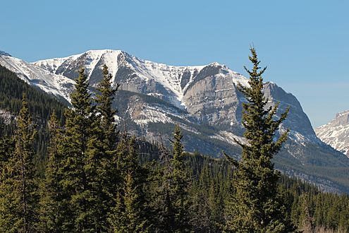
Pigeon Mountain

.jpg)
