Puerto Baquerizo Moreno facts for kids
Quick facts for kids
Puerto Baquerizo Moreno
|
||
|---|---|---|
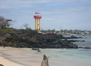
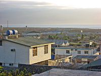
The shoreline of Puerto Baquerizo with a sea lion in the foreground
|
||
|
||
| Motto(s):
"Capital del Paraíso" - "Paradise's Capital"
|
||
| Country | ||
| Province | ||
| Canton | San Cristóbal | |
| Area | ||
| • City | 2.75 km2 (1.06 sq mi) | |
| Elevation | 6 m (20 ft) | |
| Population
(2022 census)
|
||
| • City | 7,290 | |
| • Density | 2,651/km2 (6,866/sq mi) | |
| Time zone | UTC-6 | |
| Climate | BSh | |
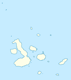
Puerto Baquerizo Moreno is the capital city of the Galápagos Province in Ecuador. It is found on the southwest coast of San Cristóbal Island. This island is the easternmost one in the archipelago (a group of islands).
The city was founded in the mid-19th century. It is named after President Alfredo Baquerizo (1859–1951), who visited the islands. Today, many local people work in fishing. Tourism is also growing, with more hotels and shops appearing along the waterfront.
The town has a cathedral, a post office, and a hospital. It also has a branch of the Universidad San Francisco de Quito. You can visit the Centro de Interpretación of the Galápagos National Park here. There is also a natural history museum. San Cristóbal Airport serves the town, connecting it to mainland Ecuador.
Contents
History of Puerto Baquerizo Moreno
General José de Villamil started the town in the 1830s or 1840s. However, it was named after Alfredo Baquerizo, who was the first president to visit the Galápagos in 1916. The Governor of Galápagos lives in the city. The Governor's home is a large grey stone building. It also holds the Naval headquarters.
Puerto Baquerizo Moreno is the oldest settlement in the Galápagos Islands. An agricultural area called El Progreso was set up in 1879. It was a large farm with a sugar factory.
The Albatross Foundation USA (Fundación Ecológica Albatros) is a group that started in 1993. People from the town created it. Their goal is to teach young people about protecting the island's environment and animals.
In 2010, the town had about 6,672 people living there.
Geography and Nature
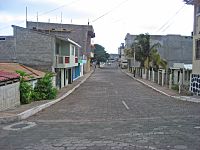
Puerto Baquerizo Moreno is the capital and main city of Ecuador's Galápagos Province. It is on the southwest coast of San Cristóbal Island. Locals sometimes call the town "Cristóbal" after the island. The town is about 6 meters (20 feet) above sea level. The main roads in the town are paved.
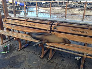
There is a small beach in town just for the sea lions. These animals are very important to the local people. There are two more beaches north of town, Playa Mann and Playa Carola, which are open to everyone. You can often see sea lions relaxing on boat decks or even on park benches!
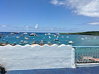
The town sits at the foot of Cerro San Joaquin mountain. This mountain is 896 meters (2,940 feet) tall, making it the highest point on San Cristóbal. Cerro de las Tijeretas (Frigatebird Hill) is about 1.6 kilometers (1 mile) southeast of town. The walk to it goes through a forest of fragrant palo santo trees. This hill is famous for two kinds of black frigatebirds that often visit. From the top, you can see ships in Bahía Naufragio (Shipwreck Bay).
Tongo Reef is west of the town. It's a popular spot for surfing from December to February. Puerto Grande is a protected cove northwest of town. It has a white sandy beach where you can swim. Tijeretas Cove is great for snorkeling.
Climate in the Galápagos
Puerto Baquerizo Moreno has a hot semi-arid climate. This means it's usually warm and dry. Even though it's near the Equator, temperatures don't get extremely hot. They stay fairly similar all year.
There are two main seasons:
- A warm, wet season from December to May. This brings sunshine and sometimes strong tropical thunderstorms.
- A cooler, dry season from June to November. This season has continuous fog-like rain called garúa, mild temperatures, and often cloudy skies. Winds can make it feel cooler.
The Galápagos Islands get less rainfall than other places near the Equator. On average, the whole archipelago gets less than 75 centimeters (30 inches) of rain each year. The amount of rain can change a lot from year to year. For example, in 1950, Puerto Baquerizo Moreno got only 3.55 cm (1.4 inches) of rain. But in 1953, during an El Niño year, it received 141.9 cm (55.9 inches) of rain!
This climate is affected by the cold Humboldt Current. This current flows north from Peru and Chile, keeping the ocean waters around the islands cool. Sometimes, the warm El Niño current takes over, which can change weather patterns across the South Pacific and even globally.
The average monthly temperature is about 24°C (75°F). The hottest average daily maximum is 30°C (86°F) from February to April. The coolest average daily minimum is 18°C (64°F) in September. The town gets about 2343 hours of sunshine each year.
| Climate data for Puerto Baquerizo Moreno, San Cristobal, Galapagos Islands, Ecuador | |||||||||||||
|---|---|---|---|---|---|---|---|---|---|---|---|---|---|
| Month | Jan | Feb | Mar | Apr | May | Jun | Jul | Aug | Sep | Oct | Nov | Dec | Year |
| Record high °C (°F) | 32.4 (90.3) |
33.6 (92.5) |
34.2 (93.6) |
33.8 (92.8) |
32.6 (90.7) |
31.6 (88.9) |
30.9 (87.6) |
30.0 (86.0) |
28.8 (83.8) |
29.4 (84.9) |
30.4 (86.7) |
30.2 (86.4) |
34.2 (93.6) |
| Mean daily maximum °C (°F) | 29.2 (84.6) |
30.3 (86.5) |
30.5 (86.9) |
30.2 (86.4) |
29.2 (84.6) |
27.6 (81.7) |
26.4 (79.5) |
25.6 (78.1) |
25.7 (78.3) |
26.0 (78.8) |
27.0 (80.6) |
27.8 (82.0) |
28.0 (82.4) |
| Mean daily minimum °C (°F) | 22.9 (73.2) |
23.1 (73.6) |
22.9 (73.2) |
22.8 (73.0) |
22.7 (72.9) |
21.7 (71.1) |
20.7 (69.3) |
19.8 (67.6) |
19.8 (67.6) |
20.0 (68.0) |
20.9 (69.6) |
21.7 (71.1) |
21.6 (70.9) |
| Record low °C (°F) | 17.2 (63.0) |
16.2 (61.2) |
18.1 (64.6) |
17.7 (63.9) |
16.0 (60.8) |
15.2 (59.4) |
13.2 (55.8) |
14.0 (57.2) |
13.5 (56.3) |
14.6 (58.3) |
15.4 (59.7) |
16.2 (61.2) |
13.2 (55.8) |
| Average precipitation mm (inches) | 83.4 (3.28) |
107.4 (4.23) |
106.3 (4.19) |
94.9 (3.74) |
41.9 (1.65) |
32.5 (1.28) |
18.8 (0.74) |
9.8 (0.39) |
7.6 (0.30) |
11.0 (0.43) |
12.6 (0.50) |
51.5 (2.03) |
577.7 (22.74) |
| Average precipitation days | 11 | 10 | 11 | 6 | 5 | 8 | 13 | 14 | 12 | 11 | 8 | 10 | 119 |
| Average relative humidity (%) | 80 | 82 | 82 | 82 | 80 | 78 | 78 | 79 | 78 | 77 | 74 | 76 | 79 |
| Mean monthly sunshine hours | 156 | 158 | 175 | 180 | 191 | 166 | 152 | 148 | 151 | 157 | 166 | 168 | 1,968 |
| Source 1: World Meteorological Organization | |||||||||||||
| Source 2: Deutscher Wetterdienst (extremes, humidity and sun) | |||||||||||||
Plants and Animals
You can find many lava fields and desert plants around the town. Some plants that have spread widely in the highlands near the town include the quinine tree, Cuban cedar, and tall elephant grass.
Economy and Jobs
Fishing is a very important job in Puerto Baquerizo Moreno. In 2014, about 520 fishermen worked from the port. They used 212 fishing boats of different sizes. Farming is not very common because there isn't much water on the island. People feel that using their boats for tourism makes more money.
Drinking water for the town comes from a lake near El Progreso. This lake also helps water nearby farms. The town has a steady supply of electricity.
Tourism is growing along the coast. This has led to more hotels, restaurants, souvenir shops, and tourist offices being built.
Important Places to Visit
There are several important places to see in Puerto Baquerizo Moreno. These include the Centro de Interpretación of the Galápagos National Park, the La Inmaculada cathedral, and a museum. A Charles Darwin Research substation was opened in 1998. It has different sections for studying marine life, insects, and teaching about the environment.
Cine Naval is the only movie theater in town. It's inside the naval station but open to everyone. Every July, it hosts a film festival with movies from Ecuador and Latin America.
Centro de Interpretación
The Centro de Interpretación is a visitor center for the Galápagos National Park. It opened in 1988 in the northern part of town. It has exhibits about the islands' amazing plants, animals, and human history. You can watch interactive videos and listen to audio in English and Spanish. These shows teach you about the islands' ecology, plants, and animals.
The main hall also has changing art exhibits. They hold cultural events and workshops on dance and painting. Outside, you can walk along boardwalks to see many cacti and other local plants. The center also has a unique display: a recreated ship's storage area filled with giant tortoises turned upside down. This shows how pirates and whalers used to transport them.
Catedral La Inmaculada
The Immaculate Conception Cathedral, Puerto Baquerizo Moreno is a Roman Catholic church. It is located at the head of the bay. Inside, you can see beautiful murals (wall paintings). These murals show stories from the New Testament but with local Galápagos animals and plants in the pictures.
Natural History Museum
The small Natural History Museum (Museo de Ciencias Naturales) has a statue of Charles Darwin at its entrance. It is in the center of town, next to the Franciscan mission. The museum displays many animals, plants, and minerals from the Galápagos.
One special exhibit is a giant tortoise said to be over 80 years old. You can also see exhibits of an older type of iguana, the flightless cormorant, and the Galapagos tortoise.
Getting Around
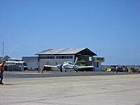
San Cristóbal Airport is the local airport. It connects the island to mainland Ecuador. An Airbus A319 jet flies daily from Guayaquil on the mainland. The port is in Bahía Naufragio (Shipwreck Bay), southwest of town. Boat companies offer tours for tourists. Buses and taxis are available for getting around the town.
Sister Cities
See also
 In Spanish: Puerto Baquerizo Moreno para niños
 | Dorothy Vaughan |
 | Charles Henry Turner |
 | Hildrus Poindexter |
 | Henry Cecil McBay |


