Puyehue Lake facts for kids
Quick facts for kids Puyehue Lake |
|
|---|---|

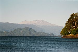
View of the lake with Puyehue volcano in the background
|
|
| Coordinates | 40°41′01″S 72°27′46″W / 40.68361°S 72.46278°W |
| Primary inflows | Gol-Gol River |
| Primary outflows | Pilmaiquén River |
| Catchment area | 1,267 km2 (489 sq mi) |
| Basin countries | Chile |
| Max. length | 23 km (14 mi) |
| Max. width | 11.5 km (7.1 mi) |
| Surface area | 157 km2 (61 sq mi) |
| Max. depth | 123 m (404 ft) |
| Water volume | 12.6 km3 (10,200,000 acre⋅ft) |
| Surface elevation | 212 m (696 ft) |
| Islands | Fresia Island, Cuicui Islands |
| Settlements | Entre Lagos |
| References | Cuenca del río Bueno |
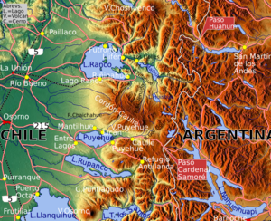
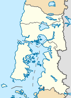
Puyehue Lake is a beautiful lake located in Chile. Its name comes from the Mapudungun language, where puye means "small fish" and hue means "place." So, Puyehue means "place of small fish." This lake is found in the Andes mountains, right on the border between the Los Lagos Region and the Los Ríos Region.
Contents
How Puyehue Lake Was Formed
Puyehue Lake was created by huge glaciers. Long ago, during the Ice Age, a massive ice sheet called the Patagonian Ice Sheet covered this area. As the glacier moved, it carved out the land, forming the deep basin where the lake now sits. When the ice melted, it filled this basin, creating Puyehue Lake.
Along the western side of the lake, you can still see hills of rock and dirt left behind by the glaciers. These are called moraines.
The Lake's Shape and Features
Puyehue Lake is long and narrow, stretching from east to west. In the middle of the lake, there's an island called Fresia Island. The lake's edge is mostly smooth, with one main bay called Futacullín Bay on the south side. The only town right on the lake is Entre Lagos, located at its western end.
What the Lake Tells Us About Earth's Past
Like many other lakes in southern Chile, Puyehue Lake collects sediment (tiny bits of rock and dirt) that washes down from the Andes mountains. Scientists can study these layers of sediment at the bottom of the lake.
By taking samples, called sediment cores, from the lakebed, scientists can learn about Earth's history. For example, cores taken in 2001 and 2002 helped show that a period called the Little Ice Age also happened in the Southern Hemisphere. Longer cores have even helped scientists understand how the lake and its surrounding area have changed over the last 18,000 years.
When the glacier in the Puyehue area melted, it formed a temporary lake. At the same time, the glacier in the nearby Rupanco Lake basin was at its biggest. For a while, melting water from the Rupanco glacier flowed north into Puyehue Lake.
Impact of the 2011 Volcano Eruption
In 2011, the Puyehue Volcano erupted. This eruption caused a lot of ash and volcanic material to fall. The Gol-Gol River, which flows into Puyehue Lake, became polluted with this material. Sadly, many fish in the river died because of it.
Volcanic ash also reached Puyehue Lake through the river. This caused a layer of volcanic ash to settle at the bottom of the lake.

History of the Lake's Name
In the 1500s, when the Spanish first arrived, they knew the lake by a different name: Llobén. This name came from the Huilliche language, and it meant "abundant and continuous rain."
See also
 In Spanish: Lago Puyehue para niños
 | Dorothy Vaughan |
 | Charles Henry Turner |
 | Hildrus Poindexter |
 | Henry Cecil McBay |


