
Restigouche River facts for kids
Quick facts for kids Restigouche River |
|
|---|---|
_(facing_East).jpg)
The Restigouche River at Matapédia
|
|
| Country | Canada |
| Cities | Matapédia, Quebec, Campbellton, New Brunswick |
| Physical characteristics | |
| Main source | Confluence of Little Main Restigouche River and Kedgwick River 118 m (387 ft) 47°39′52″N 67°29′28″W / 47.66444°N 67.49111°W |
| River mouth | Chaleur Bay 0 m (0 ft) 48°03′46″N 66°19′45″W / 48.06278°N 66.32917°W |
| Length | 200 km (120 mi) |
| Basin features | |
| Basin size | 12,820 km2 (4,950 sq mi) |
| Tributaries |
|

The Restigouche River (French: Rivière Ristigouche) is a beautiful river in Canada. It flows through the northwestern part of New Brunswick and the southeastern part of Quebec.
The river starts in the Appalachian Mountains in New Brunswick. It flows northeast for about 200 kilometres (120 mi) until it reaches Chaleur Bay. Many smaller rivers, called tributaries, feed into the Restigouche. These include the Kedgwick River, Gounamitz River, Patapédia River, and Matapedia River from Quebec. The Upsalquitch River also joins it from New Brunswick.
Most of the river is in New Brunswick. However, part of it forms the border between New Brunswick and Quebec. This border section starts where the Patapédia River joins and ends at Dalhousie, New Brunswick and Miguasha, Quebec. Here, the river flows into Chaleur Bay.
The part of the river near the sea is called an estuary. This estuary is about 25 kilometres (16 mi) long. It stretches from Dalhousie in the east to Tide Head, New Brunswick in the west. This area is very important for sea ducks, especially black scoters and surf scoters. They stop here during their migration journeys. Because of its importance for birds, the Canadian Wildlife Service has named this estuary an Important Bird Area.
The Royal Canadian Navy has even named two warships after this river: HMCS Restigouche (H00) and HMCS Restigouche (DDE 257).
The Restigouche River begins where the Little Main Restigouche River and Kedgwick River meet. This meeting point is in New Brunswick. From there, the river flows for about 140.5 kilometres (87.3 mi) before reaching the sea.
Contents
River's Journey: From Source to Sea
The Restigouche River has a long and winding journey. It starts in New Brunswick and flows mostly northeast.
The Upper River: Where it Begins
The first part of the river flows for about 31.4 kilometres (19.5 mi). It winds through the landscape, making curves and turns. Along this section, smaller streams like Soldiers Creek and Tracy Brook join the river. Eventually, the Patapédia River joins from the west. This is where the river starts to form the border between Quebec and New Brunswick.
The Middle River: Flowing Along the Border
After the Patapédia River joins, the Restigouche flows for another 50.0 kilometres (31.1 mi). In this section, more streams from both Quebec and New Brunswick flow into it. The river continues its journey northeast, passing through different areas and forming wide curves. The Upsalquitch River from New Brunswick also joins the Restigouche in this middle section.
The Lower River: Reaching the Bay
The final part of the river's journey is about 59.1 kilometres (36.7 mi) long. After the Upsalquitch River joins, the Restigouche flows towards the east. The Matapedia River joins it from the west. The river then passes under railway and highway bridges. It widens as it gets closer to the sea, forming an archipelago (a group of small islands). Finally, it flows past Pointe-à-la-Croix, Quebec and Campbellton. The river then crosses Escuminac Bay and reaches Chaleur Bay near Pointe Miguasha and Dalhousie.
History of the Restigouche River

The name Restigouche likely comes from the Mi'gmaq word Listuguj. This word probably means "good river." The Mi'gmaq First Nation has lived in this area for hundreds of years. The Restigouche watershed, which is the land drained by the river and its streams, has many mountains and forests.
In the 17th and 18th centuries, French settlers built some communities along the river. However, not many Europeans lived there until after the French and Indian War in 1760. During this war, a big naval battle, the Battle of Restigouche, happened on the river. British and French ships fought here. The French ships were trying to bring supplies to Quebec, but they were stopped. This battle was important because it helped the British win the war.
After the American Revolutionary War, some families from Scotland moved to the area. They found work in the growing timber industry. The Restigouche River and its tributaries became like highways for log drives. Logs were floated down the river to sawmills in Campbellton and Dalhousie. Later, in the 1930s, factories that made pulp and paper were built in these towns. This helped use the timber resources from the Restigouche area.
Salmon Fishing on the Restigouche
The Restigouche River is famous around the world for its Atlantic salmon fishing. Many people come here just to fish for these amazing salmon. This type of fishing, called fly fishing, brings a lot of money to the region. A 55-kilometre (34 mi) part of the Restigouche is even part of the Canadian Heritage Rivers System. This means it's recognized for its special natural and cultural value.
Between 15,000 and 25,000 salmon enter the Restigouche River each year. This attracts anglers (people who fish with a rod and line) from all over the world. Restigouche salmon are known for being very active. Once hooked, they fight hard and jump out of the water!
The Restigouche River is known for its clear water and very large Atlantic salmon. It's common to catch salmon weighing between 20-to-30-pound (9.1 to 13.6 kg). Some fish even weigh over 40 pounds (18 kg)! The best time to catch these big salmon is from early spring until the end of June.
For over 100 years, people from all over the world have visited the river. They enjoy its calm beauty and perfect conditions for canoeing and salmon fishing. Many famous people have been guests at the fishing lodges here. These include the Duke of Windsor, Hubert Humphrey, Ted Williams, Lord Beaverbrook, Bing Crosby, Louis St. Laurent, Maurice Richard, Norman Schwarzkopf, George H. W. Bush, and Brian Mulroney.
The Restigouche River is known for its special fishing rules. The government sells fishing rights for parts of the river to the highest bidder. Many private fishing lodges are owned by companies or wealthy people. These fishing rights can be very expensive, costing millions of dollars for just a few years. People who lease these areas must follow conservation laws. They hire their own fish wardens to patrol their leased sections. Anyone fishing in a leased area must also have a provincial fishing license. The public can use the river for boating, but they cannot fish in the leased areas.
The Irving family, a wealthy family from New Brunswick, owns a lodge at a great fishing spot where the Kedgwick River meets the Restigouche. The government of New Brunswick also has a lodge nearby called Larry's Gulch. This lodge is a special place for politicians and their friends. William Kissam Vanderbilt, a very rich American, loved fishing on the river so much that he had a private fishing lodge built. He hired a famous architect, Stanford White, to design it. This lodge, called Kedgwick Lodge, helped make the Restigouche River popular with wealthy Americans.
The Restigouche River has been a focus for conservation for a long time. In 1824, some of the earliest conservation laws in North America were put in place here to prevent over-fishing. Later, the Fisheries Act in 1858 allowed private fishing clubs to lease fishing areas. Today, groups like the Canadian Parks and Wilderness Society continue to work to protect the river. They say that only a small part of the Restigouche watershed is protected from development.
Images for kids
-
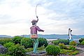
Statue of salmon fishing on the Restigouche River.
.jpg)
