Richard's Castle facts for kids
Quick facts for kids Richard's Castle |
|
|---|---|
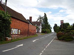 The B4361 road through the village – the pub is to the right |
|
| Population | 674 (2011) |
| Shropshire | 424 |
| Herefordshire | 250 |
| OS grid reference | SO492696 |
| Civil parish |
|
| Unitary authority |
|
| Ceremonial county | |
| Region | |
| Country | England |
| Sovereign state | United Kingdom |
| Post town | LUDLOW |
| Postcode district | SY8 |
| Dialling code | 01584 |
| Police | West Mercia |
| Fire | Shropshire |
| Ambulance | West Midlands |
| EU Parliament | West Midlands |
| UK Parliament |
|
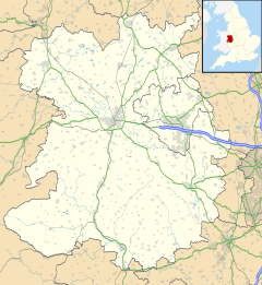
Richard's Castle is a village in England. It is also the name of a castle and two local government areas called civil parishes. The village sits right on the border between the counties of Herefordshire and Shropshire.
In 2011, about 250 people lived in the Herefordshire part. Around 424 people lived in the Shropshire part. The village is located on the B4361 road. It is about 9 kilometers (5.5 miles) south of the old market town of Ludlow.
Richard's Castle is spread out. The oldest part is near the castle itself. This area is about 1.2 kilometers (0.75 miles) northwest of the main village. The main village area is along the B4361 road. Here you can find the village hall and The Castle Inn, a traditional public house.
Contents
Richard's Castle: A Historic Fortress
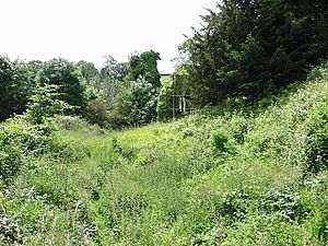
Today, Richard's Castle is mostly ruins. You can still see its earthworks and foundations. An earthwork is a large mound of earth built for defense. A tall mound, called a motte, once held a many-sided tower, known as a keep. You might have reached this tower through a curved entrance called a barbican.
Parts of the outer wall, called a bailey, still stand about 6 meters (20 feet) high. You can also see parts of several towers. There are also remains of an early gatehouse around the castle's edge. Outside the main castle, earth mounds show where an outer defense once stood. This area protected the local church, St Bartholomew's, and a small town.
The Castle's Story
The castle was built by a Norman knight named Richard Scrob. He was given land by the Saxon King Edward the Confessor. This happened before the Norman Conquest of England in 1066. Richard built his castle before the year 1051.
Richard's Castle was a "motte-and-bailey" style castle. This means it had a large mound (motte) with a tower and a walled courtyard (bailey). It was one of only a few castles of this type built before the Norman Conquest. Most motte-and-bailey castles were built after 1066.
Richard Scrob was last mentioned in records in 1067. His castle then went to his son, Osbern Fitz Richard. Osbern married Nesta, whose father was King Gruffydd ap Llywelyn of Wales.
Over the years, the castle was passed down through different families. It eventually came into the hands of the Talbots. By the 1500s, the castle was already in ruins.
Richard's Castle: Where It Is
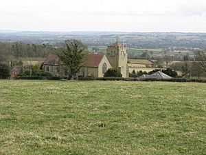
The village is on the western edge of the Teme valley. The castle and older part of the village are higher up. They are about 180 meters (590 feet) above sea level. The main part of the village, on the B4361 road, is lower. It is about 100 meters (330 feet) above sea level.
Two Parishes, One Village
Most of Richard's Castle is in Herefordshire. However, there are two civil parishes that share the name. One is called Richard's Castle (Hereford) and is in Herefordshire. The other is called Richard's Castle (Shropshire) and is in Shropshire.
Both parishes have their own local councils. These councils work together on some issues for the whole Richard's Castle community. They even share the same clerk, who helps with their paperwork.
The castle ruins, St Bartholomew's Church, and The Castle Inn pub are in the Herefordshire part. All Saints Church, the Village Hall, and the old primary school are in the Shropshire part. The Shropshire parish also includes other small villages like Overton and Woofferton.
The Woofferton transmitting station is a large radio tower. It is a well-known landmark in the area. This station is so big that it sits across both the Herefordshire and Shropshire parishes.
The Welsh Marches Line is a railway line that runs through the area. It passes by the now-closed Woofferton railway station. Trains on this line stop at nearby towns like Leominster and Ludlow.
Past Times and Markets
Long ago, Richard's Castle was part of a larger area called Avretone (Overton). This was recorded in the Domesday Book of 1086. The Domesday Book was a huge survey of England ordered by William the Conqueror.
A long time ago, King John gave Richard's Castle the right to hold a market. This market was held on an open piece of land called The Green. People would gather there to buy and sell goods. However, this market has not been used for a very long time.
Places of Worship
The first parish church in Richard's Castle was St Bartholomew's Church. It is in Herefordshire, close to the east side of the castle. Richard Fitz Scrob or his son likely founded this church.
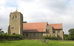
This church has a separate bell tower. It is one of only six churches in the county with a bell tower that stands apart from the main building. The bell tower was built in the late 1200s. St Bartholomew's Church is now no longer used for regular services.
The current parish church is All Saints. It was designed by a famous architect named Richard Norman Shaw. All Saints Church opened in 1892. It is located north of the village, in Shropshire, near the B4361 road. This church is a Grade I Listed building, meaning it is very important historically. Inside, you can see a beautiful artwork called a triptych, created by Charles Edgar Buckeridge.
There was also a Primitive Methodist chapel in the village. This building is now a home.
Learning and Schools
Moor Park School is a preparatory school. This type of school prepares students for secondary school. It is located in the Shropshire parish, between Richard's Castle and Overton.
Richard's Castle used to have its own primary school. This school was next to the building that is now the village hall.
Fun and Games
Soap Box Derby
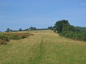
Every year in mid-July, a fun event called a Soap Box Derby takes place. It happens at Hanway Common, which is an open area that crosses the county border. In this race, people build special cars that have no engines. These "motorless cars" race down a hill, powered only by gravity! The first annual Soap Box Derby was held in 2004.
 | Kyle Baker |
 | Joseph Yoakum |
 | Laura Wheeler Waring |
 | Henry Ossawa Tanner |


