River Blackwater, Essex facts for kids
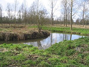
The River Blackwater is a river in Essex, England. It starts as the River Pant in the northwest part of Essex, close to Saffron Walden. It flows southeast through places like Great Sampford and Great Bardfield. When it reaches Bocking, near Braintree, it changes its name to the River Blackwater.
From Bocking, the river turns east, passing Bradwell Juxta Coggeshall and Coggeshall. Then it turns south, flowing past Kelvedon and Witham. Finally, it reaches Maldon. There, it turns east again and flows into the Blackwater Estuary. This estuary then connects to the North Sea near Mersea Island.
The River Blackwater has two main rivers that join it. The River Brain meets it just south of Witham. The River Chelmer joins it east of Maldon. Part of the River Chelmer, from Chelmsford, was made into a canal in the 1790s. This canal takes water north of the Blackwater through Maldon. It then flows into the Blackwater Estuary at Heybridge Basin.
Contents
History of the River Blackwater
Viking Battles and Ancient Finds
One of the most famous Viking battles in Britain, called the Battle of Maldon, might have happened at the mouth of this river in 991 AD. An old poem from the early 1000s describes this battle. It mentions the "Panta," which is the old name for the River Blackwater. The poem also talks about a causeway that was covered by the tide. This could be the path leading to Northey Island. In the battle, the Saxons were defeated, and their leader, Byrhtnoth, was killed.
During the time of the Romans, the Blackwater River was a good place to find fish and oysters for the town of Maldon. In the 1990s, people found parts of Saxon fish traps in the river. These traps show how people used the river long ago.
In the winter of 1776, the Blackwater River froze solid. It was frozen from Maldon all the way to Osea Island, which is about four miles. This ice trapped fishing boats and ships carrying goods. It stopped things like coal, oil, and wool from reaching Maldon.
In 1793, a company called the Chelmer and Blackwater Navigation Company was started by a special law. Over the next four years, this company built a waterway. It went from Chelmsford to meet the tidal part of the River Blackwater. This meeting point is now called Heybridge Basin.
The leaders of the town of Maldon did not want the canal to go through their town. So, the company built it just outside the town's border. This is why it ended up at Colliers Reach instead of going right into Maldon. From Chelmsford, the waterway mostly followed the River Chelmer. It went until it reached Beeleigh, near Maldon. Then, it followed the River Blackwater to Heybridge. From there, a canal went to a sea lock at Colliers Reach.
A weir (a small dam) connected the waterway to the tidal River Blackwater at Heybridge. This weir helped power a water mill. The Heybridge mill was taken down after bad floods in 1953. However, the old mill house is still there. The river in this area, sometimes called Heybridge Creek, was dammed in 1954. This was done to help protect against floods. Today, most of the water from the River Blackwater flows over a weir at Beeleigh. It then goes along the tidal part of the Chelmer before joining the Blackwater again at Heybridge Basin.
Changes to the River
In 1865, the government passed the Maldon Harbour Act. This law allowed a wharf (a platform for loading and unloading ships) to be built. It was on the west side of Heybridge Creek. The law also allowed for improvements to the channels of the Chelmer and Blackwater rivers. About ten thousand pounds were spent to make the river wider, deeper, and better for boats. This work was done from the Fullbridge to Herring's Point, near Heybridge Basin. After these changes, boats had to pay a small fee to use the river.
An old stone bridge with five arches crossed the River Blackwater at Heybridge. This bridge gave the village its name. In 1870, a new brick bridge with two arches replaced it. This bridge was at the north end of the Causeway. The bridge there now is very hard to see as a separate structure.
Industry
The Maldon Crystal Salt Company makes special sea salt from the waters of the Blackwater. They use old-fashioned panning methods to get the salt crystals.
Islands of the Blackwater Estuary
Osea Island
Osea Island is located in the Blackwater Estuary. It is north of Steeple.
Northey Island
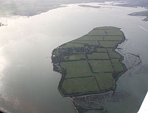
Northey Island is owned by the National Trust. It is about one mile west of Osea Island. This island is part of a very old landscape. It is connected to the shore by a causeway that is covered by the tide. Many people believe that Northey Island was the place where the Battle of Maldon happened in 991 AD. It is also a great place to go birdwatching.
See also
 In Spanish: Río Blackwater (Essex) para niños


